MyTopo
Classic USGS Carlisle Minnesota 7.5'x7.5' Topo Map
Couldn't load pickup availability
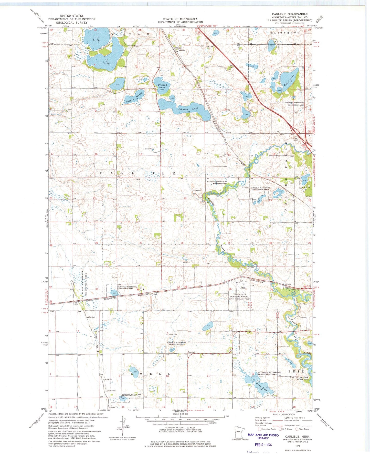
Historical USGS topographic quad map of Carlisle in the state of Minnesota. Map scale may vary for some years, but is generally around 1:24,000. Print size is approximately 24" x 27"
This quadrangle is in the following counties: Otter Tail.
The map contains contour lines, roads, rivers, towns, and lakes. Printed on high-quality waterproof paper with UV fade-resistant inks, and shipped rolled.
Contains the following named places: Carlisle, Carlisle Post Office, Fergus Falls Municipal Airport-Einar Mickelson Field, Fjestad Lake, French, French Post Office, Haarstick State Wildlife Management Area, Johnson Lake, Lake Oscar, Pelican River, Rush Lake, School Number 222, School Number 226, School Number 29, School Number 34, School Number 86, School Number 96, Skogen Marsh, Swedish Lutheran Church, Township of Carlisle, Wedel Lake