MyTopo
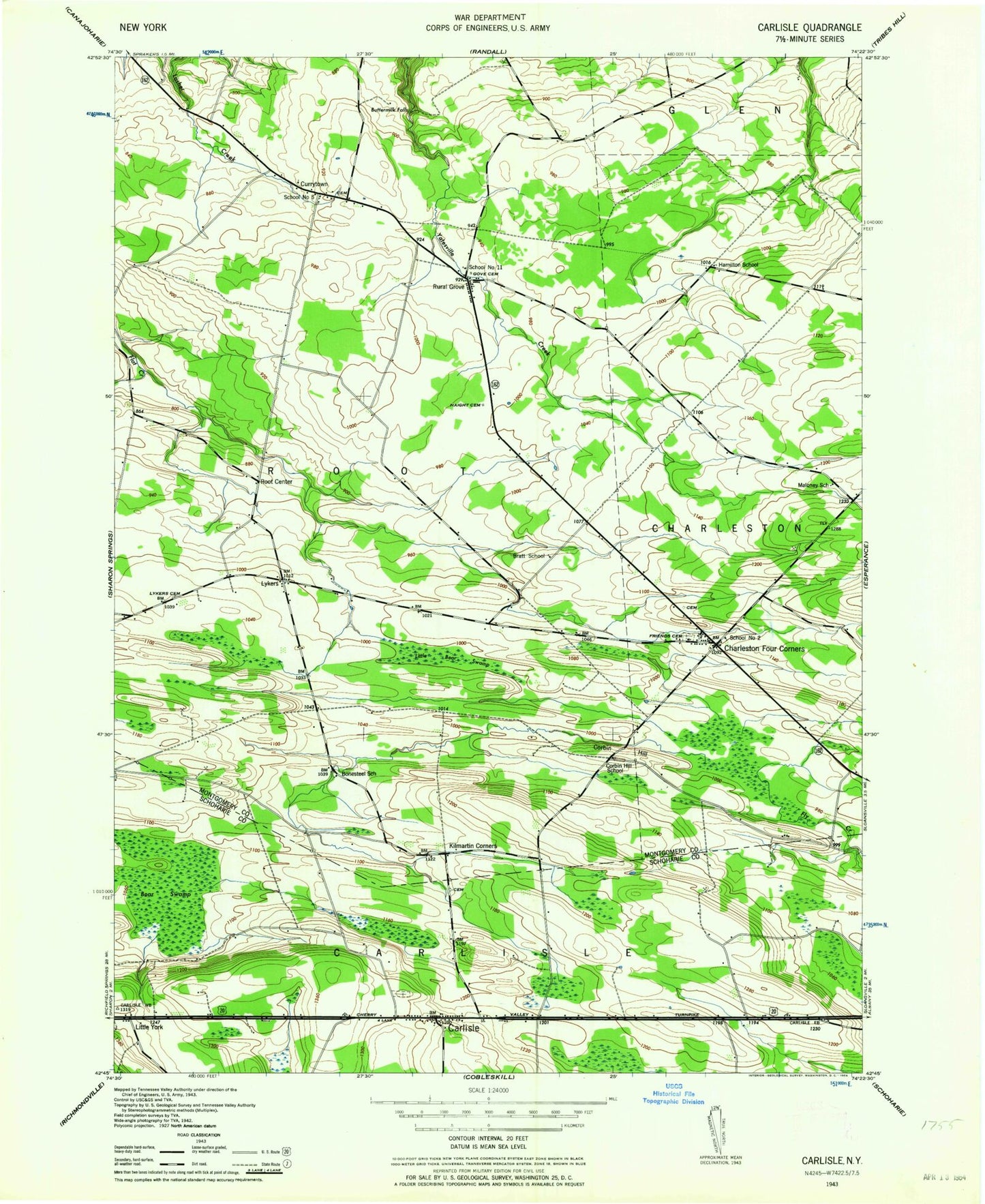
Classic USGS Carlisle New York 7.5'x7.5' Topo Map
Couldn't load pickup availability
Historical USGS topographic quad map of Carlisle in the state of New York. Map scale may vary for some years, but is generally around 1:24,000. Print size is approximately 24" x 27"
This quadrangle is in the following counties: Montgomery, Schoharie.
The map contains contour lines, roads, rivers, towns, and lakes. Printed on high-quality waterproof paper with UV fade-resistant inks, and shipped rolled.
Contains the following named places: Bear Swamp, Bonesteel School, Bratt School, Buttermilk Falls, Carlisle, Carlisle Cemetery, Carlisle Post Office, Carlisle Volunteer Fire Department, Charleston Four Corners, Charleston Volunteer Fire Department, Christian Church, Christian Church Cemetery, Corbin Hill, Corbin Hill School, Currytown, Currytown Farm, Currytown Reformed Church Cemetery, Friends Cemetery, Gove Cemetery, Haight Family Burial Ground, Hamilton School, Kilmartin Corners, Little Bear Swamp, Little York, Lyker Cemetery, Lykers, Maloney School, Root Center, Rural Grove, Russell Airport, School Number 11, School Number 2, School Number 5, The Ranch Airport, Town of Carlisle, Town of Root, ZIP Codes: 12031, 12160, 12166