MyTopo
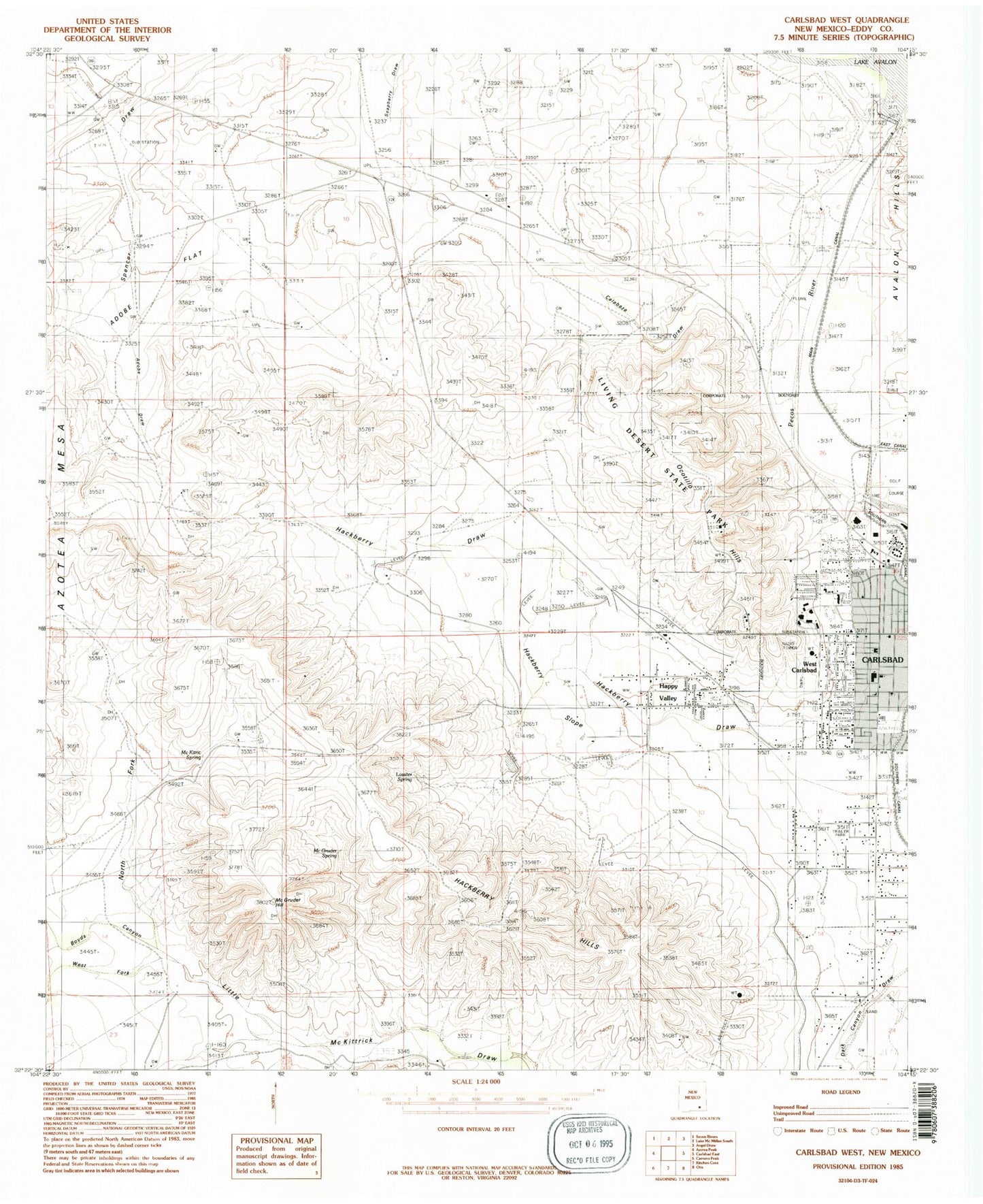
Classic USGS Carlsbad West New Mexico 7.5'x7.5' Topo Map
Couldn't load pickup availability
Historical USGS topographic quad map of Carlsbad West in the state of New Mexico. Typical map scale is 1:24,000, but may vary for certain years, if available. Print size: 24" x 27"
This quadrangle is in the following counties: Eddy.
The map contains contour lines, roads, rivers, towns, and lakes. Printed on high-quality waterproof paper with UV fade-resistant inks, and shipped rolled.
Contains the following named places: Adobe Draw, Adobe Flat, Allen Well, Calabaza Draw, Carlsbad National Wildlife Refuge, Dark Canyon Wells, Frank Jones Ranch, Golden Eagle Mine, Hackberry Draw, Hackberry Hills, Hackberry Slope, Happy Valley, Leck Ranch, Leck Well, Main Canal, McGruder Hill, McGruder Spring, Southern Canal, Thayer Wells, Windham Ranch, North Fork Little McKittrick Draw, Ocotillo Hills, West Fork Little McKittrick Draw, Lassiter Spring, Four Forks, West Carlsbad, Living Desert State Park, Carlsbad Medical Center, Victory Baptist Church, Standpipe Road Baptist Church, Lake Avalon, Mc Kitric Spring, Carlsbad Spring Number 16, Lancaster Spring, Mc Kitric Spring, Lone Eagle, Rose Gravel Co Plant, Eddy County Pits, Avalon Dam, Hackberry Draw Site Number One Dam, Hackberry Draw Watershed Site Number Two Dam, 10210 Water Well, 10212 Water Well, 10211 Water Well, 10209 Water Well, 10208 Water Well, 10214 Water Well, 10213 Water Well, 10190 Water Well, 10189 Water Well, Lake Avalon Weather Station, Eddy County, Happy Valley Census Designated Place, Happy Valley Volunteer Fire Department, Happy Valley Fire Department Station 1, Carlsbad Fire Department Station 2