MyTopo
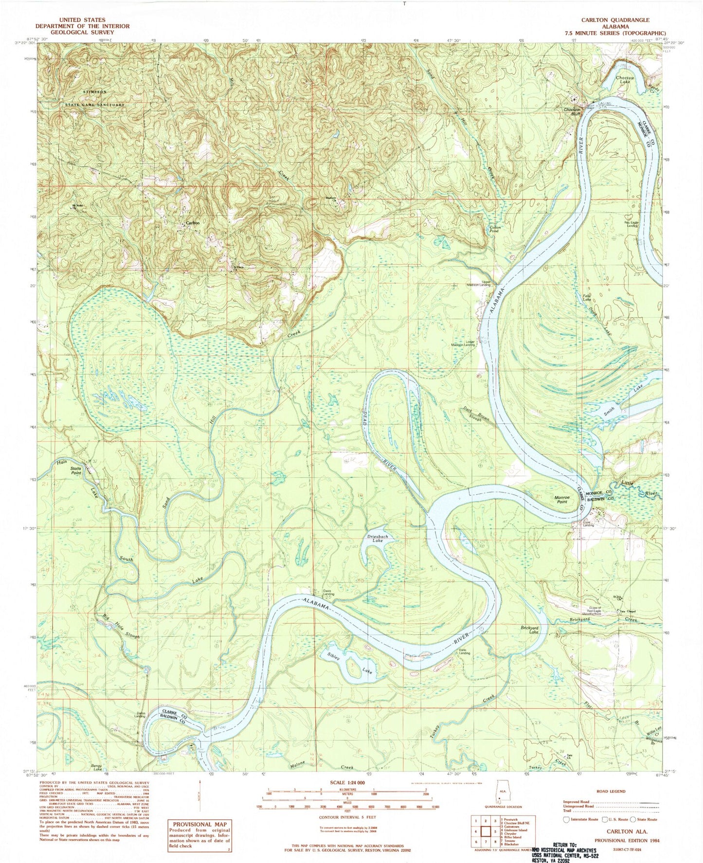
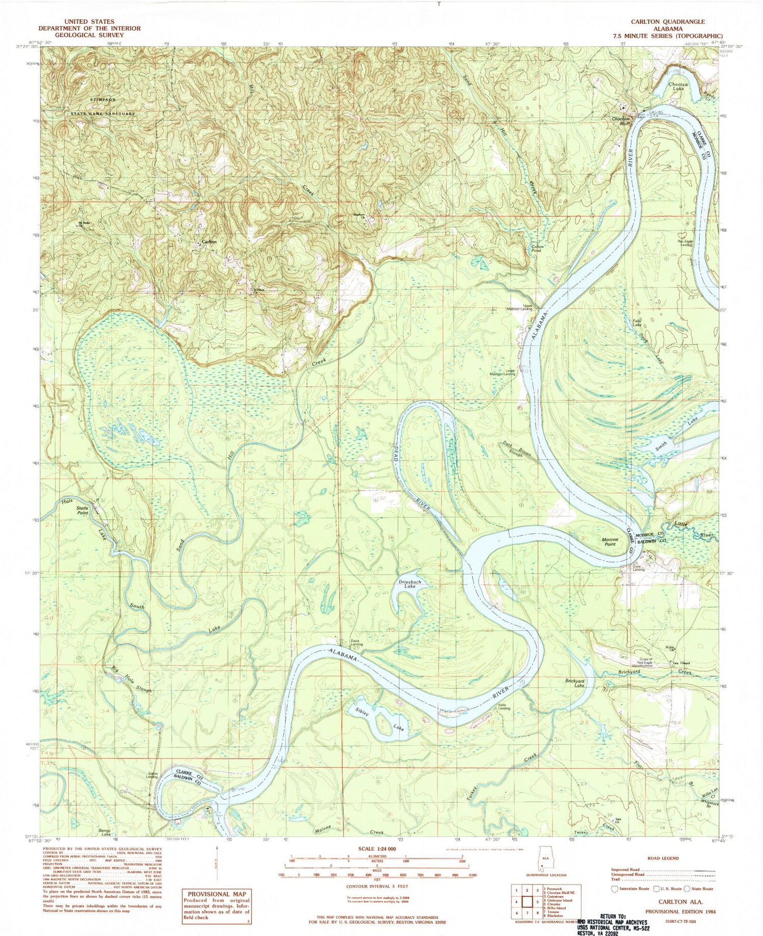
Classic USGS Carlton Alabama 7.5'x7.5' Topo Map
Couldn't load pickup availability
Historical USGS topographic quad map of Carlton in the state of Alabama. Map scale may vary for some years, but is generally around 1:24,000. Print size is approximately 24" x 27"
This quadrangle is in the following counties: Baldwin, Clarke, Monroe.
The map contains contour lines, roads, rivers, towns, and lakes. Printed on high-quality waterproof paper with UV fade-resistant inks, and shipped rolled.
Contains the following named places: Big Hole Slough, Brickyard Creek, Brickyard Lake, Carlton, Carlton Census Designated Place, Choctaw Bend, Choctaw Bluff, Choctaw Lake, Church of God, Colton Pond, Dallas Landing, Dark Brown Slough, Davis Landing, Dead Lake, Dead River, Dixie Cut-Off, Dixie Landing, Driesbach Lake, Earl Bar, Earle Landing, Fells Lake, Flat Branch, Fort Stonewall, H G Davis Lodge, Joe David Landing, Little River, Little River School, Lower Madison Lodge, Madison Church, Malone Creek, Matthewson Sawmill, Matthewsons Bar, Mill Creek, Monroe Point, Moore Landing, Mount Gillerd Baptist Church, Mount Nebo Church, Red Eagle Landing, Saint Joe Baptist Church, Saint Pauls Church, Sand Hill Creek, Sibley Lake, Smith Island, Smith Lake, Stolls Point, Tate Chapel African Methodist Episcopal Church, Tate Chapel Community Center, Tate Church, Tate Creek Baptist Church, Turkey Creek, Upper Madison Landing, Whipstock Branch, William Weatherford Memorial Park, Willie Lee Creek, Wilson Landing