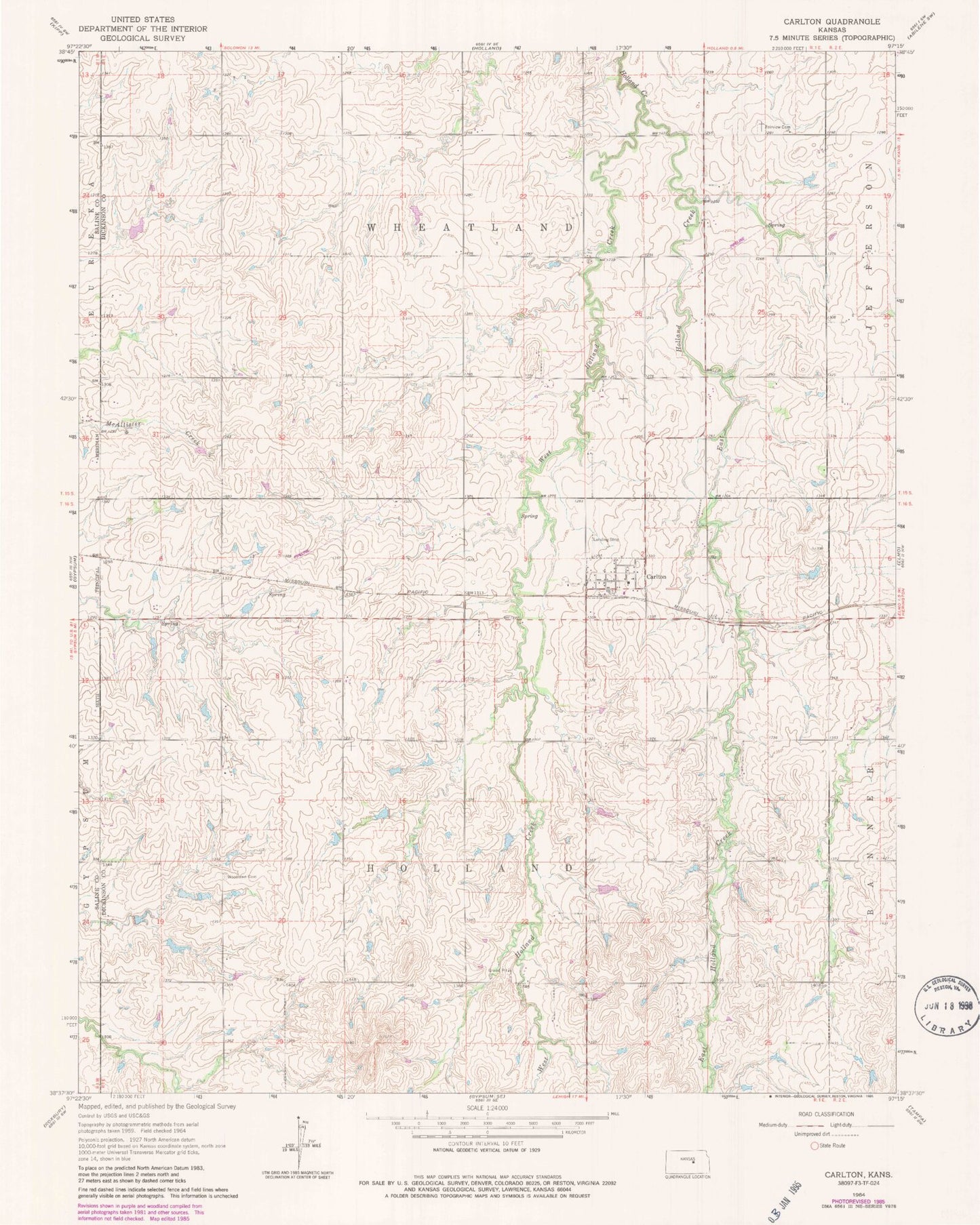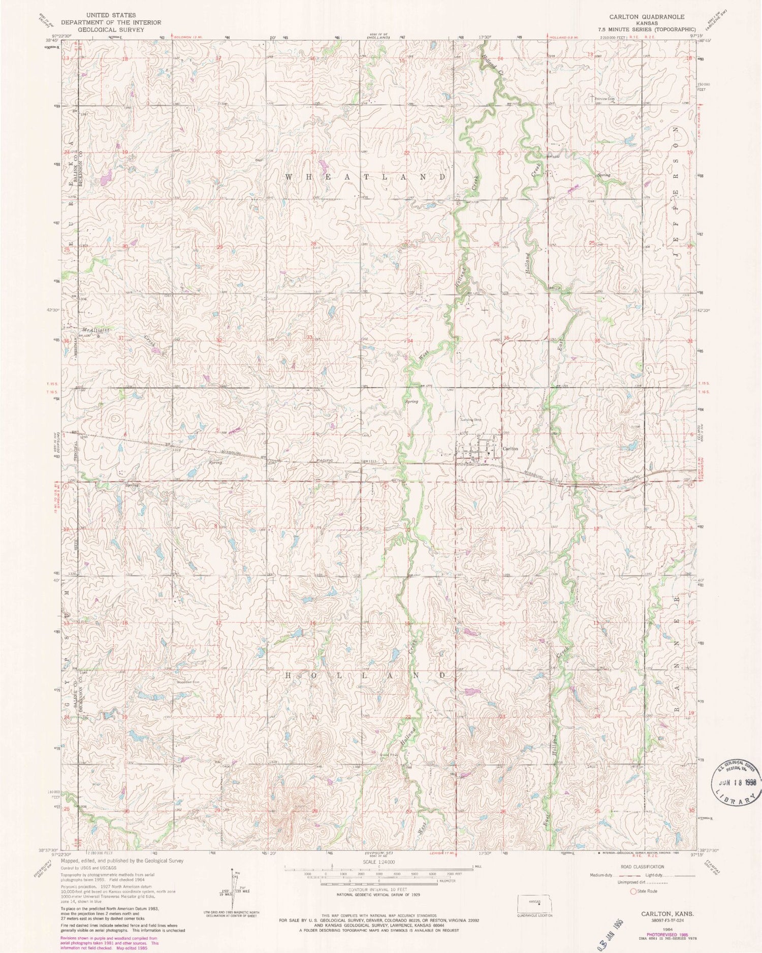
MyTopo
Classic USGS Carlton Kansas 7.5'x7.5' Topo Map
Couldn't load pickup availability
Historical USGS topographic quad map of Carlton in the state of Kansas. Map scale may vary for some years, but is generally around 1:24,000. Print size is approximately 24" x 27"
This quadrangle is in the following counties: Dickinson, Saline.
The map contains contour lines, roads, rivers, towns, and lakes. Printed on high-quality waterproof paper with UV fade-resistant inks, and shipped rolled.
Contains the following named places: Agricultural Producers Grain Elevator Number 2, Carlton, Carlton First Presbyterian Church, City of Carlton, East Holland Creek, Fairview Cemetery, Saline County Fire District 1 - Carlton Station, Township of Holland, Township of Wheatland, West Holland Creek, Woodlawn Cemetery