
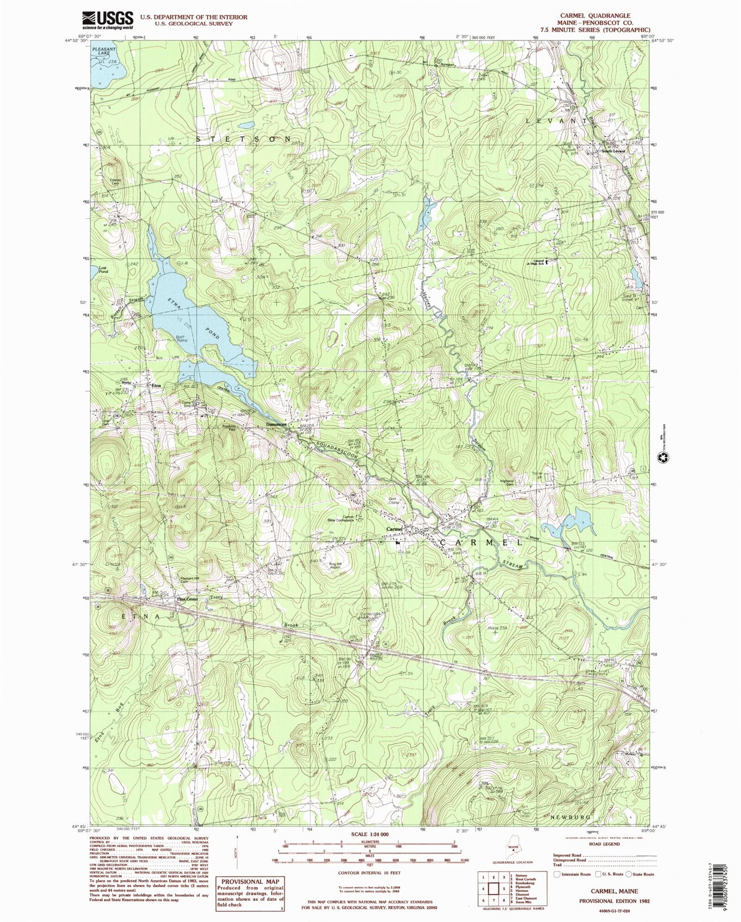
MyTopo
Classic USGS Carmel Maine 7.5'x7.5' Topo Map
Couldn't load pickup availability
Historical USGS topographic quad map of Carmel in the state of Maine. Map scale may vary for some years, but is generally around 1:24,000. Print size is approximately 24" x 27"
This quadrangle is in the following counties: Penobscot.
The map contains contour lines, roads, rivers, towns, and lakes. Printed on high-quality waterproof paper with UV fade-resistant inks, and shipped rolled.
Contains the following named places: Buzzell Stream, Camp Etna, Caravel Middle School, Carmel, Carmel Bible Conference, Carmel Elementary School, Carmel Fire Department and Rescue, Carmel Post Office, Carmel Valley Golf Club, Carmel Village Cemetery, Coboro Cemetery, Damascus, Etna, Etna Bog, Etna Cemetery, Etna Center, Etna Pond, Etna Post Office, Etna Volunteer Fire Department, Glory Chapel, Harvey Stream, Highland Cemetery, Hill Brook, Longfellow School, Lost Pond, Pleasant Hill Cemetery, Ring Hill Airport, Simpson Memorial Library, South Levant, South Levant Baptist Church, Town of Carmel, Tracy Brook, ZIP Codes: 04419, 04488


