
MyTopo
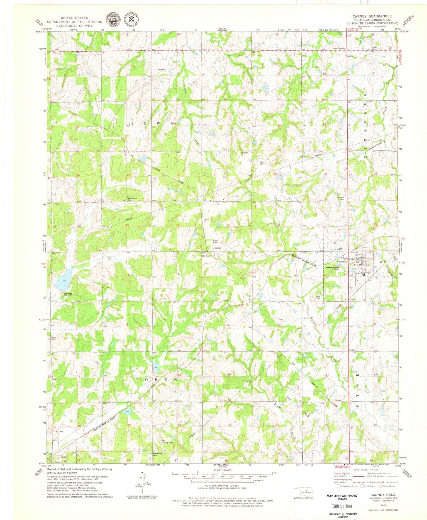
Classic USGS Carney Oklahoma 7.5'x7.5' Topo Map
Couldn't load pickup availability
Historical USGS topographic quad map of Carney in the state of Oklahoma. Map scale may vary for some years, but is generally around 1:24,000. Print size is approximately 24" x 27"
This quadrangle is in the following counties: Lincoln.
The map contains contour lines, roads, rivers, towns, and lakes. Printed on high-quality waterproof paper with UV fade-resistant inks, and shipped rolled.
Contains the following named places: Bear Fall Coon Creek Site 2r Dam, Bear Fall Coon Creek Site 2r Reservoir, Bear Fall Coon Creek Site 3r Dam, Bear Fall Coon Creek Site 3r Reservoir, Belton, Bethlehem Cemetery, Carney, Carney Cemetery, Carney Elementary School, Carney High School, Carney Police Department, Carney Post Office, Carney Volunteer Fire Department, Dudley, Emsey, Forest Cemetery, Four Corners, Great Hope Cemetery, Iowa Oklahoma Tribal Statistical Area, Ives Airport, Merrick Volunteer Fire Department, Oknoname 08106 Dam, Oknoname 08106 Reservoir, Oknoname 08113 Dam, Oknoname 08113 Reservoir, Pilgrim Church, Pollick Cemetery, Town of Carney, Township of Tohee, ZIP Code: 74832


