MyTopo
Classic USGS Carrabelle Florida 7.5'x7.5' Topo Map
Couldn't load pickup availability
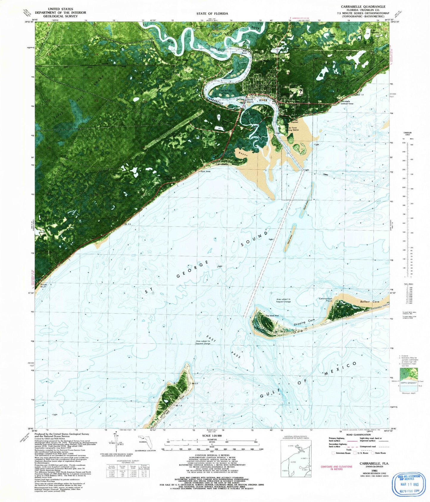
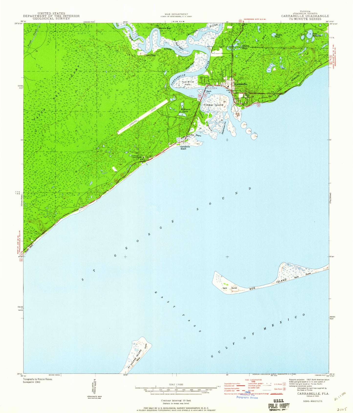
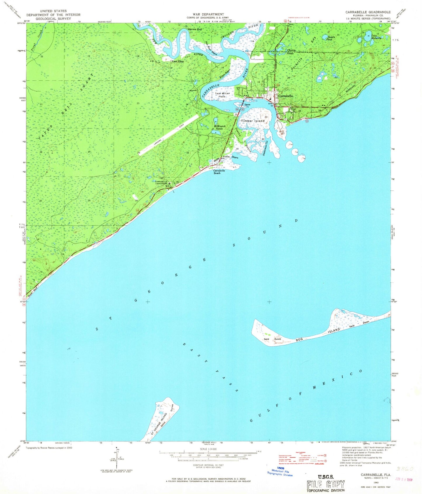
Historical USGS topographic quad map of Carrabelle in the state of Florida. Map scale may vary for some years, but is generally around 1:24,000. Print size is approximately 24" x 27"
This quadrangle is in the following counties: Franklin.
The map contains contour lines, roads, rivers, towns, and lakes. Printed on high-quality waterproof paper with UV fade-resistant inks, and shipped rolled.
Contains the following named places: Anneewakee Hospital, Boggy Jordan Bayou, Carrabelle, Carrabelle Beach, Carrabelle Harbor, Carrabelle High School, Carrabelle Lighthouse, Carrabelle Police Department, Carrabelle Post Office, Carrabelle River, Carrabelle Volunteer Fire Department, Carrabelle-Thompson Airport, Charlie McKissack Cut, Chason Ponds, City of Carrabelle, Crooked River, Crooked River Lighthouse, Davis Island, Dickerman Cut, East Pass, Kapes Bayou, Lake Morality, McKissack Ponds, New River, New River Bayou, Picketts Bay, Postun Bayou, Royal Bluff, Saint George Sound, Sandy Pond, Teal Miller Flats, Tillie Miller Bridge, Timber Island, Warrens Bluff, Yent Place