MyTopo
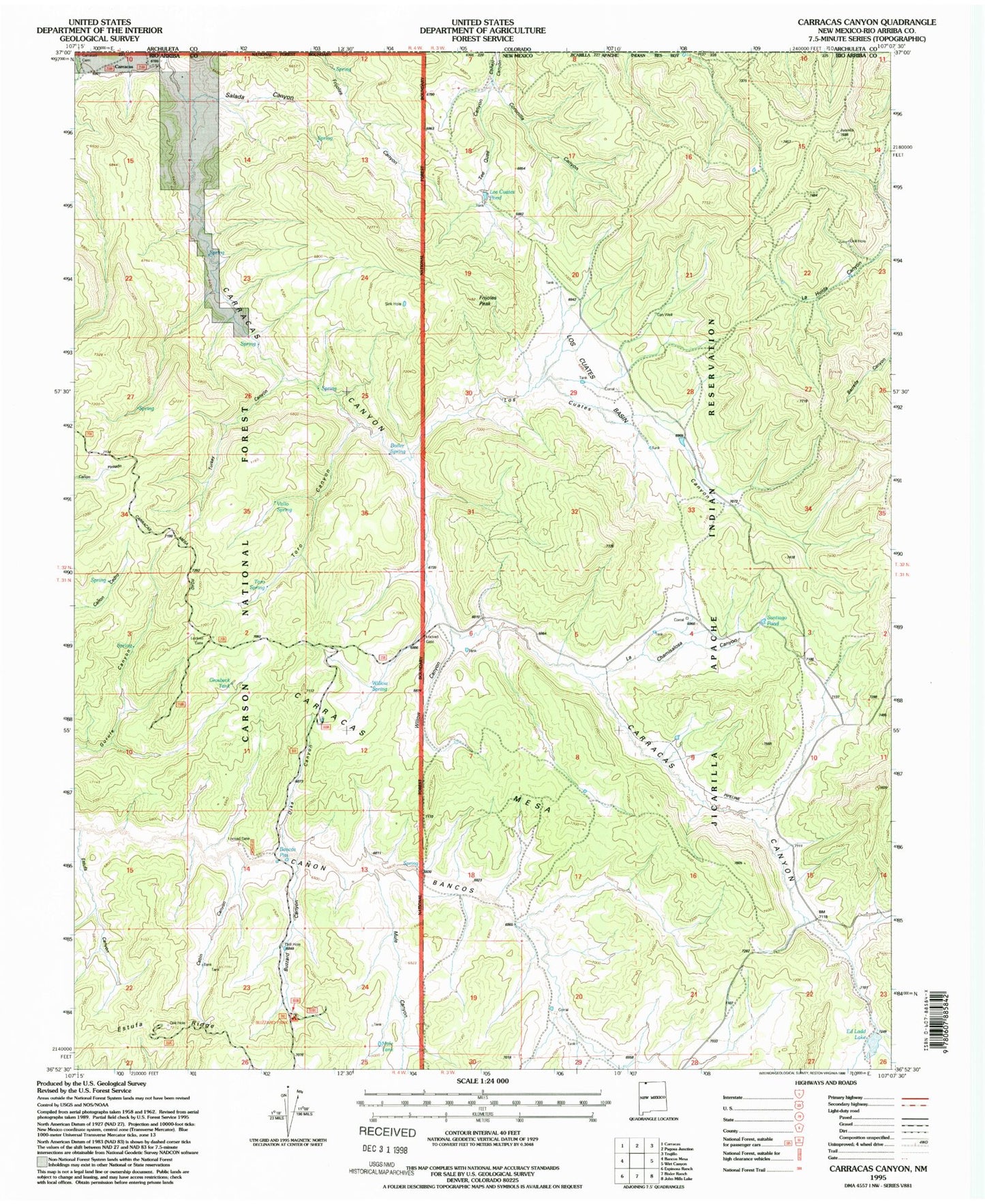
Classic USGS Carracas Canyon New Mexico 7.5'x7.5' Topo Map
Couldn't load pickup availability
Historical USGS topographic quad map of Carracas Canyon in the state of New Mexico. Map scale may vary for some years, but is generally around 1:24,000. Print size is approximately 24" x 27"
This quadrangle is in the following counties: Rio Arriba.
The map contains contour lines, roads, rivers, towns, and lakes. Printed on high-quality waterproof paper with UV fade-resistant inks, and shipped rolled.
Contains the following named places: Bancos Pits, Boiler Spring, Buzzard Canyon, Buzzard Park Campground, Cabin Canyon, Carracas, Carracas Canyon, Carracas Mesa, Coronilla Canyon, Dike Canyon, Ed Ladd Lake, Estufa Canyon, Estufa Ridge, Frijoles Peak, Grosbeck Tank, La Chamisalosa Canyon, La Huida Canyon, Los Cuates Basin, Los Cuates Canyon, Los Cuates Pond, Mule Canyon, Mule Tank, Salada Canyon, Santiago Pond, Tee Quee Canyon, Toro Canyon, Toro Spring, Turkey Canyon, Vallo Spring, Willow Canyon, Willow Spring