MyTopo
Classic USGS Carrie Kentucky 7.5'x7.5' Topo Map
Couldn't load pickup availability
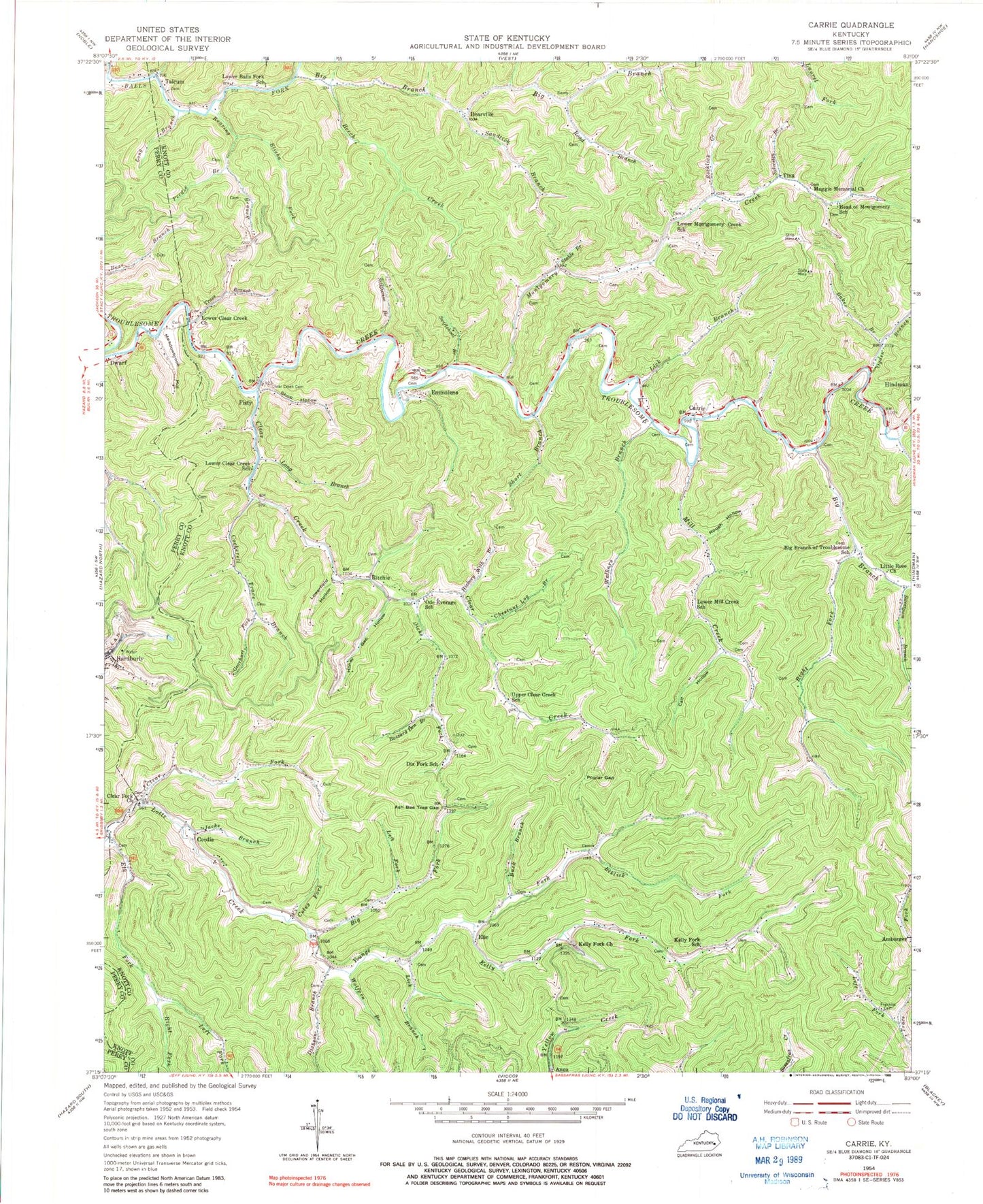
Historical USGS topographic quad map of Carrie in the state of Kentucky. Map scale may vary for some years, but is generally around 1:24,000. Print size is approximately 24" x 27"
This quadrangle is in the following counties: Knott, Perry.
The map contains contour lines, roads, rivers, towns, and lakes. Printed on high-quality waterproof paper with UV fade-resistant inks, and shipped rolled.
Contains the following named places: Adam Terry Cemetery, Ash Bee Tree Gap, Baker Branch, Bearville, Bearville Post Office, Beech Creek, Big Branch, Big Branch Church Cemetery, Big Branch Of Ball Elementary School, Big Branch of Troublesome School, Big Branch School Number Eight, Big Fork, Buck Branch, Burlingham Railroad Station, Buzzard Den Branch, Calf Hollow, Camp Nathanial, Carrie, Carrie Post Office, Chestnut Log Branch, Clear Creek, Clear Creek Cemetery, Clear Creek Church Regular Baptist of Jesus Christ, Clear Creek Evangelical Church, Clear Creek Free Church, Clear Fork, Clear Fork Regular Baptist Church of Jesus Christ, Cockerell Trace Branch, Coles Fork, Combs Cemetery, Cordia, Cordia Post Office, Dicks Fork, Dickson Branch, Dix Fork School, Elic, Elic Post Office, Elisha Fork, Elk Fork, Elklick Fork, Emmalena, Emmalena Elementary, Emmalena Post Office, Fisty, Fisty Post Office, Fisty Volunteer Fire Department, Franklin Cemetery, Fuller Cemetery, Gearhart Fork, Hardburly, Head of Montgomery School, Hickory With Branch, Holiness Tabernacle of God, Honey Gap Hollow, Jacks Branch, Kelly Fork, Kelly Fork Church of God, Kelly Fork School, Left Fork Elk Fork, Left Fork Trace Fork, Lick Branch, Little Rose Church, Long Branch, Lotts Creek, Lotts Creek Community School, Lotts Creek United Baptist Church, Lotts Creek Volunteer Fire Department, Lower Balls Fork School, Lower Clear Creek School, Lower Mill Creek School, Lower Montgomery Creek School, Lowerfield Hollow, Maggie Memorial Church, Maggie Memorial Church of Old Regular Baptist, Meadowbrook Hollow, Mill Creek, Mink Post Office, Montgomery, Montgomery Baptist Church, Montgomery Creek, New Bethlehem Church, New Bethlehem Old Regular Baptist Church, Ode Everage School, Ogden Branch, Owen Cemetery, Peedee Branch, Philadelphia Regular Primitive Baptist Church, Poplar Gap, Push Back Branch, Right Fork Big Branch, Right Fork Elk Fork, Ritchie, Ritchie Post Office, Road Branch, Roaring Branch, Rocklick Creek, Rough Hollow, Sandlick Branch, School Number Nine, School Number Six, School Number Ten, Scripture Memory Mountain Mission Church, Shop Hollow, Short Branch, Stable Branch, Stillhouse Branch, Summertown Old Regular Baptist Church, Sweetgum Branch, Swiftshoal Branch, Sylvester Branch, Talcom Post Office, Talcum, Tina, Tina Post Office, Trace Branch, Upper Clear Creek School, Upper Kelly Cemetery, Walkers Branch, WKCB-AM (Hindman), Wolfpen Branch, Yellow Creek Post Office, Youngs Fork, ZIP Codes: 41722, 41725, 41739, 41740