MyTopo
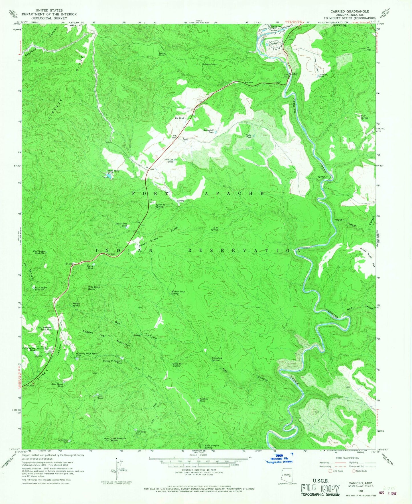
Classic USGS Carrizo Arizona 7.5'x7.5' Topo Map
Couldn't load pickup availability
Historical USGS topographic quad map of Carrizo in the state of Arizona. Map scale may vary for some years, but is generally around 1:24,000. Print size is approximately 24" x 27"
This quadrangle is in the following counties: Gila.
The map contains contour lines, roads, rivers, towns, and lakes. Printed on high-quality waterproof paper with UV fade-resistant inks, and shipped rolled.
Contains the following named places: A Ninetysix Spring, Bat Canyon, Bear Tank, Butterball Tank, Calf Pasture Tank, Calf Pasture Tank Number One, Carrizo, Carrizo Census Designated Place, Carrizo Tank, Corduroy Creek, Cow Butte Tank, Cow Pasture Butte, Feed Box Spring, Felton Tank, Flying V Maintenance Yard, Flying V Pasture Tank, Fox Canyon Tank Number One, Fox Canyon Tank Number Two, Gully Tank, Highway Drift Fence Tank, Javelina Tank, John Moore Tank, Limestone Spring, Limestone Tank, Mud Cat Tank, Peach Tree Tank, Pit Tank, Ragged Top Mountain, Red Canyon, Rock Canyon Spring, Rocky Tank, Spear-R Spring, Squaw Dress Ridge, V Thirtyseven Spring, Water Trough Canyon, Wild Dove Butte, Wild Steer Dam, Wild Steer Tank, Willow Spring, Willow Trap Springs