MyTopo
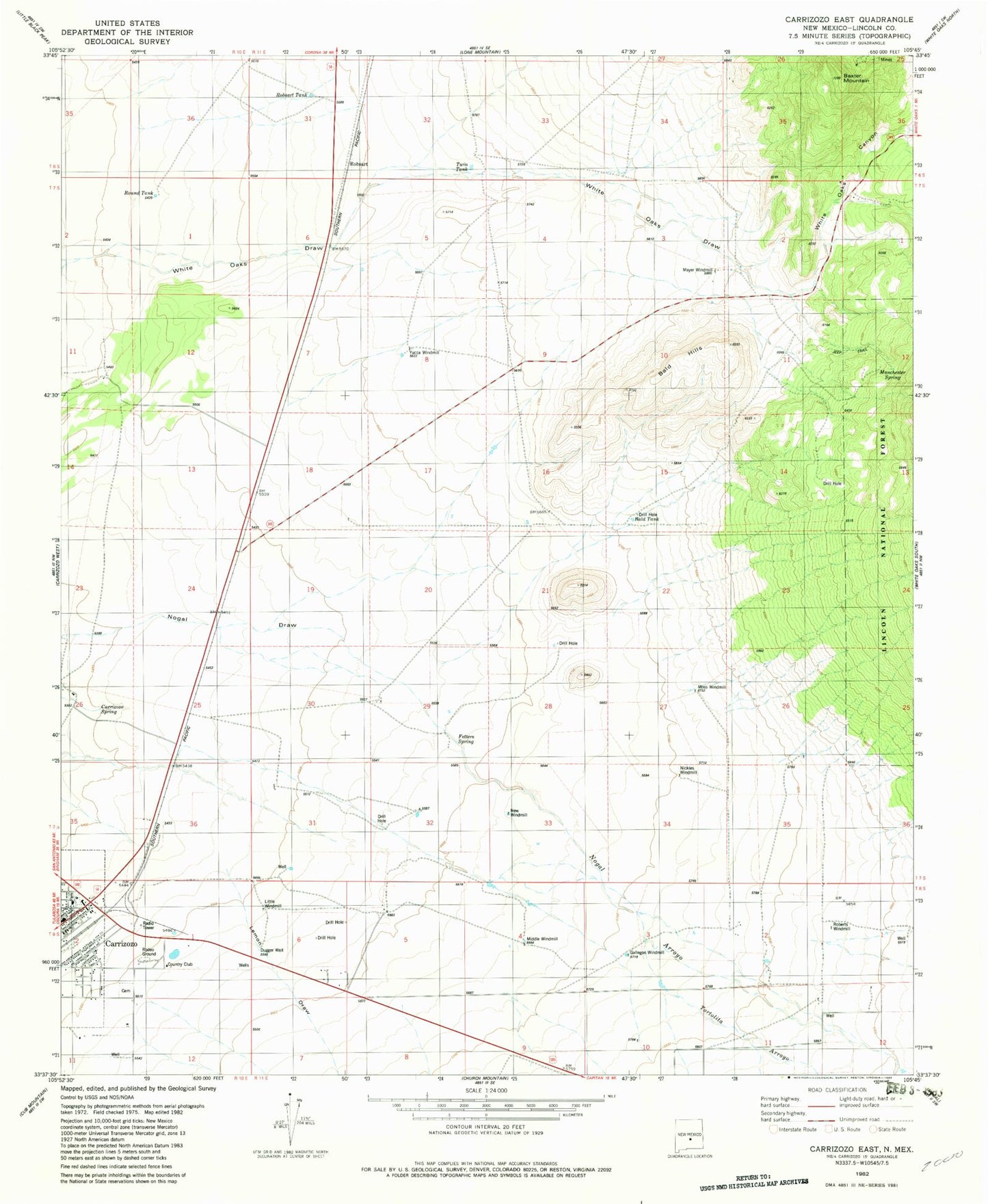
Classic USGS Carrizozo East New Mexico 7.5'x7.5' Topo Map
Couldn't load pickup availability
Historical USGS topographic quad map of Carrizozo East in the state of New Mexico. Map scale may vary for some years, but is generally around 1:24,000. Print size is approximately 24" x 27"
This quadrangle is in the following counties: Lincoln.
The map contains contour lines, roads, rivers, towns, and lakes. Printed on high-quality waterproof paper with UV fade-resistant inks, and shipped rolled.
Contains the following named places: Annie Cade Mine, Bald Hills, Bald Tank, Baxter Mountain, Carrizozo Fire Department, Carrizozo Plant, Carrizozo Spring, Carrizozo Volunteer Fire Department, Collier Mine, Cristopher, Dark Canyon, Dugger Well, Fetters Spring, Forgotten, Gallegos Windmill, Gregory Mine, Homestake South, Lemon Draw, Little Windmill, Lovelace Plant, Luckless, Manchester, Manchester Post Office, Manchester Spring, Mayer Windmill, Middle Windmill, Moss Windmill, New Windmill, Nickles Windmill, Nogal Arroyo, Nogal Creek, Omega Mine, Roberts Windmill, Robsart, Robsart Tank, Round Tank, Southwest Mineral Corp Mill, Spencer, Town of Carrizozo, Twin Tank, White Oaks Canyon, Yucca Windmill