MyTopo
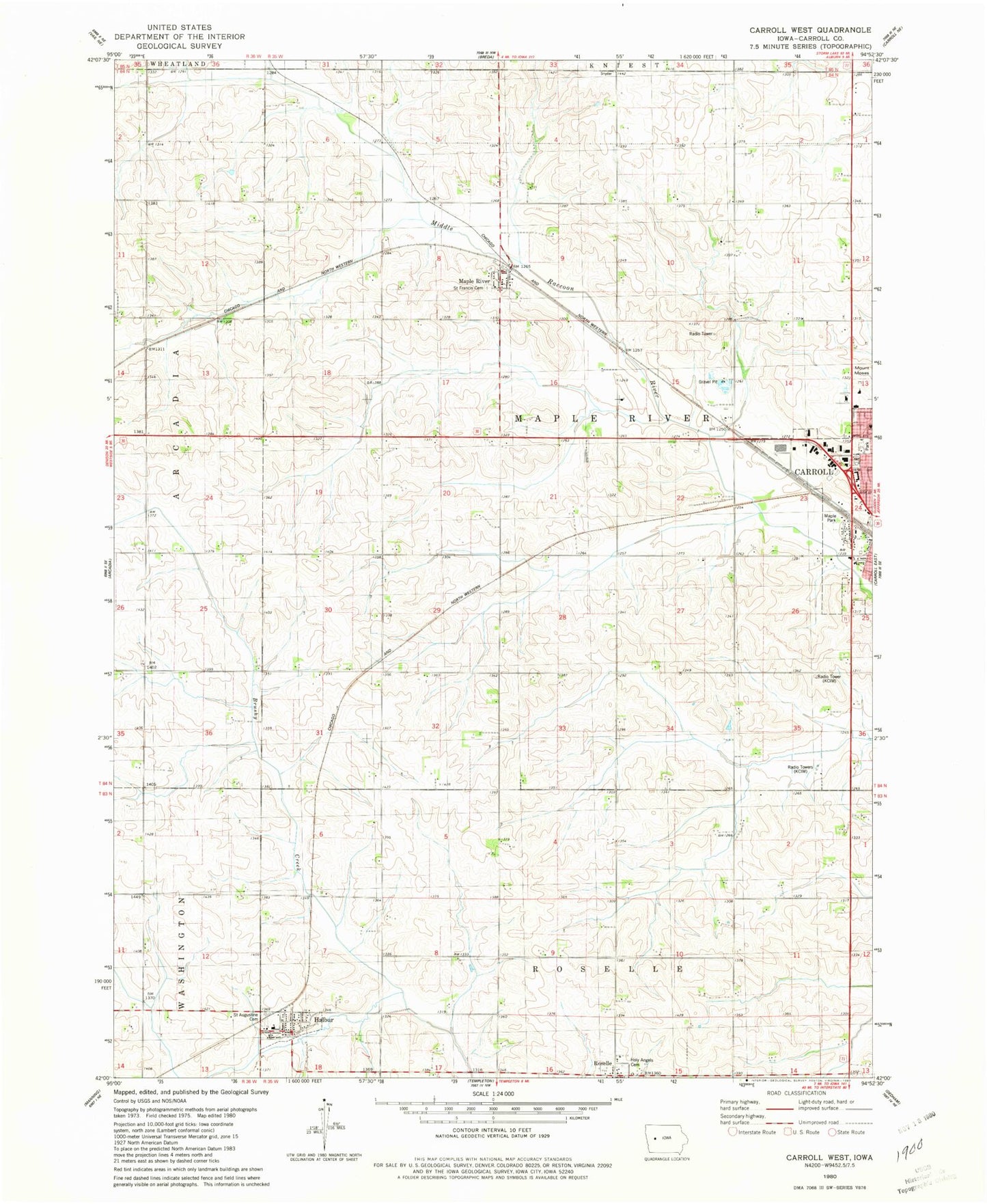
Classic USGS Carroll West Iowa 7.5'x7.5' Topo Map
Couldn't load pickup availability
Historical USGS topographic quad map of Carroll West in the state of Iowa. Map scale may vary for some years, but is generally around 1:24,000. Print size is approximately 24" x 27"
This quadrangle is in the following counties: Carroll.
The map contains contour lines, roads, rivers, towns, and lakes. Printed on high-quality waterproof paper with UV fade-resistant inks, and shipped rolled.
Contains the following named places: City of Halbur, First Assembly of God Church, Halbur, Halbur Community Center, Halbur Fire Department, Halbur First Responders, Halbur Post Office, Halbur Ridge Wildlife Area, Halburn Creek, Holy Angels Cemetery, KCIM-AM (Carroll), Kittyhawk Avenue Bridge, KKRL-FM (Carroll), Koster Grain Incorporated Elevator, Maple Park, Maple River, Maple River Post Office, Mid-Prairie Park, Northwest Park, Roselle, Roselle Post Office, Saint Augustine Cemetery, Saint Augustine School, Saint Augustine's Church, Saint Augustine's School, Saint Francis Cemetery, Saint Paul Lutheran Church, The Church of Jesus Christ of Latter Day Saints, Township of Maple River, ZIP Code: 51444