MyTopo
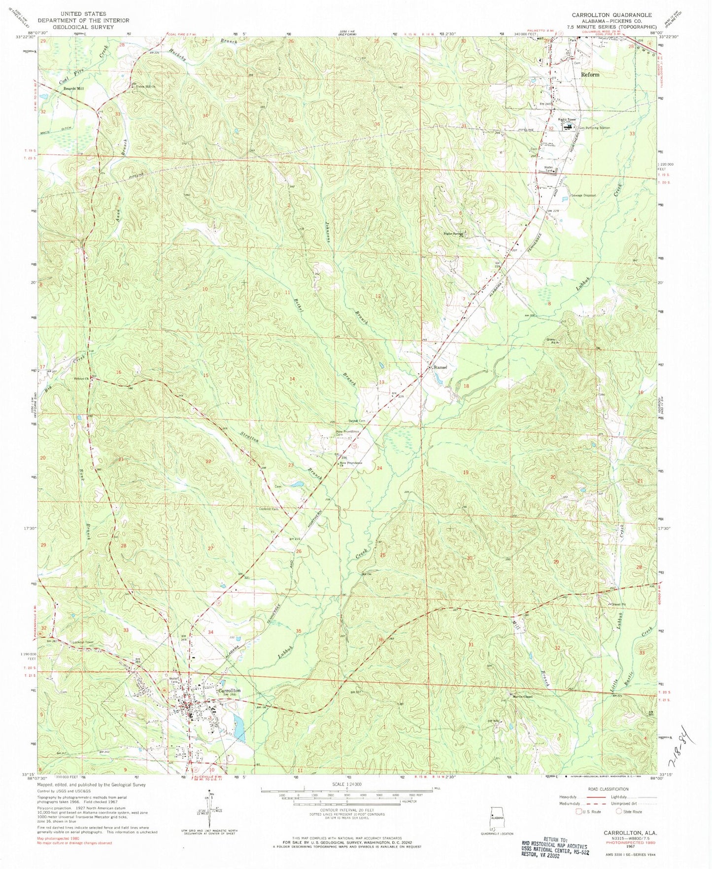
Classic USGS Carrollton Alabama 7.5'x7.5' Topo Map
Couldn't load pickup availability
Historical USGS topographic quad map of Carrollton in the state of Alabama. Map scale may vary for some years, but is generally around 1:24,000. Print size is approximately 24" x 27"
This quadrangle is in the following counties: Pickens.
The map contains contour lines, roads, rivers, towns, and lakes. Printed on high-quality waterproof paper with UV fade-resistant inks, and shipped rolled.
Contains the following named places: Anna Branch, Bastic Creek, Beards Mill, Bethel Branch, Bethel Cemetery, Carloss, Carrollton, Carrollton Baptist Church, Carrollton Cemetery, Carrollton High School, Carrollton Junior High School, Carrollton Methodist Church, Carrollton Police Department, Carrollton Post Office, Carrollton Volunteer Fire Department, Cockrell Cemetery, Community Cemetery, Faith Church, Graham Cemetery, Hebron Baptist Church, Hebron Church Cemetery, Huckeby Branch, Infant Baptist Church, Johnsons Branch, Kilpatrick Lake, Marvin Chapel Church, Mastons Mill, Mill Branch, Mill Branch School, New Providence Cemetery, New Providence Church, Old Sardis Cemetery, Owens, Parson Dam, Pickens Academy, Pickens County, Pickens County Courthouse, Pickens County Medical Center, Pickens County Sheriff's Office, Poplar Springs Cemetery, Poplar Springs Church, Reform Temple Church, Salem Church, Shepherd, Stansel, Stansel Church, Stratton Branch, Town of Carrollton, Union Hill Cemetery, Union Hill Freewill Baptist Church, Windle Cemetery