MyTopo
Classic USGS Carrolltown Pennsylvania 7.5'x7.5' Topo Map
Couldn't load pickup availability
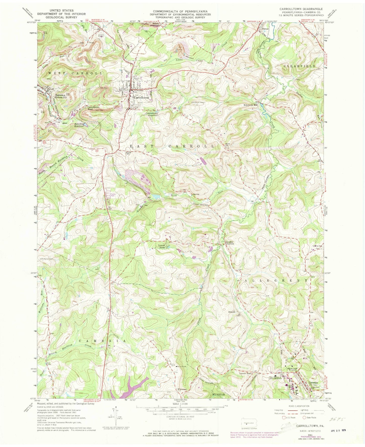
Historical USGS topographic quad map of Carrolltown in the state of Pennsylvania. Map scale may vary for some years, but is generally around 1:24,000. Print size is approximately 24" x 27"
This quadrangle is in the following counties: Cambria.
The map contains contour lines, roads, rivers, towns, and lakes. Printed on high-quality waterproof paper with UV fade-resistant inks, and shipped rolled.
Contains the following named places: Bakers Crossroad, Bakerton, Bakerton Elementary School, Bakerton Reservoir, Bakerton United Methodist Church Cemetery, Borough of Carrolltown, Borough of Loretto, Bradley Junction, Cambria County Fire School, Carmelite Cemetery, Carrolltown, Carrolltown 6th Ward Elementary School, Carrolltown Airport, Carrolltown Fire Engine Company Station 51, Carrolltown Police Department, Carrolltown Post Office, Carrolltown Reservoir, Carrolltown Road, City Reservoir, Dividing Ridge, Driscoll, Duclos Run, Eckenrode Mill, Elmora, Elmora Post Office, Foxburg, Franciscan Friar Cemetery, John Carroll Area Ambulance Station 64, Jones Portal, Lauer School, Laurel Lick Run, Lonely Acres, Loretto, Loretto Fire Department Station 73, Loretto Post Office, Loretto Road, Morchesky Airport, Mount Assisi Monastery, Original Sisters of Mercy Cemetery, Saint Benedict Roman Catholic Church, Saint Benedicts Catholic Cemetery, Saint Benedicts School, Saint Francis College, Saint Michael Cemetery, Saint Michaels School, Saint Therese of Lisieux Monastery, Shingle Run, Strittmatter Airport, Township of East Carroll, Township of West Carroll, Tunnel Siding, WAMQ-AM (Loretto), Weber School, West Carrol Township Water Sewer Authority Dam, Winterset, ZIP Codes: 15722, 15940