MyTopo
Classic USGS Carsonville Michigan 7.5'x7.5' Topo Map
Couldn't load pickup availability
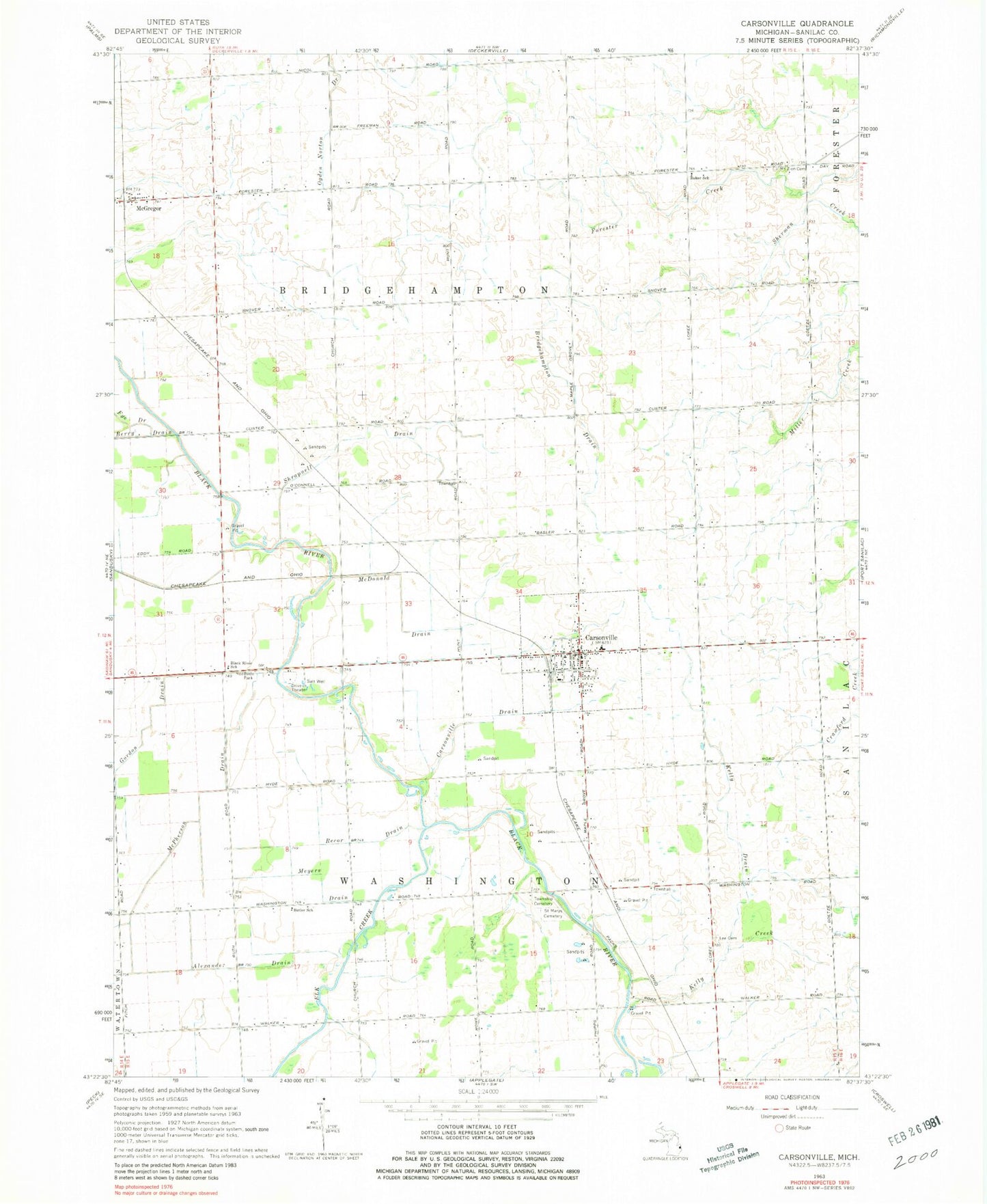
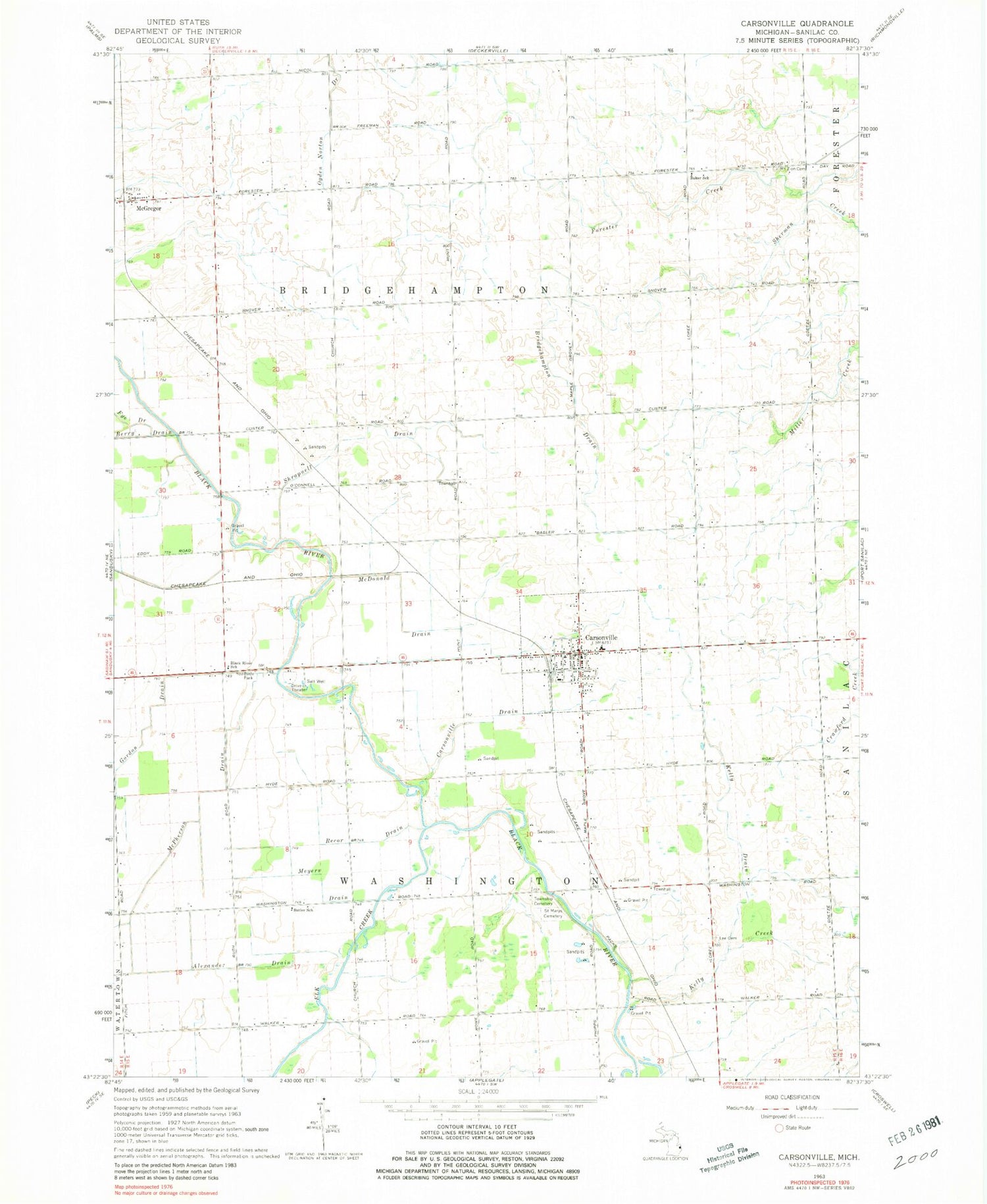
Historical USGS topographic quad map of Carsonville in the state of Michigan. Map scale may vary for some years, but is generally around 1:24,000. Print size is approximately 24" x 27"
This quadrangle is in the following counties: Sanilac.
The map contains contour lines, roads, rivers, towns, and lakes. Printed on high-quality waterproof paper with UV fade-resistant inks, and shipped rolled.
Contains the following named places: Alexander Drain, Baker School, Black River School, Bridge Hampton Township Hall, Bridgehampton Drain, Bridgehampton Post Office, Butler School, Carsonville, Carsonville Assembly of God Church, Carsonville Drain, Carsonville Fire Department, Carsonville Police Department, Carsonville Post Office, Carsonville Station, Carsonville-Port Sanilac Elementary School, Carsonville-Port Sanilac High School, Elk Creek, Gordon Drain, Hi-Way Drive-In Theater, Kelly Creek, Kelly Drain, Lee Cemetery, McDonald Drain, McGregor, McGregor Post Office, McGregor Station, McPherson Drain, Meyers Drain, Mount Zion Cemetery, Ogden Norton Drain, Pack's Mills Post Office, Pack's Mills Station, Recor Drain, Saint Marys Cemetery, Sanilac County, Shrapnell Drain, Township of Bridgehampton, Township of Washington, Tucker Cemetery, United Methodist Church, Village of Carsonville, Washington Township Cemetery, ZIP Code: 48419