MyTopo
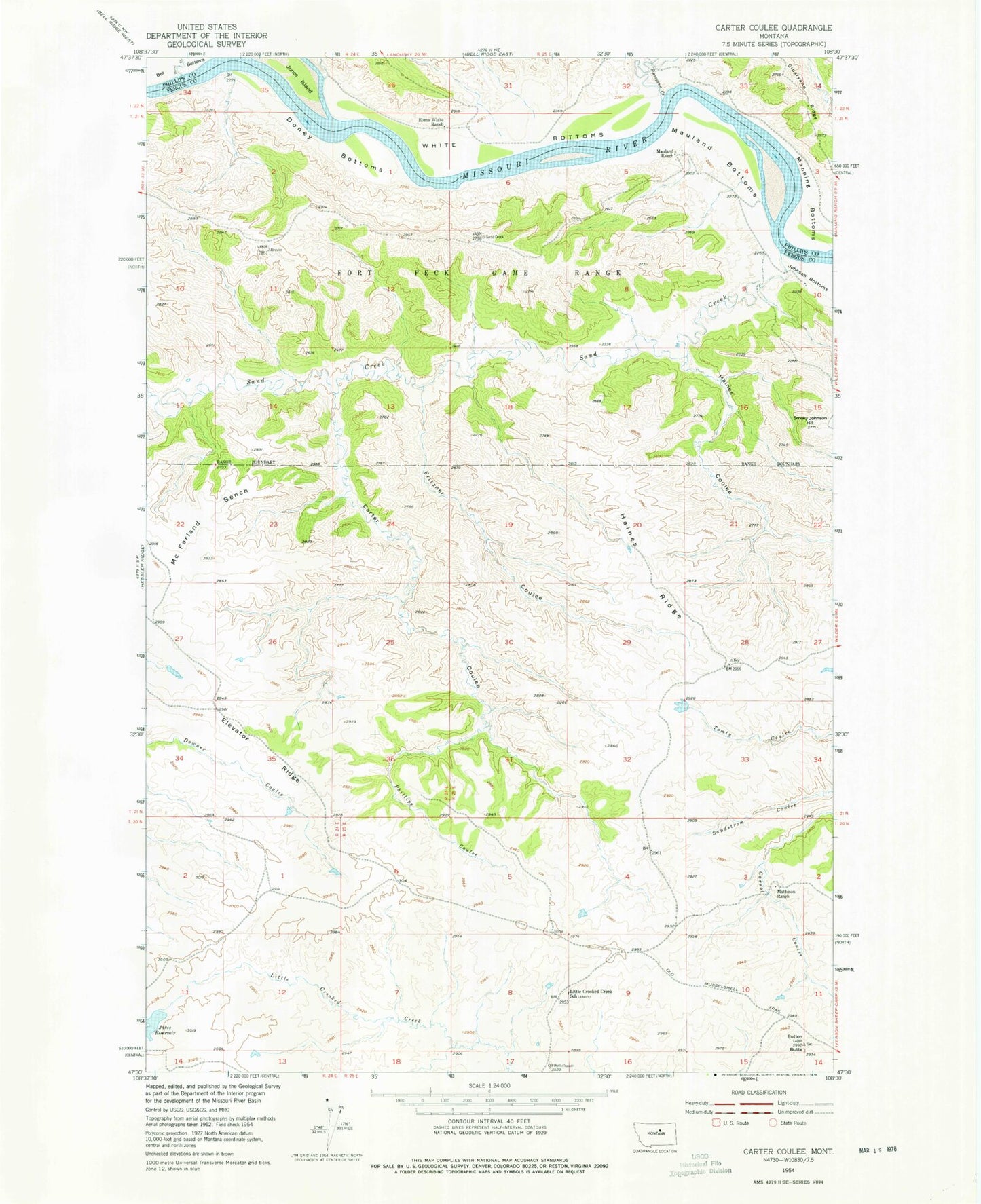
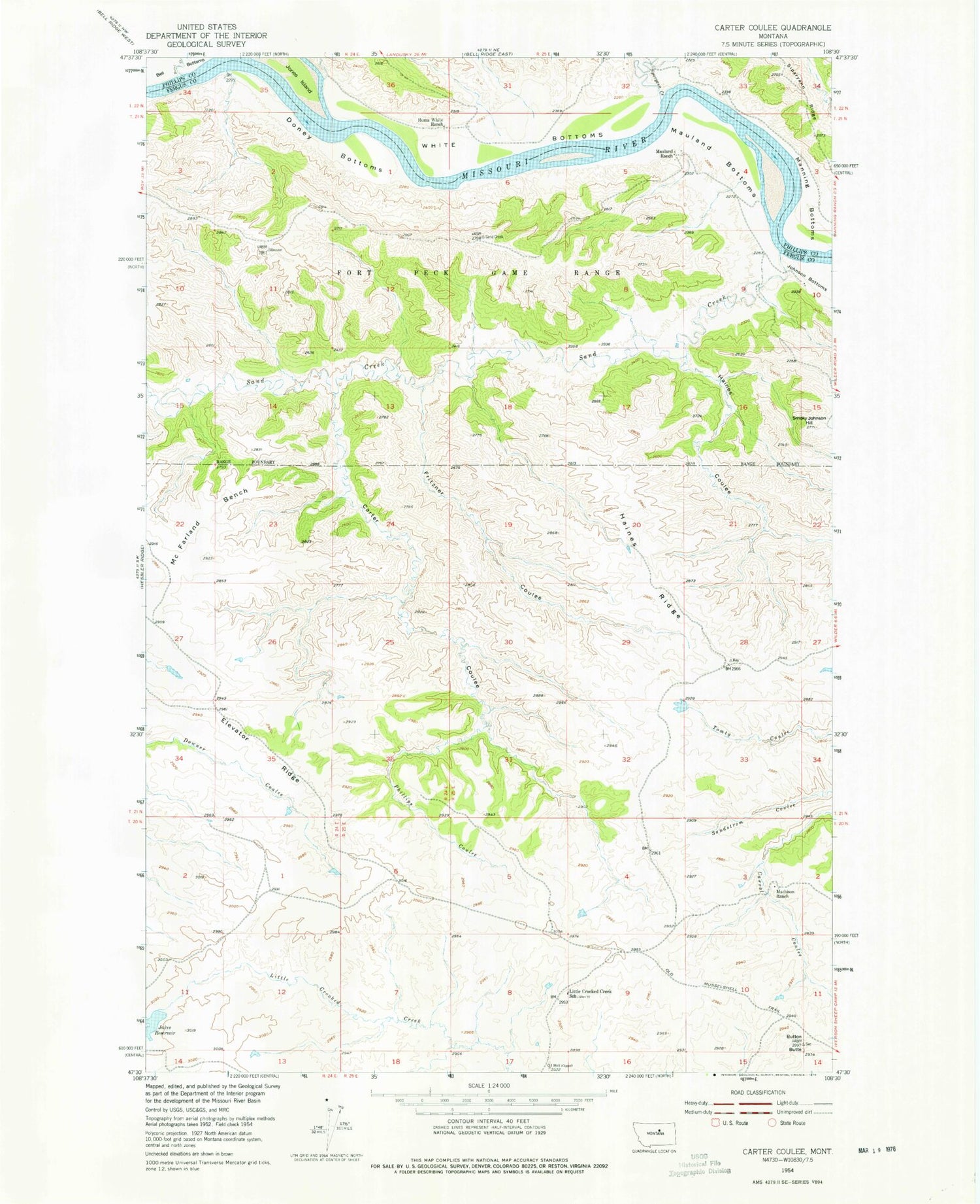
Classic USGS Carter Coulee Montana 7.5'x7.5' Topo Map
Couldn't load pickup availability
Historical USGS topographic quad map of Carter Coulee in the state of Montana. Map scale may vary for some years, but is generally around 1:24,000. Print size is approximately 24" x 27"
This quadrangle is in the following counties: Fergus, Phillips.
The map contains contour lines, roads, rivers, towns, and lakes. Printed on high-quality waterproof paper with UV fade-resistant inks, and shipped rolled.
Contains the following named places: 21N24E01AA__01 Well, 21N24E13BA__01 Well, Apex Number 2 Mine, Bell Bottoms, Button Butte, Byford School, Carter Coulee, Cimrhakl Number 4 Dam, Doney Bottoms, Dutch Dam, Duval Creek, Elevator Ridge, Fritzner Coulee, Haines Coulee, Haines Ridge, Jakes Dam, Jakes Reservoir, Jones Island, Little Crooked, Little Crooked Creek School, Little Crooked Post Office, Mathison Ranch, Mauland Bottoms, Mauland Ranch, Mc Farland Bench, Phillips Coulee, Roma White Ranch, Sand Creek, Siparyann Creek, Smoky Johnson Hill, White Bottoms