MyTopo
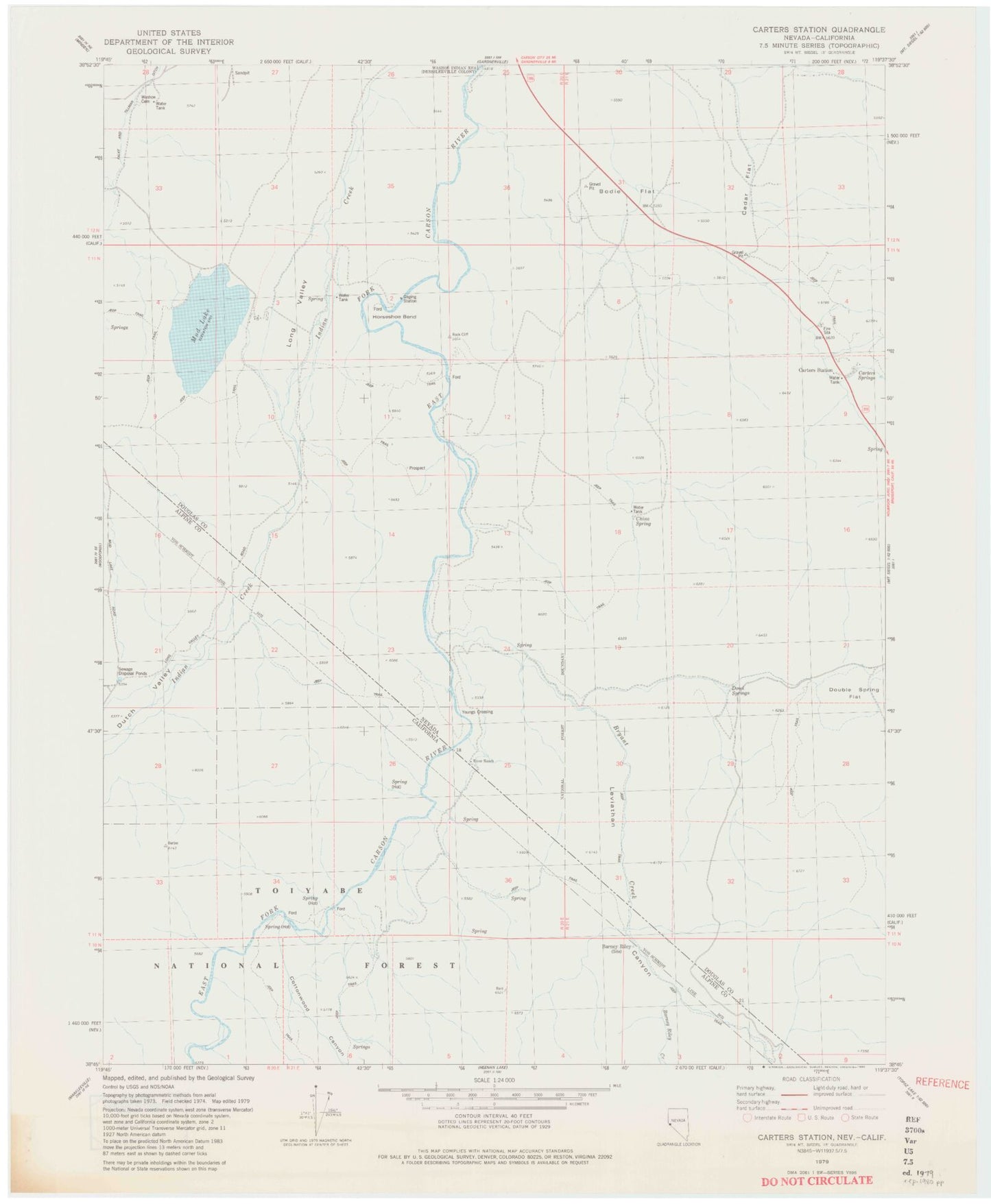
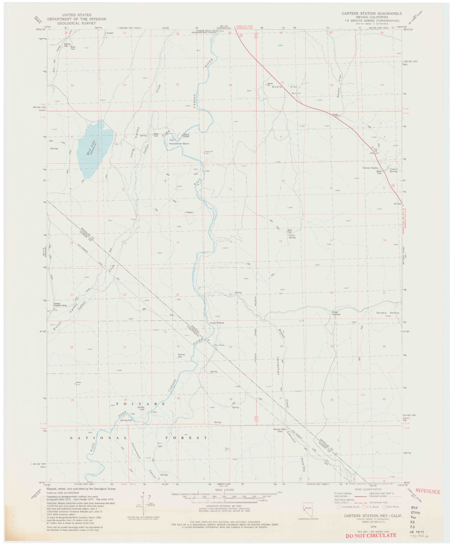
Classic USGS Carters Station Nevada 7.5'x7.5' Topo Map
Couldn't load pickup availability
Historical USGS topographic quad map of Carters Station in the states of Nevada, California. Typical map scale is 1:24,000, but may vary for certain years, if available. Print size: 24" x 27"
This quadrangle is in the following counties: Alpine, Douglas.
The map contains contour lines, roads, rivers, towns, and lakes. Printed on high-quality waterproof paper with UV fade-resistant inks, and shipped rolled.
Contains the following named places: Leviathan Canyon, Uhalde Springmeyer Stock Bridge, Horse Shoe Bend Dam Site, Pinyon Dam Site, Indian Valley Ranch, Nevada Tungsten Mill, Bodie Flat, Carters Springs, Carters Station, Cedar Flat, China Spring, Doud Springs, Falke and Tillman Ditch, Horseshoe Bend, Long Valley, Mud Lake, River Ranch, Washoe Cemetery, Youngs Crossing, China Spring Youth Camp, Stoddard and Jewel Jacobsen High School, Carter Springs Census Designated Place, Barney Riley, Barney Riley Creek, Bryant Creek, Cottonwood Canyon, Dutch Valley, Hot Springs