
MyTopo
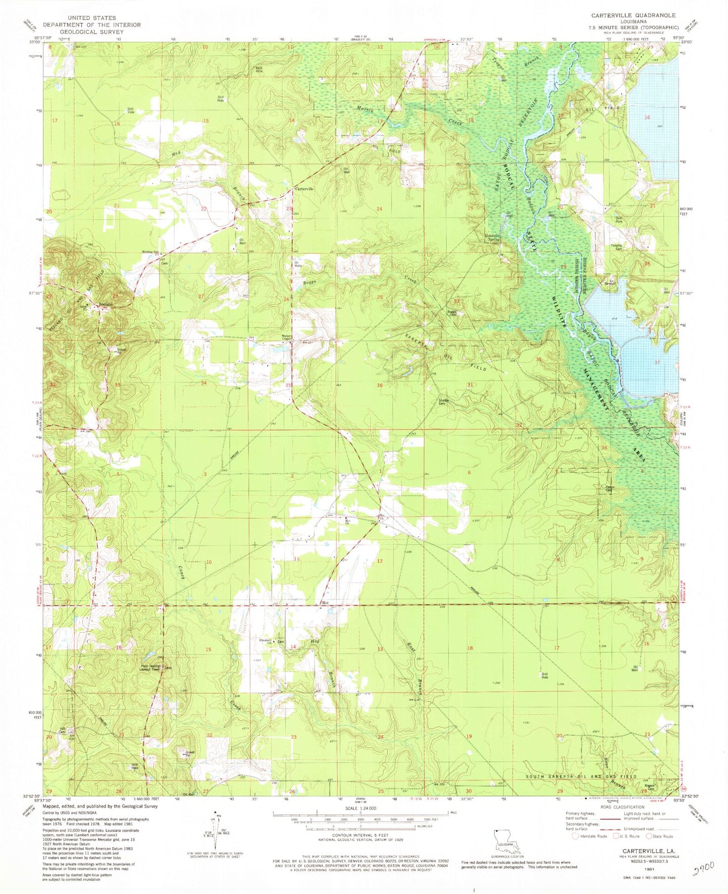
Classic USGS Carterville Louisiana 7.5'x7.5' Topo Map
Couldn't load pickup availability
Historical USGS topographic quad map of Carterville in the state of Louisiana. Map scale may vary for some years, but is generally around 1:24,000. Print size is approximately 24" x 27"
This quadrangle is in the following counties: Bossier, Webster.
The map contains contour lines, roads, rivers, towns, and lakes. Printed on high-quality waterproof paper with UV fade-resistant inks, and shipped rolled.
Contains the following named places: Boggs Cemetery, Boggs Creek, Carterville, Cason Cemetery, East Branch Caney Creek, Elizabeth Church, Elizabeth School, Goodwin Spring, Hog Branch, Martin Creek, May Branch, Morning Star Church, Mot, Mot Church, Murray Lake Annex Dam, Northeast Bossier Fire District 5, Paper Mill Pond, Plain Dealing Lookout Tower, Pleasant Hill Cemetery, Redland, Rogers Cemetery, Salem Church, Sarepta Oil Field, Stubbs Cemetery, Teague Branch, Timothy, Timothy Cemetery, Walker Chapel, ZIP Code: 71075