
MyTopo
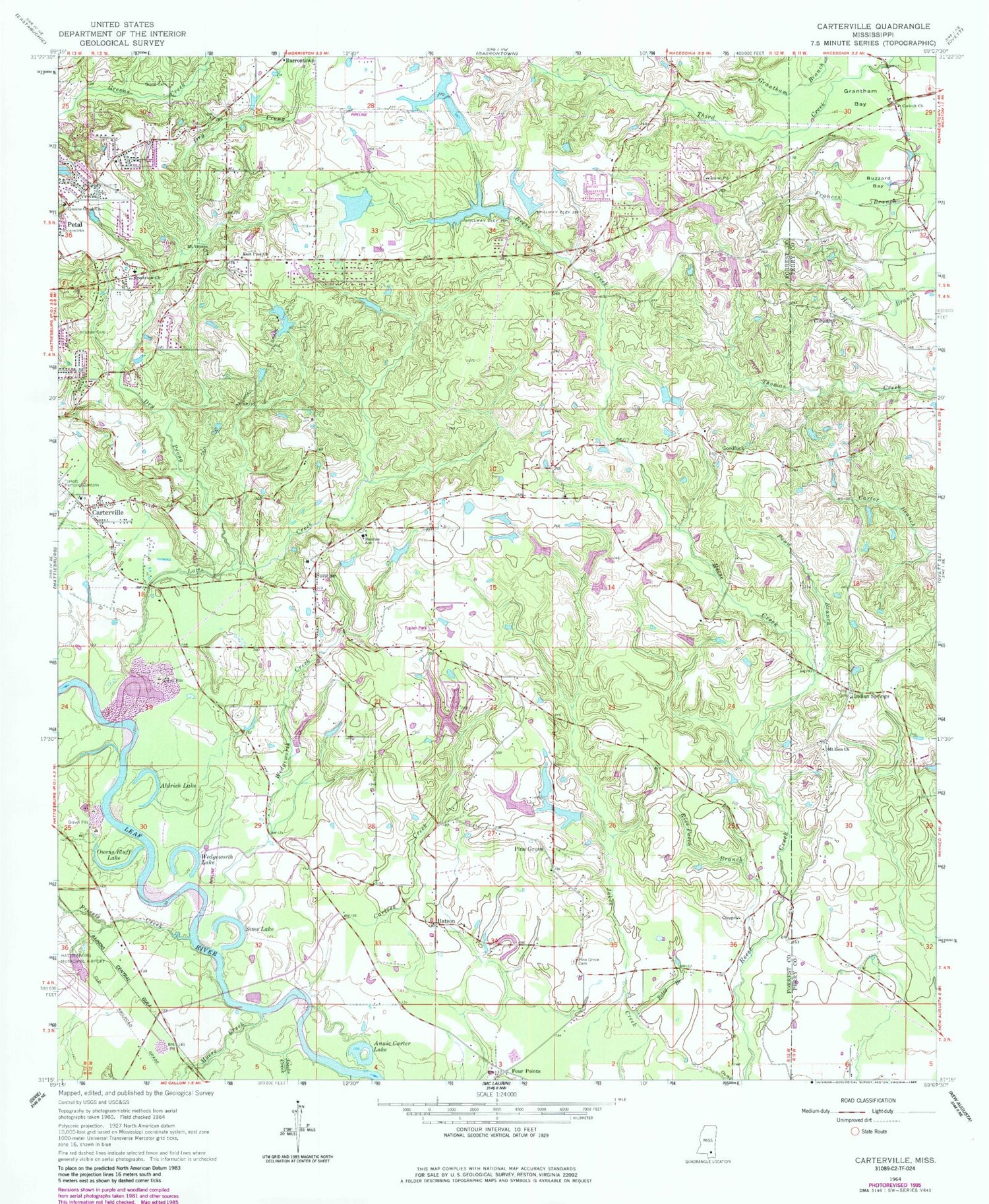
Classic USGS Carterville Mississippi 7.5'x7.5' Topo Map
Couldn't load pickup availability
Historical USGS topographic quad map of Carterville in the state of Mississippi. Map scale may vary for some years, but is generally around 1:24,000. Print size is approximately 24" x 27"
This quadrangle is in the following counties: Forrest, Perry.
The map contains contour lines, roads, rivers, towns, and lakes. Printed on high-quality waterproof paper with UV fade-resistant inks, and shipped rolled.
Contains the following named places: Aldrich Lake, Annie Carter Lake, Asbury United Methodist Church, Batson, Beach Church, Betsy Branch, Buzzard Bay, Calvary Baptist Church, Carters Creek, Carterville, Carterville Baptist Church, Church of Christ of Petal, City of Petal, Corinth, Corinth Church, Crestview Baptist Church, Dry Prong, E C Simmons Lake Dam, East Petal Baptist Church, East Pine Church, Eastside, Edwards Lake Dam, First Baptist Church of Petal, First Pentecostal Church, Forrest Memorial Gardens, Four Points, Gay's Mobile Home Park, Goodluck, Grant Cemetery, Grantham Bay, Greens Creek Baptist Church, H D and R Ranch Dam, H L Womack Lake Dam, Hillcrest Cemetery, Indian Springs, Indian Springs Baptist Church, Jacobs Creek, Jessie Bruce Pond Dam, Leo Turner Pond Dam, Lotts Creek, Lynn Ray Road Baptist Church, Mount Vernon Baptist Church, Mount Zion Church, Myers Creek, Owens Bluff Lake, Penn Branch, Petal Fire Department Station 3, Petal Recreational Club, Pine Grove, Pine Grove Cemetery, Piney Grove Missionary Baptist Church, Priests Creek, Rice Patch Branch, Rivers of Life Church, Sims Lake, Smith Pond Dam, Sunrise, Sunrise Baptist Church, Sunrise School, Sunrise Volunteer Fire Department, Supervisor District 3, Tom Ray Phillips Lake Dam, Twin Pines Country Club, Wedgeworth Creek, Wedgeworth Lake, ZIP Code: 39465


