MyTopo
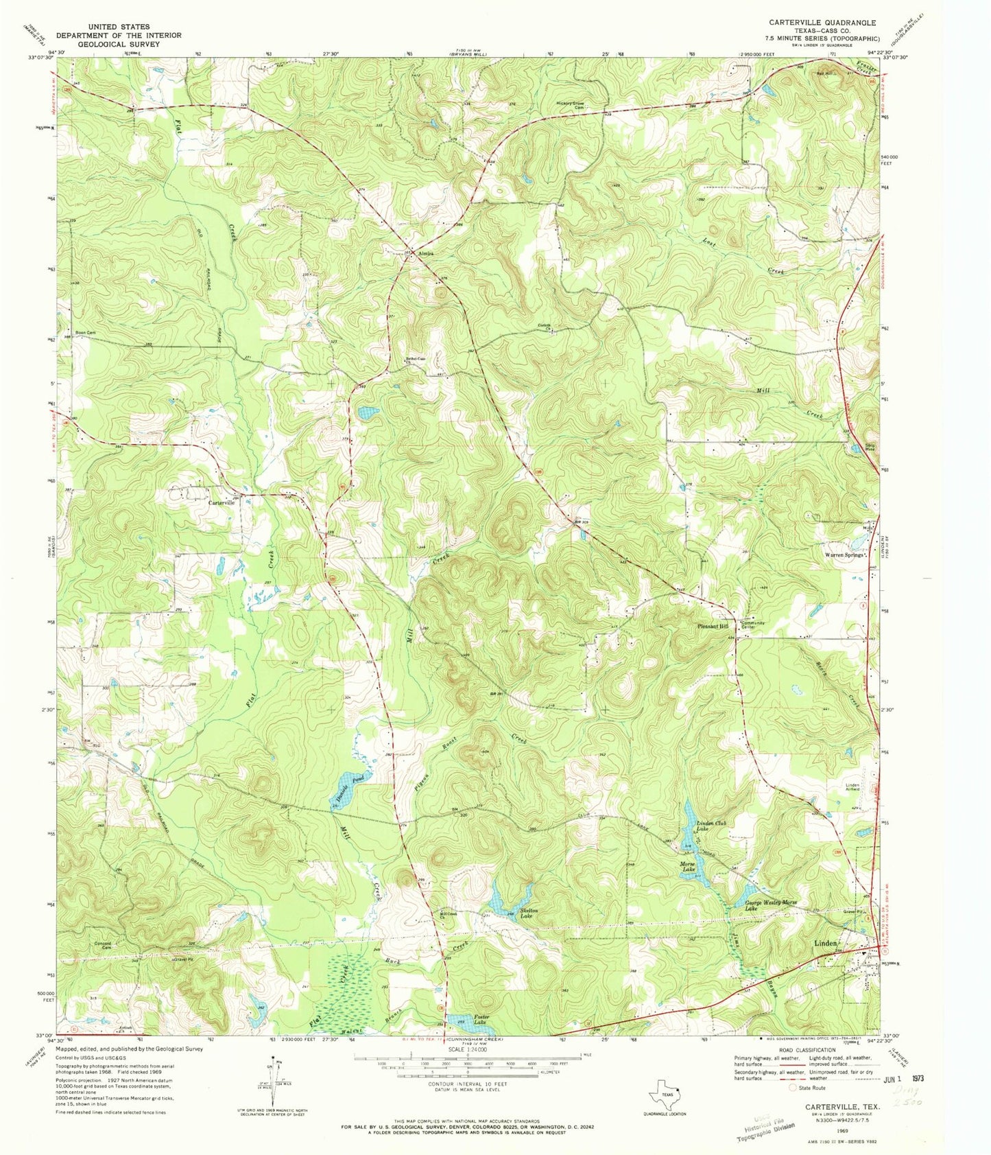
Classic USGS Carterville Texas 7.5'x7.5' Topo Map
Couldn't load pickup availability
Historical USGS topographic quad map of Carterville in the state of Texas. Typical map scale is 1:24,000, but may vary for certain years, if available. Print size: 24" x 27"
This quadrangle is in the following counties: Cass.
The map contains contour lines, roads, rivers, towns, and lakes. Printed on high-quality waterproof paper with UV fade-resistant inks, and shipped rolled.
Contains the following named places: Antioch Church, Bethel-Cass Church, Boon Cemetery, Buck Creek, Concord Cemetery, Corinth Church, Daniels Pond, George Wesley Morse Lake, Hickory Grove Cemetery, Linden Club Lake, Mill Creek, Mill Creek Church, Morse Lake, Pigeon Roost Creek, Skelton Lake, Walnut Branch, Foster Lake, Almira, Carterville, Pleasant Hill, Warren Springs, Boon/Lovelace Airport, Linden Club Dam, Skelton Lake Dam, Foster Lake Dam, Morse Dam, Cass County Jail, Cass County Sheriff's Office, Cass County Constable's Office Precinct 3, Cass County Constable's Office Precinct 1