MyTopo
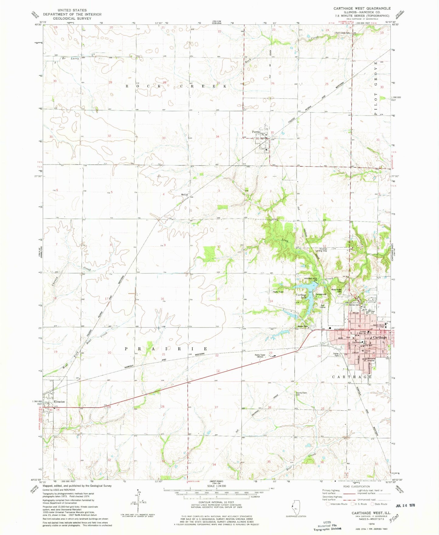
Classic USGS Carthage West Illinois 7.5'x7.5' Topo Map
Couldn't load pickup availability
Historical USGS topographic quad map of Carthage West in the state of Illinois. Map scale may vary for some years, but is generally around 1:24,000. Print size is approximately 24" x 27"
This quadrangle is in the following counties: Hancock.
The map contains contour lines, roads, rivers, towns, and lakes. Printed on high-quality waterproof paper with UV fade-resistant inks, and shipped rolled.
Contains the following named places: Barnes Cemetery, Carthage, Carthage City Hall, Carthage Courthouse Square Historic District, Carthage Fire Department, Carthage High School, Carthage Junior High School, Carthage Lake, Carthage Lake Number 2 Dam, Carthage Police Department, Carthage Post Office, Central Elementary School, City of Carthage, County Home Cemetery, Eagle School, Elvaston, Elvaston City Cemetery, Ferris, Ferris Post Office, Ferris School, First Baptist Church, First Christian Church, First United Methodist Church, First United Presbyterian Church, Grapevine School, Hancock County, Hancock County Courthouse, Hancock County Farm, Hancock County Sheriff's Office, Hanks Hangar Airport, Immaculate Conception Catholic Church, Jaycee Park, Lafayette School, Martins Airport, McCall, McCall School, Memorial Hospital Heliport, Moss Ridge Cemetery, Old Carthage Cemetery, Pioneer School, Plain Crazy Airport, Robert Morris Junior College, Rock Creek Cemetery, Schilson Field, Shiloh School, Township of Prairie, Trinity Lutheran Church, Union Douglas Elementary School, Village of Elvaston, Village of Ferris, WCAZ-AM (Carthage), WCAZ-FM (Carthage), Williams Airport, Young America School, ZIP Codes: 62334, 62336