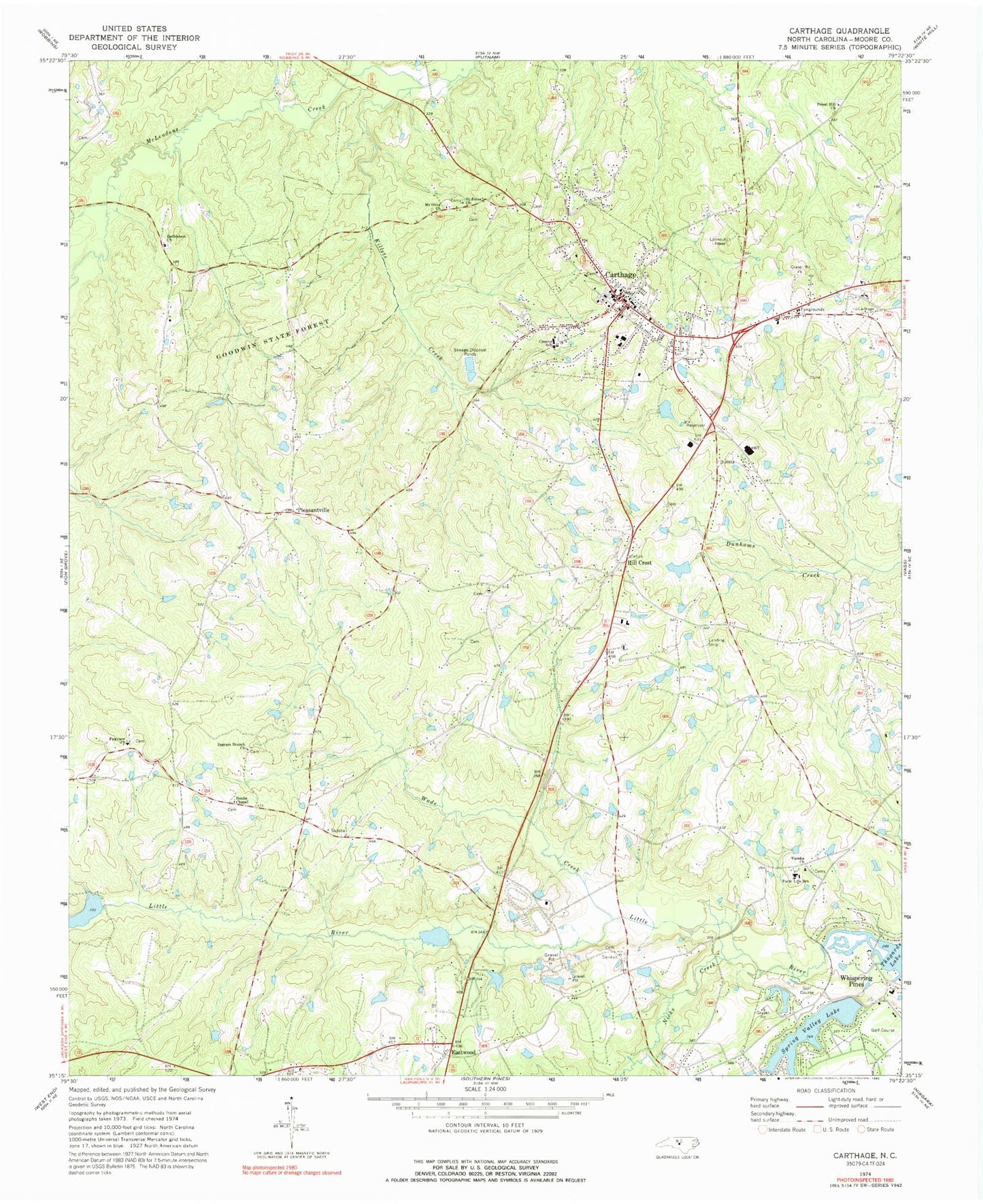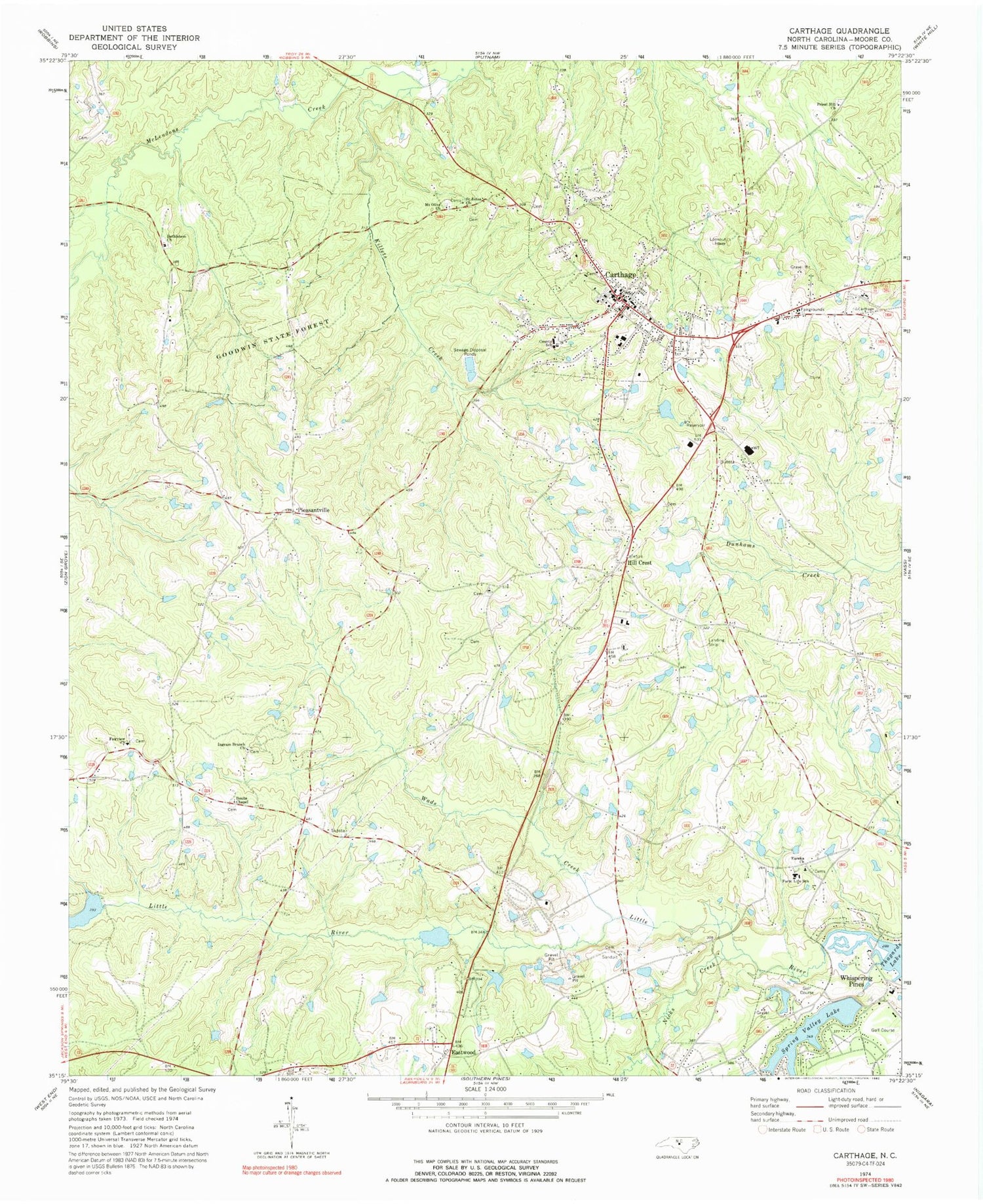
MyTopo
Classic USGS Carthage North Carolina 7.5'x7.5' Topo Map
Couldn't load pickup availability
Historical USGS topographic quad map of Carthage in the state of North Carolina. Typical map scale is 1:24,000, but may vary for certain years, if available. Print size: 24" x 27"
This quadrangle is in the following counties: Moore.
The map contains contour lines, roads, rivers, towns, and lakes. Printed on high-quality waterproof paper with UV fade-resistant inks, and shipped rolled.
Contains the following named places: Bethlehem Church, Doubs Chapel, Eureka Church, Fairview Church, Farm Life School, Goodwin State Forest, Ingram Branch Church, Killets Creek, Mount Olive Church, Nicks Creek, Pleasantville, Priest Hill Church, Saint Johns Church, Spring Valley Lake, Wads Creek, Spring Valley Lake Dam, Fly Rod Lake, Fly Rod Lake Dam, Long Leaf Lake, Long Leaf Lake Dam, Pine Lakes Shooting Preserve Lake, Shadow Lake, Shadow Lake Dam, Carthage Lake Dam Number Two, Carthage Lake Number Two, Carthage Elementary School, Moore County, Carthage, Hill Crest, Township 1-Carthage, Town of Carthage, Village of Whispering Pines, First Presbyterian Church, Eastwood Volunteer Fire Department, Carthage Fire Department, Gilliam - Mc Connell Airfield, Tobacco Road Airport, Carthage Rescue Squad, Whispering Pines Fire and Rescue Squad, Moore County Sheriff's Office, Carthage Police Department, Carthage Post Office