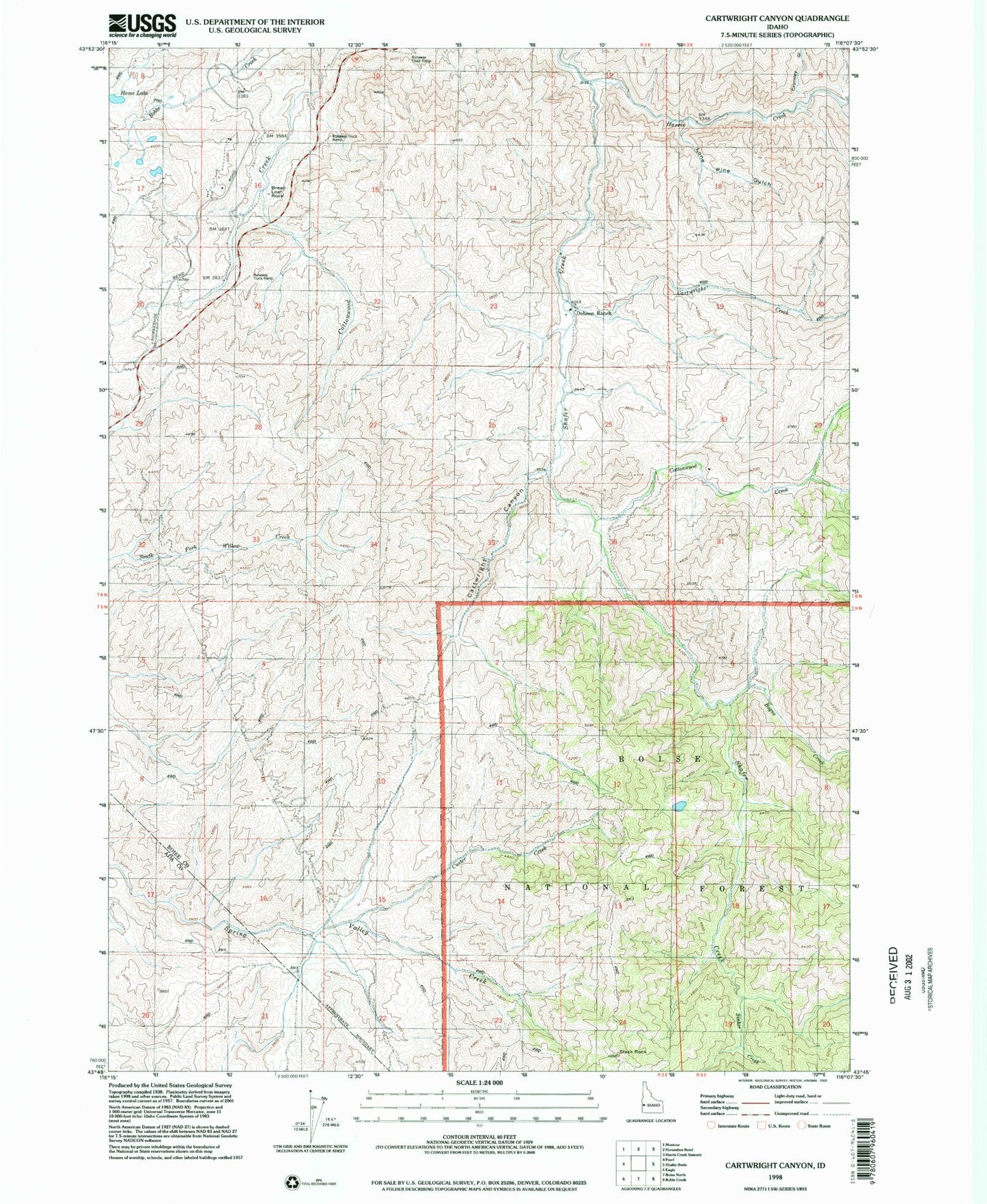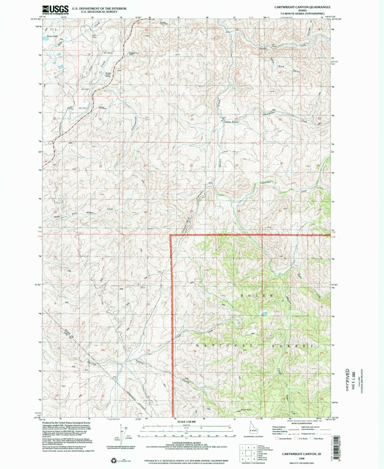
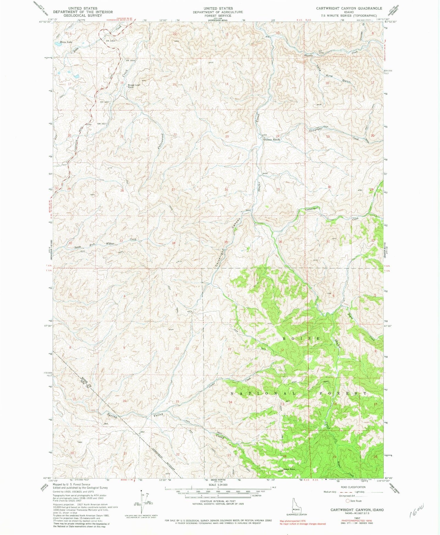
MyTopo
Classic USGS Cartwright Canyon Idaho 7.5'x7.5' Topo Map
Regular price
$16.95
Regular price
Sale price
$16.95
Unit price
per
Couldn't load pickup availability
Historical USGS topographic quad map of Cartwright Canyon in the state of Idaho. Map scale may vary for some years, but is generally around 1:24,000. Print size is approximately 24" x 27"
This quadrangle is in the following counties: Ada, Boise.
The map contains contour lines, roads, rivers, towns, and lakes. Printed on high-quality waterproof paper with UV fade-resistant inks, and shipped rolled.
Contains the following named places: Bogus Creek, Bread Loaf Rock, Cartwright Canyon, Cartwright Creek, Cottonwood Creek, Crumley Gulch, Custer Creek, Dobson Ranch, Harris Creek, Home Lake, Lone Pine Gulch, Loomis Airport, Sinker Creek, Stack Rock