MyTopo
Classic USGS Cartwright Texas 7.5'x7.5' Topo Map
Couldn't load pickup availability
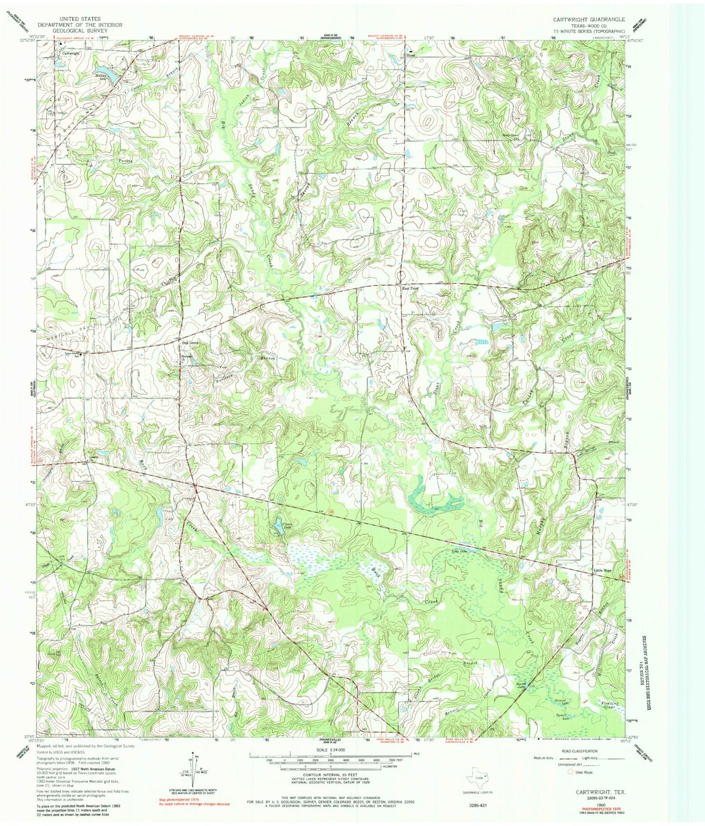
Historical USGS topographic quad map of Cartwright in the state of Texas. Map scale may vary for some years, but is generally around 1:24,000. Print size is approximately 24" x 27"
This quadrangle is in the following counties: Wood.
The map contains contour lines, roads, rivers, towns, and lakes. Printed on high-quality waterproof paper with UV fade-resistant inks, and shipped rolled.
Contains the following named places: Big Woods Spring Lake Dam, Buck Creek, Burleson Branch, Cartwright, Chicken Creek, Cooper Branch, Crones Pond, East Point, Ebenezer Church, Grinnel Lake, Homebrew Branch, Indian Creek, Jarred Branch, Liberty Church, Little Hope, Lone Grove School, Long Lake, Mansell Creek, Midway Lake, Midway Lake Dam, Mill Creek, Murphy Branch, Oak Grove, Pleasantville Branch Library, Rogers Branch, Round Lake, Sand Springs Branch, Scenic Woods Regional Library, Shady Grove Church, Slough Bridge Branch, Smith Branch Library, Stout, Stout Creek, Tarkill Lake, Turkey Creek, Tuttle Branch Library, Way Lake Oil Field, Young Branch Library