MyTopo
Classic USGS Carvers Bay South Carolina 7.5'x7.5' Topo Map
Couldn't load pickup availability
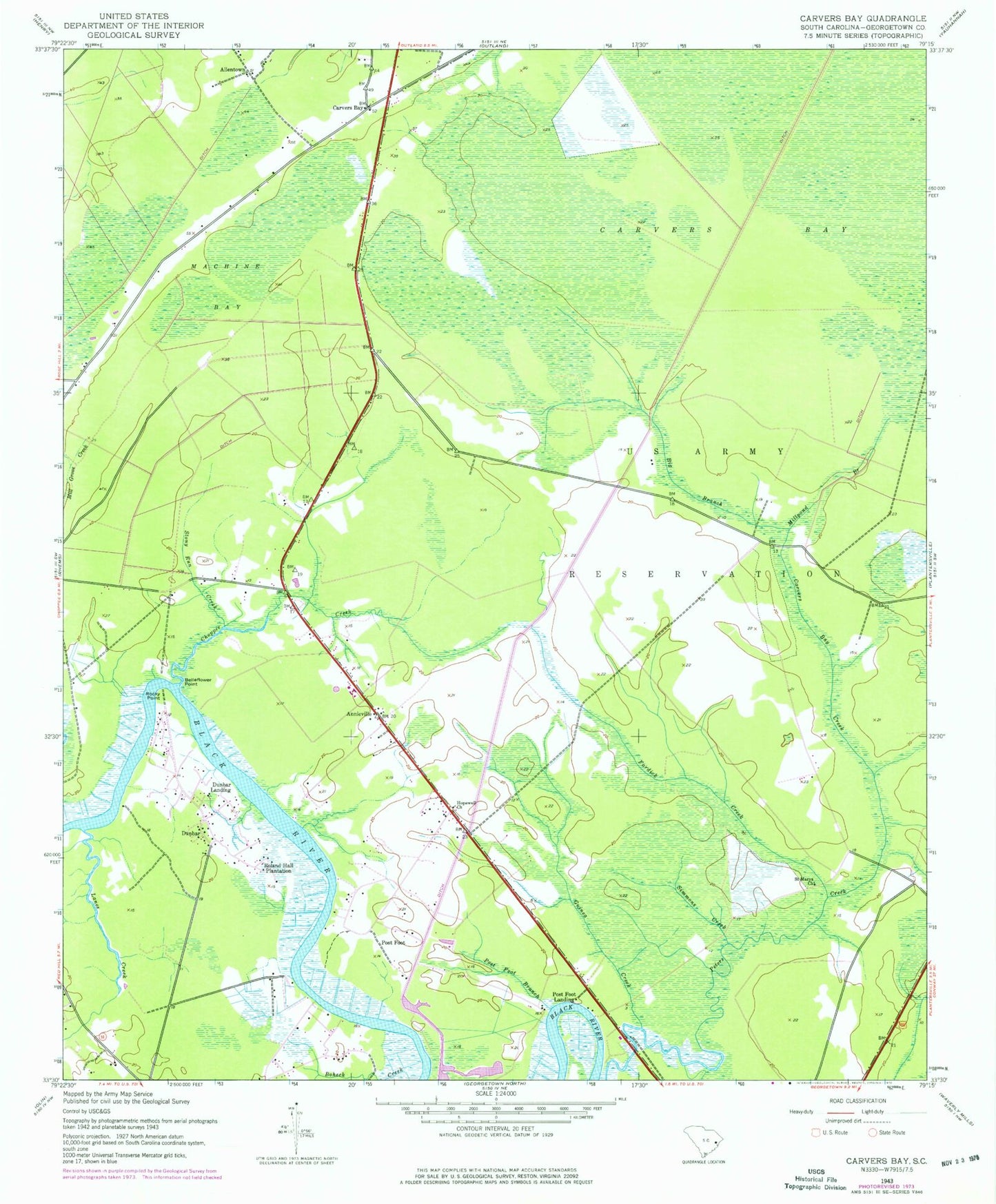
Historical USGS topographic quad map of Carvers Bay in the state of South Carolina. Map scale may vary for some years, but is generally around 1:24,000. Print size is approximately 24" x 27"
This quadrangle is in the following counties: Georgetown.
The map contains contour lines, roads, rivers, towns, and lakes. Printed on high-quality waterproof paper with UV fade-resistant inks, and shipped rolled.
Contains the following named places: Annie Village Church, Annie Village School, Annieville, Belleflower Point, Big Branch, Black River House One Pond Dam D-3591, Black River House Two Pond Dam D-3590, Black Swamp, Carvers Bay, Carvers Bay Creek, Carvers Bay High School, Carvers Bay Middle School, Choppee Creek, Choppee High School, Choppee Middle School, Dunbar, Dunbar Census Designated Place, Dunbar Landing, Dunbar School, Fardick Creek, Georgetown Fire Department Station 12, Georgetown Fire Department Station 3, Guinea Creek, Hopewell Church, Lanes Creek, Machine Bay, Millpond Branch, New Zion Church, Peters Creek, Post Foot, Post Foot Branch, Post Foot Landing, Rock Point Park, Rocky Point, Roland Hall Plantation, Saint Luke Senior Center, Saint Marys Church, Simmons Creek, Stony Run Creek