MyTopo
Classic USGS Carvers NW Nevada 7.5'x7.5' Topo Map
Regular price
$16.95
Regular price
Sale price
$16.95
Unit price
per
Couldn't load pickup availability
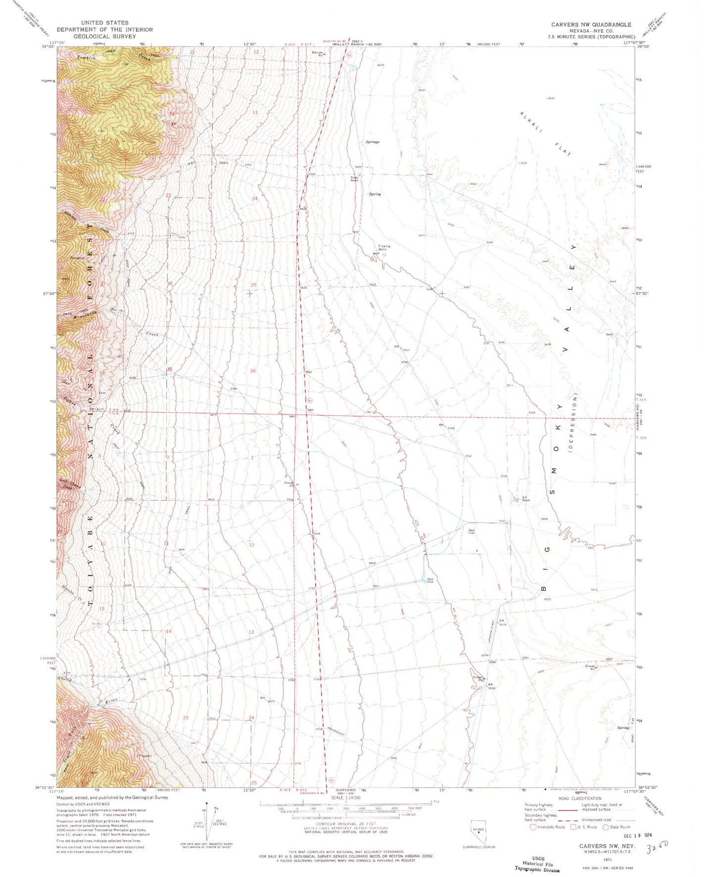
Historical USGS topographic quad map of Carvers NW in the state of Nevada. Map scale may vary for some years, but is generally around 1:24,000. Print size is approximately 24" x 27"
This quadrangle is in the following counties: Nye.
The map contains contour lines, roads, rivers, towns, and lakes. Printed on high-quality waterproof paper with UV fade-resistant inks, and shipped rolled.
Contains the following named places: Hercules Creek, Last Chance Creek, Milletts Ranch, North Twin River, Ophir Canyon, Ophir Creek, Ophir Tungsten Mill, R O Ranch, South Twin River, South Twin Trailhead, Sulphur Springs, Summit Creek, Tates Stage Station, Turks Ranch, Wisconsin Canon, Wisconsin Creek