MyTopo
Classic USGS Carvers Nevada 7.5'x7.5' Topo Map
Couldn't load pickup availability
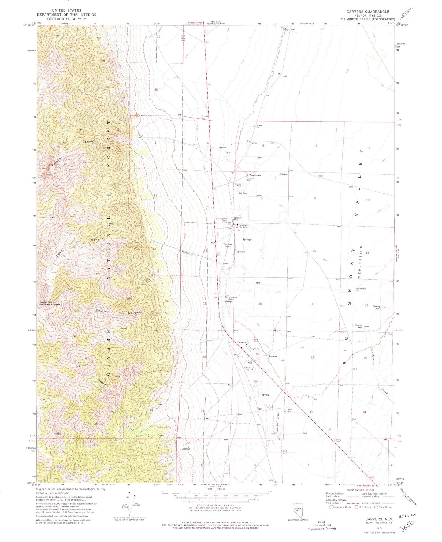
Historical USGS topographic quad map of Carvers in the state of Nevada. Map scale may vary for some years, but is generally around 1:24,000. Print size is approximately 24" x 27"
This quadrangle is in the following counties: Nye.
The map contains contour lines, roads, rivers, towns, and lakes. Printed on high-quality waterproof paper with UV fade-resistant inks, and shipped rolled.
Contains the following named places: Belcher Canyon, Bergs Ranch, Big Smoky Highway Maintenance Station, Broad Creek, Carvers, Carvers Roadside Rest Area, Cove Canyon, Darroughs Hot Springs, Darroughs Stage Station, Devils Canyon, Howard Ranch, Indian Creek, Jefferson Creek, M and O Ranch Airport, Niagara Canon, Round Mountain Township, Smokey Valley Ambulance Service, Smokey Valley Fire Department, Smoky Valley Forest Service Facility, Toiyabe Dome Southeast Summit, Twin River Ranch, Wine Glass Ranch Airport, Wineglass Ranch