
MyTopo
Classic USGS Caryville Florida 7.5'x7.5' Topo Map
Couldn't load pickup availability
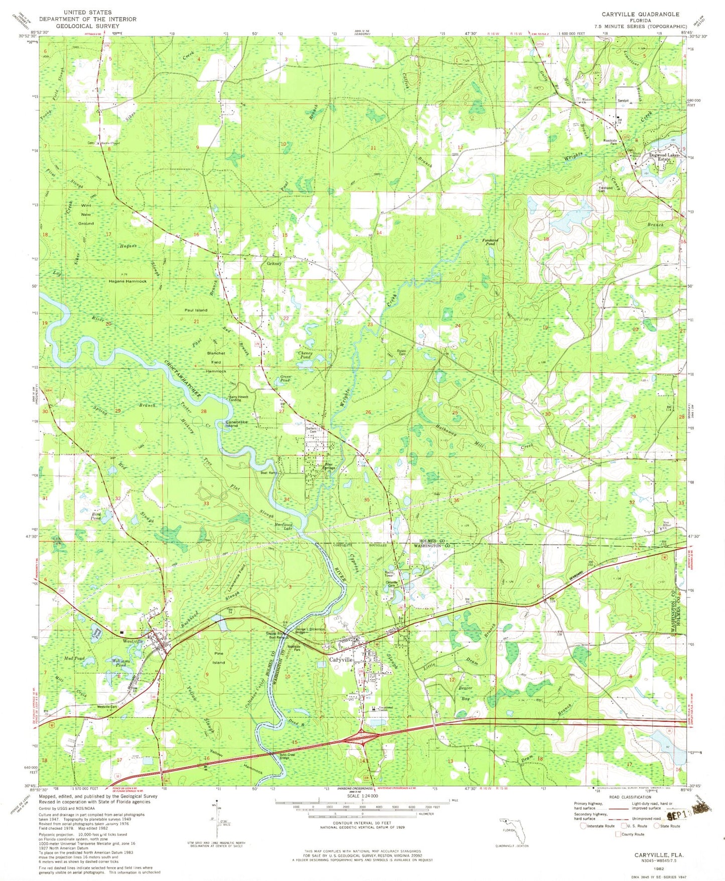
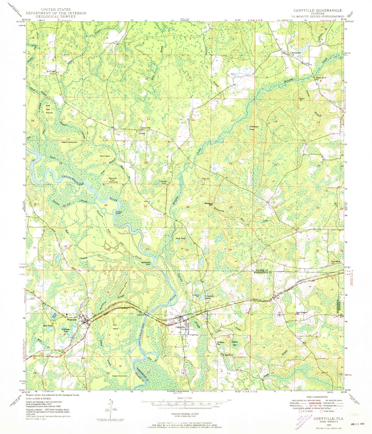
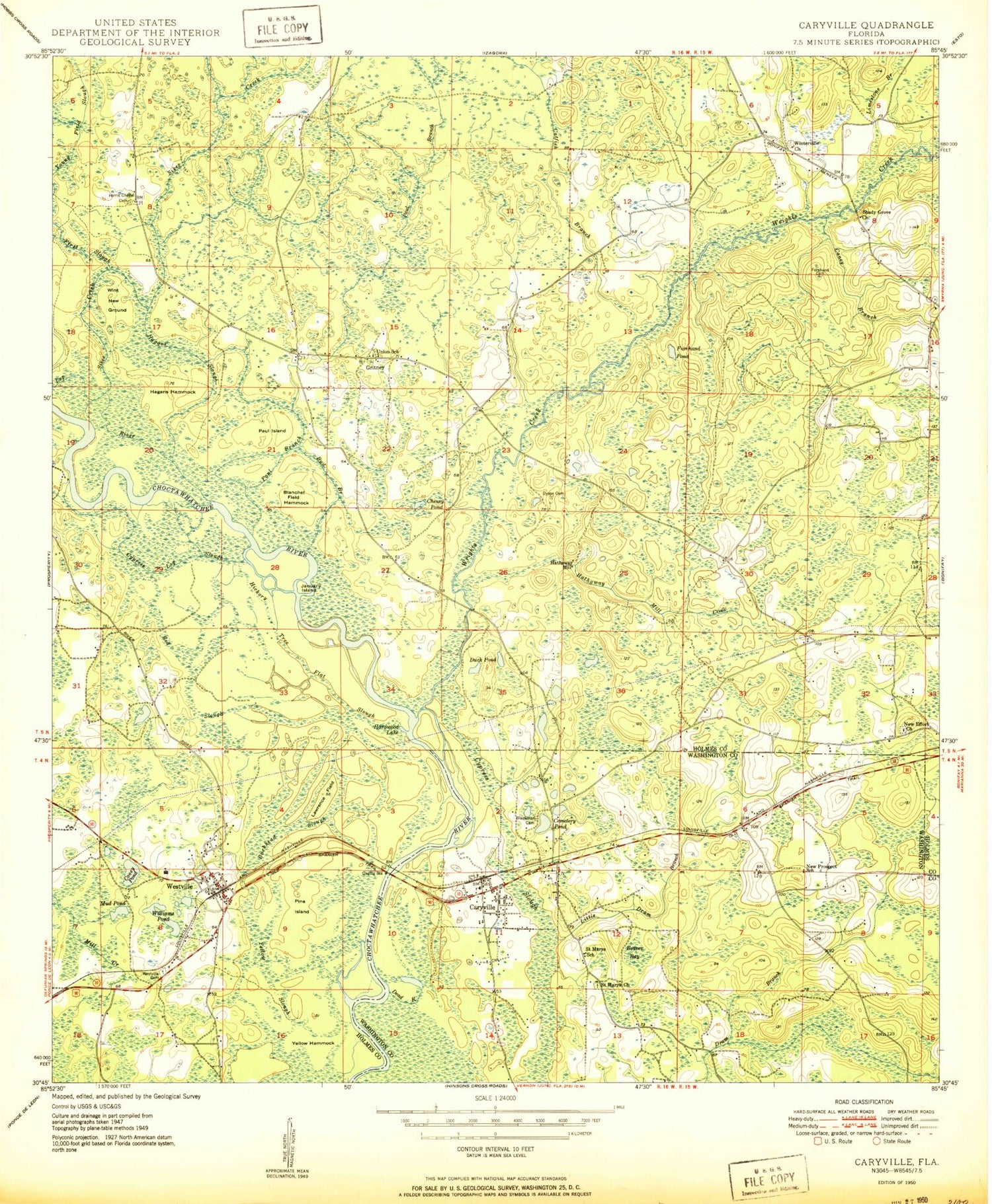
Historical USGS topographic quad map of Caryville in the state of Florida. Typical map scale is 1:24,000, but may vary for certain years, if available. Print size: 24" x 27"
This quadrangle is in the following counties: Holmes, Washington.
The map contains contour lines, roads, rivers, towns, and lakes. Printed on high-quality waterproof paper with UV fade-resistant inks, and shipped rolled.
Contains the following named places: Wrights Creek, Limestone Branch, Beaver Bay, Blackman Cemetery, Blanchet Field Hammock, Buckhead Slough, Bud Branch, Caney Branch, Catfish Branch, Cemetery Pond, Cheney Pond, Cooeg Pond, Spring Branch, Dead River, Duck Pond, Dyson Cemetery, First Slough, Forehand Cemetery, Forehand Pond, Gully Branch, Hagans Hammock, Hagans Slough, Hardwood Lake, Harris Chapel Cemetery, Hathaway Mill Creek, Hickory Tree Flat Slough, Canebrake Island, Lawrence Field, Little Dram Branch, Log River, Mill Branch, Mill Creek, Mud Pond, New Effort Church, New Prospect School, Paul Branch, Paul Branch, Paul Island, Pine Island, Red Slough, Saint Marys Church, Saint Marys School, Shady Grove Church, Sikes Creek, Union School, Westville, Westville Cemetery, Williams Pond, Wint New Ground, Winterville Church, Yellow Hammock, Yellow Slough, Young Field Slough, Caryville, Gritney, Hathaway Mill, Holmes County, Cooney Pond, Mac Steverson Pond, A Bar H Ranch Pond, Prosperity Elementary School, Gritney Church, Union Church, Riverside School, WJED-FM (Dogwood Lakes Estate), Town of Caryville, Town of Westville, Green Pond, Gritney Fire Department, Westville Volunteer Fire Department, Caryville Volunteer Fire Department, Holmes County Emergency Medical Services Station 2, Garner Field, Caryville Post Office, Westville Post Office, Wrights Creek, Limestone Branch, Beaver Bay, Blackman Cemetery, Blanchet Field Hammock, Buckhead Slough, Bud Branch, Caney Branch, Catfish Branch, Cemetery Pond, Cheney Pond, Cooeg Pond, Spring Branch, Dead River, Duck Pond, Dyson Cemetery, First Slough, Forehand Cemetery, Forehand Pond, Gully Branch, Hagans Hammock, Hagans Slough, Hardwood Lake, Harris Chapel Cemetery, Hathaway Mill Creek, Hickory Tree Flat Slough, Canebrake Island, Lawrence Field, Little Dram Branch, Log River, Mill Branch, Mill Creek, Mud Pond, New Effort Church, New Prospect School, Paul Branch, Paul Branch, Paul Island, Pine Island, Red Slough, Saint Marys Church, Saint Marys School, Shady Grove Church, Sikes Creek, Union School, Westville, Westville Cemetery, Williams Pond, Wint New Ground, Winterville Church, Yellow Hammock, Yellow Slough, Young Field Slough, Caryville, Gritney, Hathaway Mill, Holmes County, Cooney Pond, Mac Steverson Pond, A Bar H Ranch Pond, Prosperity Elementary School, Gritney Church, Union Church, Riverside School, WJED-FM (Dogwood Lakes Estate), Town of Caryville, Town of Westville, Green Pond, Gritney Fire Department, Westville Volunteer Fire Department, Caryville Volunteer Fire Department, Holmes County Emergency Medical Services Station 2, Garner Field, Caryville Post Office, Westville Post Office