MyTopo
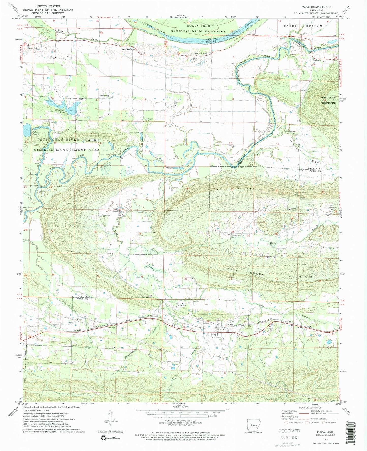
Classic USGS Casa Arkansas 7.5'x7.5' Topo Map
Couldn't load pickup availability
Historical USGS topographic quad map of Casa in the state of Arkansas. Map scale may vary for some years, but is generally around 1:24,000. Print size is approximately 24" x 27"
This quadrangle is in the following counties: Conway, Perry, Pope, Yell.
The map contains contour lines, roads, rivers, towns, and lakes. Printed on high-quality waterproof paper with UV fade-resistant inks, and shipped rolled.
Contains the following named places: A J's Airport, Bata Mill Cemetery, Big Creek, Bostic School, Bryant Cove, Bryant Cove Cemetery, Bryants Cove, Casa, Casa Post Office, Casa Volunteer Fire Department, Cotton Town, Cove Mountain, Fitch Cemetery, Grace Creek, Hambright Creek, Harris Cemetery, Hickory Grove Church, Kingfisher Lake, Kingfisher Lake Dam, Liberty Hall Church, Massey School, McGee Creek, Mill Creek, Needmore Cemetery, Needmore School, New Neely, Perry-Casa Elementary School, Perry-Casa High School, Pond Creek, Pond Creek Lake Dam, Pontoon, Rose Creek, Rose Lake, Sadler Bend, Saint Patricks Church, Slaty Crossing, Slaty Crossing Catholic Cemetery, Slaty Crossing Church, South View Church, Southview School, Sweet Home Cemetery, Sweet Home Church, Teal School, Town of Casa, Township of Casa, Township of Galla Rock, Township of Mason, Township of Petit Jean, Township of Rose Creek, Township of South View, Township of Wilson