MyTopo
USGS Classic Cascade Pass Washington 7.5'x7.5' Topo Map
Couldn't load pickup availability
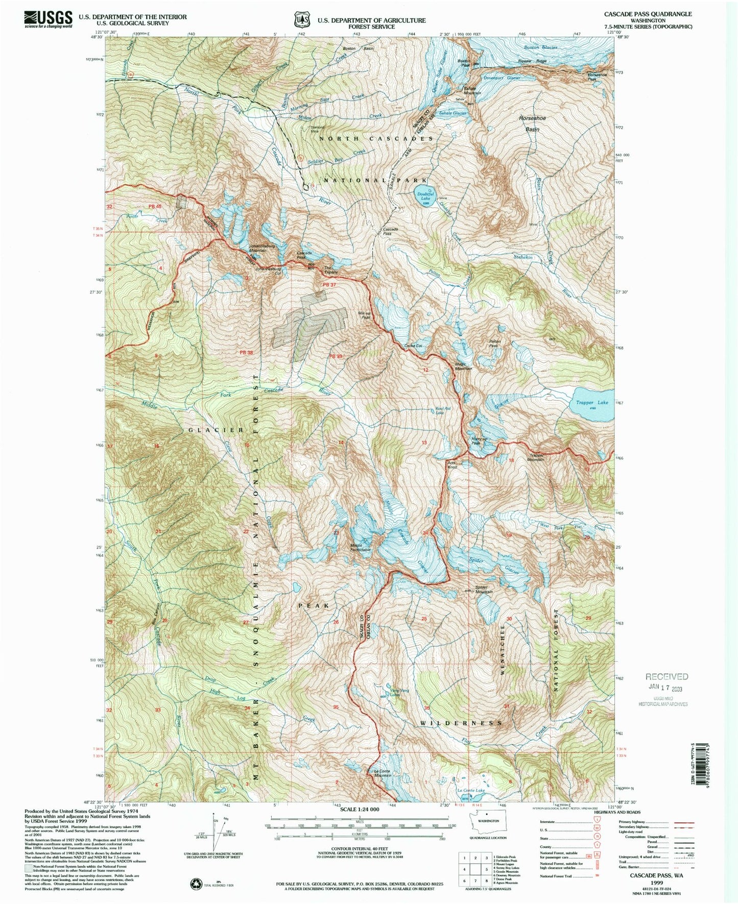
Historical USGS topographic quad map of Cascade Pass in the state of Washington. Scale: 1:24000. Print size: 24" x 27"
This quadrangle is in the following counties: Chelan, Skagit.
The map contains contour lines, roads, rivers, towns, lakes, and grids including latitude / longitude and UTM / MGRS. Printed on high-quality waterproof paper with UV fade-resistant inks.
Contains the following named places: Arts Knoll, Basin Creek, Boston Creek, Boston Peak, Box Canyon, Cache Col, Cascade Pass, Cascade Peak, Cleve Creek, Davenport Glacier, Diamond Mine, Doubtful Creek, Doubtful Lake, Drop Creek, Eldorado Creek, Mount Formidable, Gilbert Creek, High Log Creek, Horseshoe Basin, Horseshoe Peak, Hurry-up Peak, Johannesburg Col, Johannesburg Mountain, Kool-Aid Lake, Le Conte Lake, Le Conte Mountain, Magic Mountain, Midas Creek, Middle Cascade Glacier, Milt Creek, Mix-up Peak, Morning Star Creek, Pelton Creek, Pelton Peak, Quien Sabe Glacier, Ripsaw Ridge, Sahale Arm, Sahale Glacier, Sahale Mountain, Soldier Boy Creek, South Glacier, Spider Glacier, Spider Mountain, The Triplets, Trapper Lake, Trapper Mountain, Yang Yang Lakes, Yawning Glacier, S Glacier, Boston Glacier Research Natural Area, Pelton Lake, Sprenger Spires (not official)