MyTopo
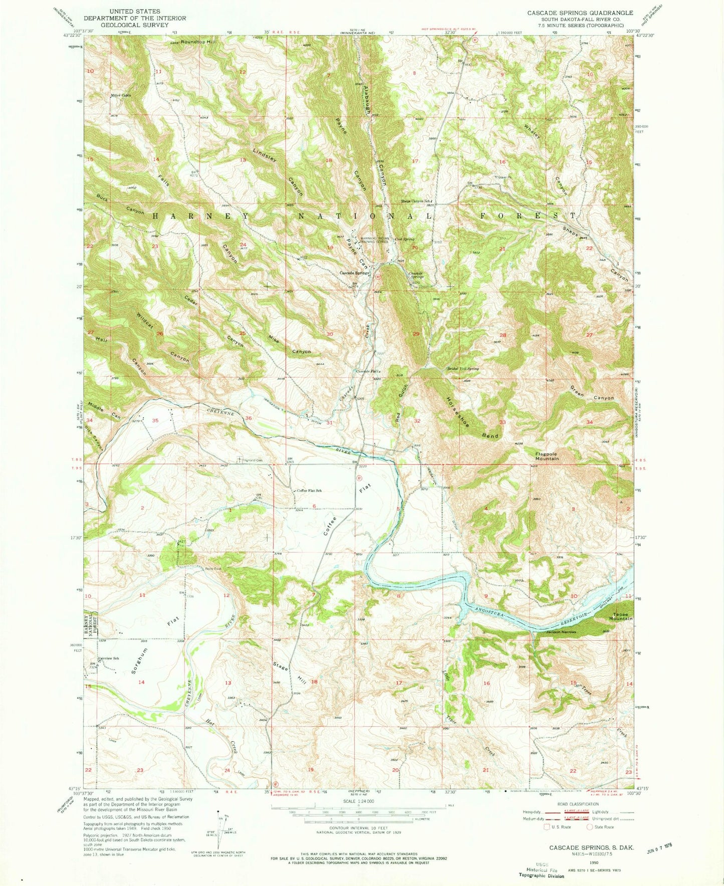
Classic USGS Cascade Springs South Dakota 7.5'x7.5' Topo Map
Couldn't load pickup availability
Historical USGS topographic quad map of Cascade Springs in the state of South Dakota. Map scale may vary for some years, but is generally around 1:24,000. Print size is approximately 24" x 27"
This quadrangle is in the following counties: Fall River.
The map contains contour lines, roads, rivers, towns, and lakes. Printed on high-quality waterproof paper with UV fade-resistant inks, and shipped rolled.
Contains the following named places: Alabaugh Canyon, Brainerd Indian Training School, Bridal Veil Spring, Buck Canyon, Cascade Creek, Cascade Falls, Cascade Fire Department, Cascade Springs, Cedar Canyon, Coffee Flat, Coffee Flat School, Cool Spring, Dick Canyon, Fairview School, Falls Canyon, Flagpole Mountain, Hat Creek, Hell Canyon, Highland Cemetery, Horseshoe Bend, J H Keith Memorial Picnic Area, Jackson Narrows, Lindsley Canyon, Little Tepee Creek, Middle Canyon, Mike Canyon, Miller Cabin, Payne Canyon, Red Gulch, Rocky Ford, Roundtop Hill, Sheps Canyon School, Sorghum Flat, Stage Hill, Tepee Creek, Whaley Canyon, Wildcat Canyon