MyTopo
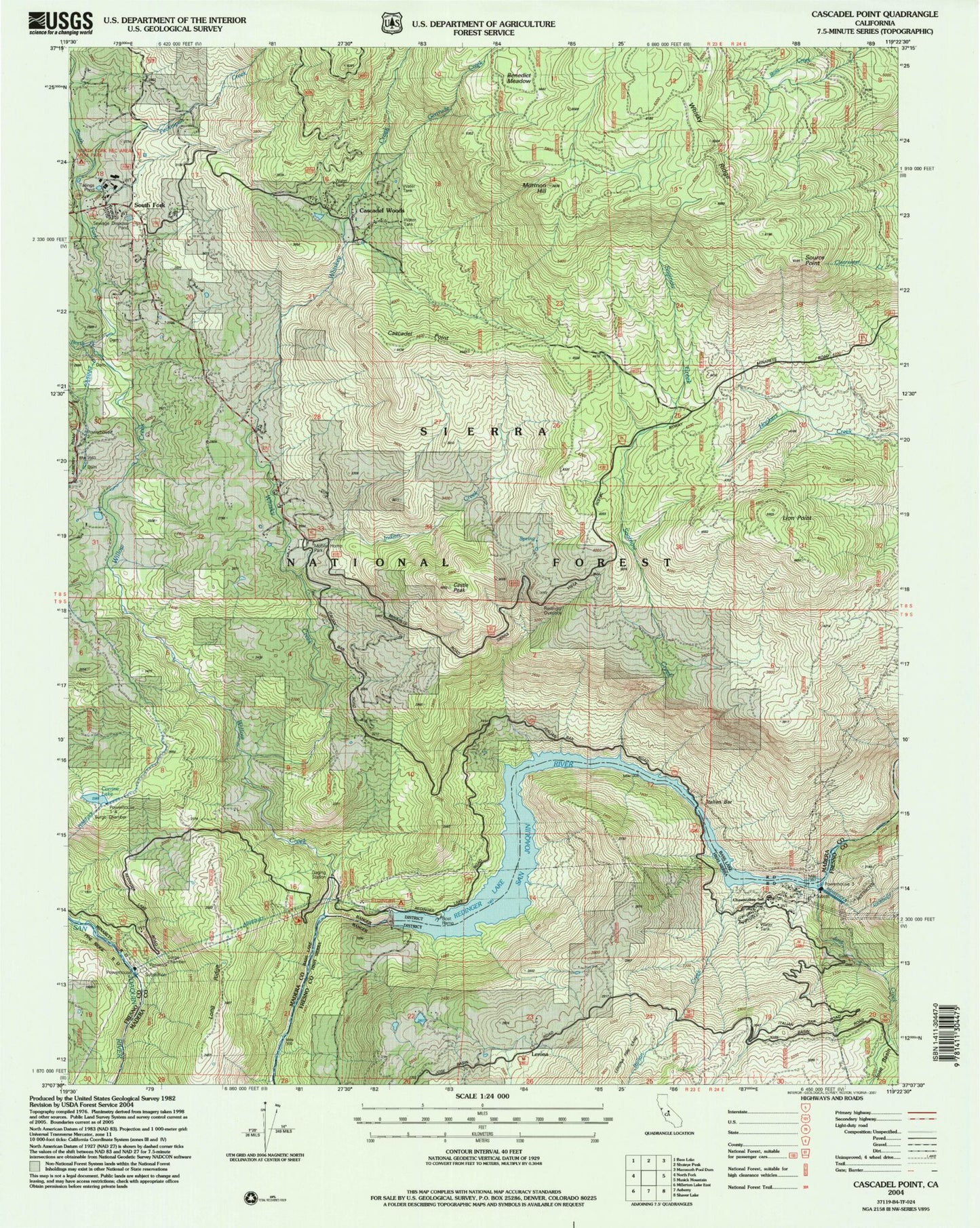
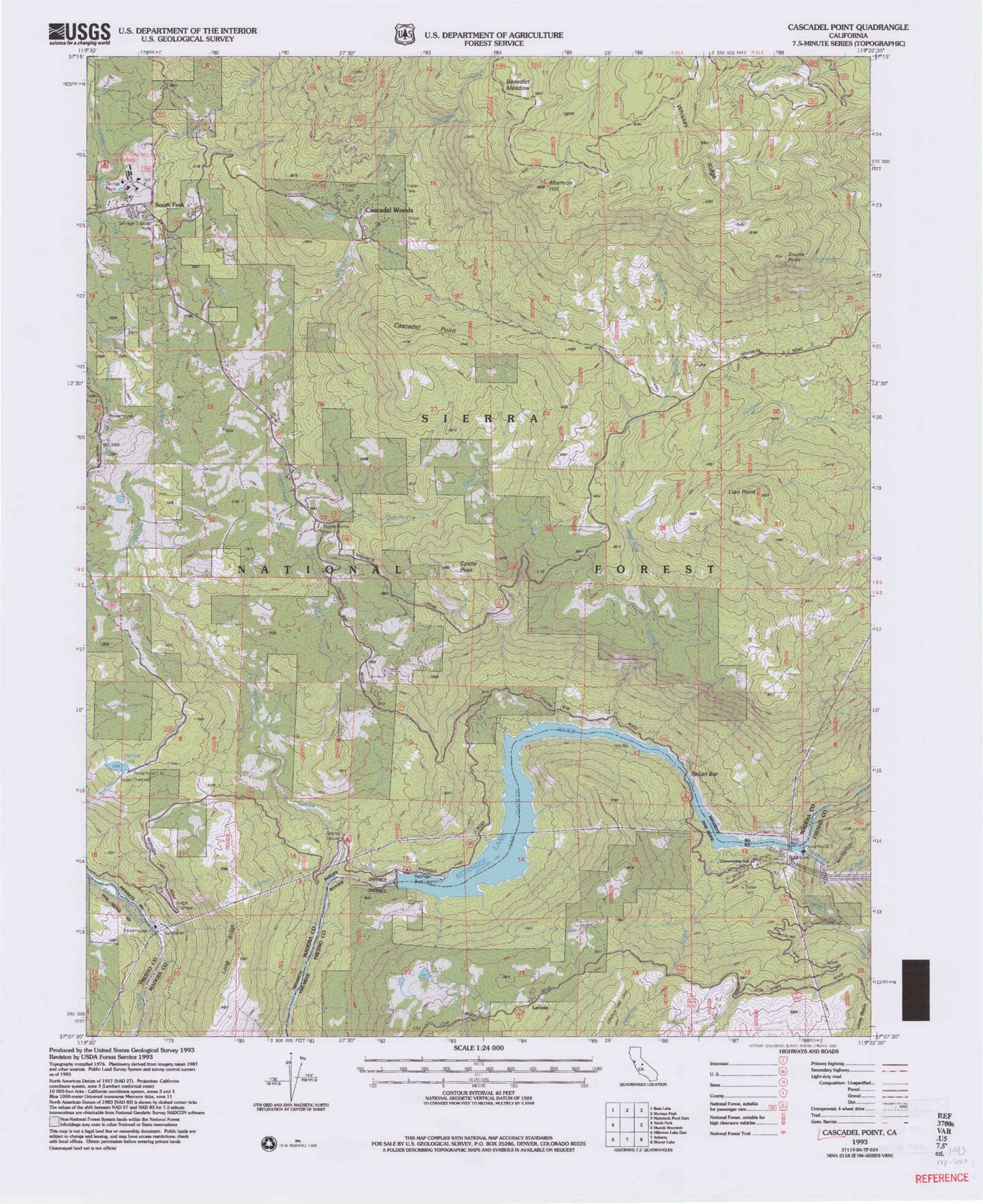
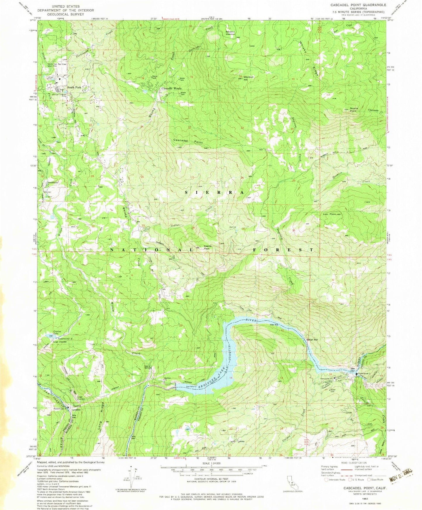
Classic USGS Cascadel Point California 7.5'x7.5' Topo Map
Couldn't load pickup availability
Historical USGS topographic quad map of Cascadel Point in the state of California. Map scale may vary for some years, but is generally around 1:24,000. Print size is approximately 24" x 27"
This quadrangle is in the following counties: Fresno, Madera.
The map contains contour lines, roads, rivers, towns, and lakes. Printed on high-quality waterproof paper with UV fade-resistant inks, and shipped rolled.
Contains the following named places: Benedict Meadow, Big Creek Number 7 104-022 Dam, Cascadel Point, Cascadel Ranch, Cascadel Woods, Castle Peak, Chawanakee School, Corrine Lake, Gertrude Creek, Indian Creek, Italian Creek, Itallan Bar, Jose Creek, Lerona, Lion Point, Long Ridge, Mill Creek, Mormon Hill, North Fork Indian Mission, North Fork Recreation Area Memorial Park, North Fork Willow Creek, Number 1 Forebay 95-004 Dam, Peckinpah Creek, Pine Grove Mine, Pitcher Creek, Powerhouse, Powerhouse Number One A, Redinger Boat Ramp, Redinger Lake, Saginaw Creek, Source Point, South Fork, South Fork Willow Creek, Whisky Creek, Willow Creek, ZIP Code: 93643