
MyTopo
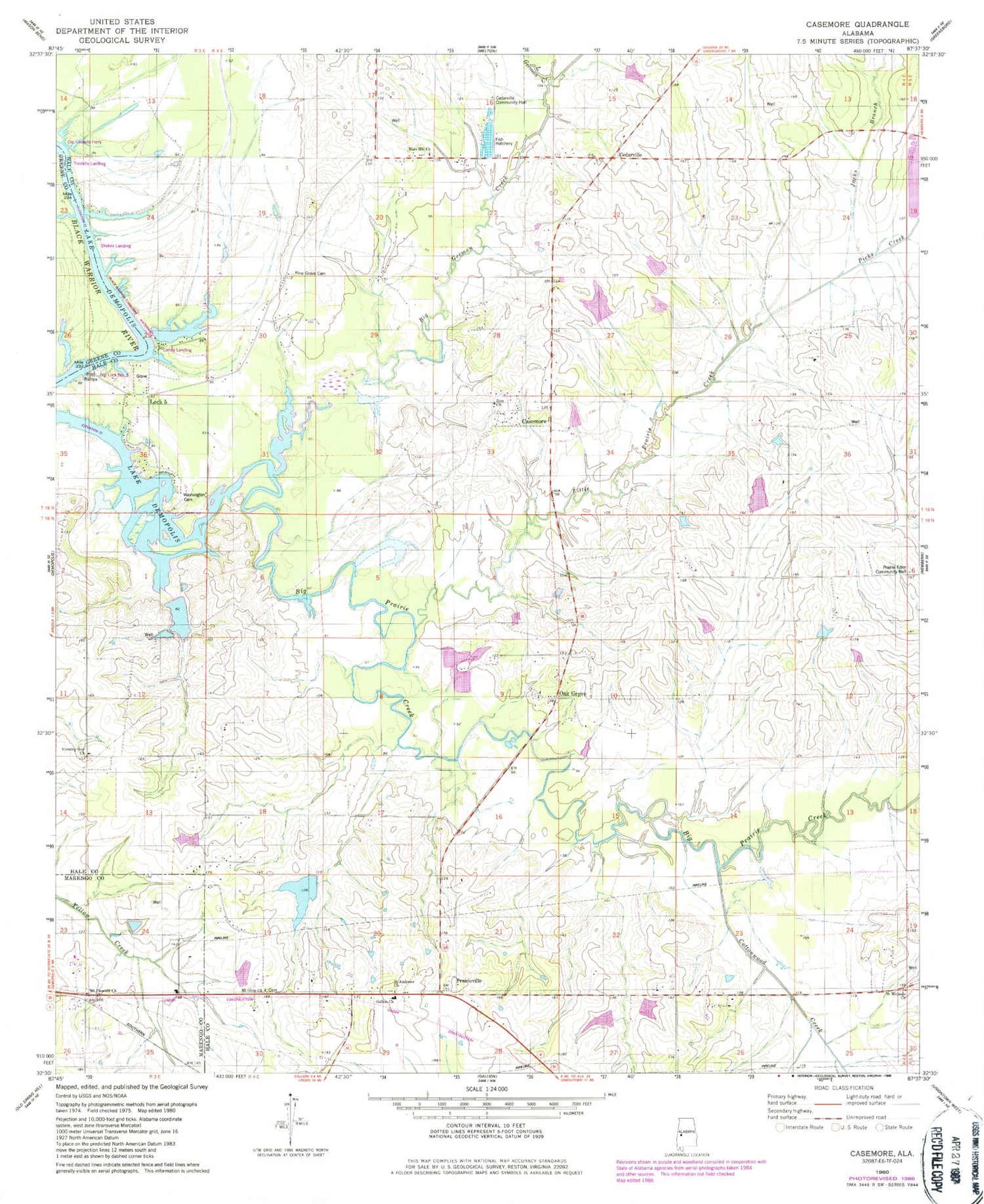
Classic USGS Casemore Alabama 7.5'x7.5' Topo Map
Couldn't load pickup availability
Historical USGS topographic quad map of Casemore in the state of Alabama. Map scale may vary for some years, but is generally around 1:24,000. Print size is approximately 24" x 27"
This quadrangle is in the following counties: Greene, Hale, Marengo.
The map contains contour lines, roads, rivers, towns, and lakes. Printed on high-quality waterproof paper with UV fade-resistant inks, and shipped rolled.
Contains the following named places: Big German Creek, Candys Landing, Casemore, Casemore Cemetery, Casemore School, Cedarville, Cedarville Community Hall, Cottonwood Creek, Drakes Landing, Drakes Landing Ferry, Dunlap Landing, Eaton Cemetery, Emory School, Evening Star Cemetery, Evening Star Church, Evening Star School, Fitzgerald Lake, Gallion Baptist Church, Gallion Post Office, Gallion Volunteer Fire Department, Jacks Branch, Johnson Cane Brake Church, Lewis Lawson Dam, Lewis Lawson Pond, Little German Creek, Little Prairie Creek, Lock 5 School, Lock Five, Lock Number Five Left Bank Public Use Area, M J Fitzgerald Dam, Mars Hill Church, Mary Grote Church, Micken Cemetery, Mount Olive Baptist Church, Mount Olive Cemetery, Mount Pleasant Church, Newbern Division, Oak Grove, Oak Grove Baptist Church, Oak Grove Cemetery, Oak Grove School, Old Lock Number Five, Old Tindells Ferry, Pickens Cemetery, Picks Creek, Pine Grove Cemetery, Praine Chapel, Prairie Eden Community Hall, Prairieville, Rosenwald School, Saint Andrews Cemetery, Saint Andrews Church, Saint Michaels Church, Saint Michaels School, Tindells Bar, Tindells Landing, Union Chapel, Washington Cemetery, Willis - Scott Cemetery, Zion Church


