MyTopo
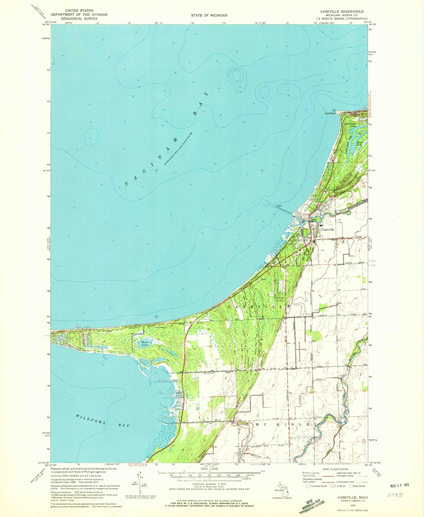
Classic USGS Caseville Michigan 7.5'x7.5' Topo Map
Couldn't load pickup availability
Historical USGS topographic quad map of Caseville in the state of Michigan. Map scale may vary for some years, but is generally around 1:24,000. Print size is approximately 24" x 27"
This quadrangle is in the following counties: Huron.
The map contains contour lines, roads, rivers, towns, and lakes. Printed on high-quality waterproof paper with UV fade-resistant inks, and shipped rolled.
Contains the following named places: Beadle Marina, Calvary Baptist Church, Campau Drain, Caseville, Caseville County Park, Caseville Family Medicine Clinic, Caseville Fire Department, Caseville High School, Caseville Municipal Harbor, Caseville Police Department, Caseville Post Office, Caseville Station, Caseville Township Cemetery, Caseville Township Hall, Caseville United Methodist Church, City of Caseville, Doerr Lake, Farver Field, Good Shepherd Lutheran Church, Hamricks Resort, Hayes Church, Hayes Post Office, Hidden Harbour Golf Course, Huron County Park, Huron Yacht Club, Lakeside Marina, Little Doerr Lake, McKinley Drain, Methodist Episcopal Church Historical Marker, Mud Creek, Mud Lake, Newman Drain, Oak Point, Oak Point Lake, Pigeon River, Saginaw Bay Marina, Saint Johns Church, Saint Roch Cemetery, Saint Roch Church, Scenic Golf and Country Club, Thiel Farms, Township of Caseville, Wild Fowl Bay