MyTopo
Classic USGS Cash Arkansas 7.5'x7.5' Topo Map
Couldn't load pickup availability
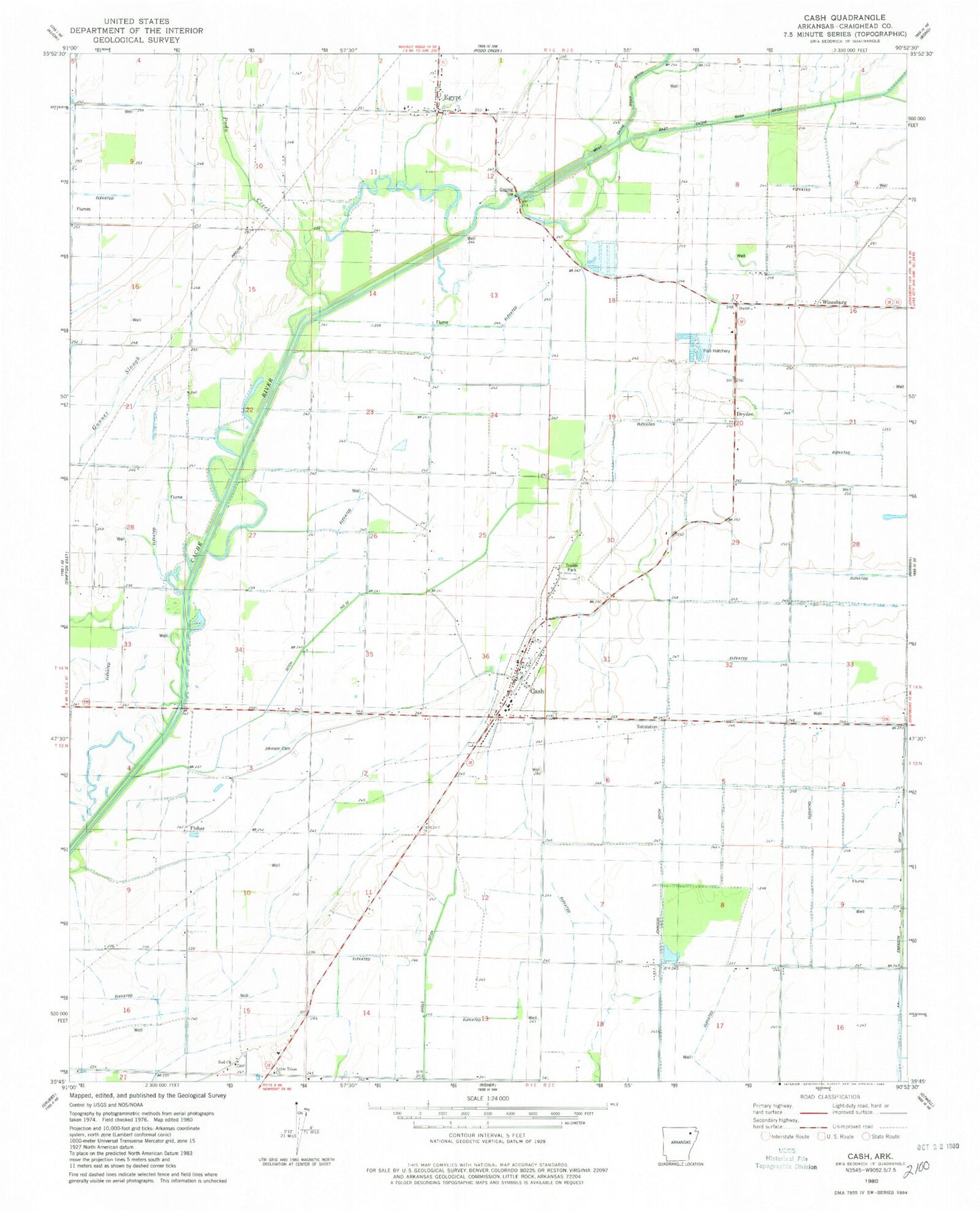
Historical USGS topographic quad map of Cash in the state of Arkansas. Map scale may vary for some years, but is generally around 1:24,000. Print size is approximately 24" x 27"
This quadrangle is in the following counties: Craighead.
The map contains contour lines, roads, rivers, towns, and lakes. Printed on high-quality waterproof paper with UV fade-resistant inks, and shipped rolled.
Contains the following named places: Cash, Cash Fire Department, Cash Post Office, Cash School, Ditch Number 32, Dryden, Egypt, Egypt Post Office, Egypt School, Egypt Volunteer Fire Department, Fisher, Fowler Ford, Gunner Slough, Hickory Ridge Church, Jimmy Ridge, Johnson Cemetery, Johnson Ditch Lateral Number 3, Little Texas Church, Logan Bridge, Logans Ferry, Over The Top Aviation, Podo Creek, Red Church, Red School, Riggs, Three Way, Town of Cash, Town of Egypt, Township of Little Texas, Township of Promised Land, Township of Texas, Winesburg, ZIP Codes: 72421, 72427