MyTopo
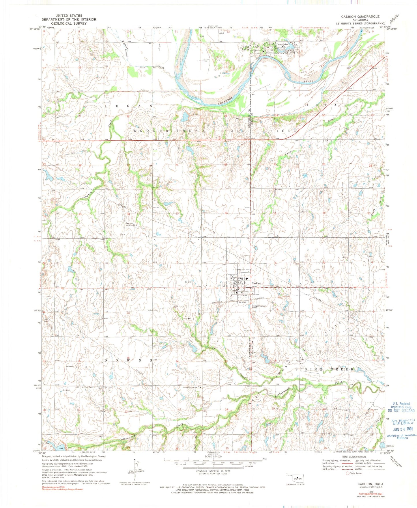
Classic USGS Cashion Oklahoma 7.5'x7.5' Topo Map
Couldn't load pickup availability
Historical USGS topographic quad map of Cashion in the state of Oklahoma. Map scale may vary for some years, but is generally around 1:24,000. Print size is approximately 24" x 27"
This quadrangle is in the following counties: Kingfisher, Logan.
The map contains contour lines, roads, rivers, towns, and lakes. Printed on high-quality waterproof paper with UV fade-resistant inks, and shipped rolled.
Contains the following named places: Campbell Creek, Cashion, Cashion Cemetery, Cashion Elementary School, Cashion Fire Station, Cashion High School Ag Farm, Cashion Police Department, Cashion Post Office, Chuck's Private Airstrip, Cottonwood Creek Site 11 Dam, Cottonwood Creek Site 11 Reservoir, Cottonwood Creek Site 12 Dam, Cottonwood Creek Site 12 Reservoir, Cottonwood Creek Site 15 Dam, Cow Creek, Lockhart Field, Mercy Cemetery, Mount Zion Cemetery, Oknoname 07301 Dam, Oknoname 07301 Reservoir, Oknoname 07302 Dam, Oknoname 07302 Reservoir, Oknoname 07304 Dam, Oknoname 07304 Reservoir, Oknoname 07305 Dam, Oknoname 07305 Reservoir, Oknoname 07306 Dam, Oknoname 07306 Reservoir, Oknoname 18 Dam, Oknoname 18 Reservoir, Town of Cashion, Township of Downs, Township of Logan, Twin Lakes, Twin Lakes Census Designated Place, Twin Lakes Volunteer Fire Department, Walnut Creek, West Edmond Oil Field, Wolf Creek, ZIP Code: 73016