MyTopo
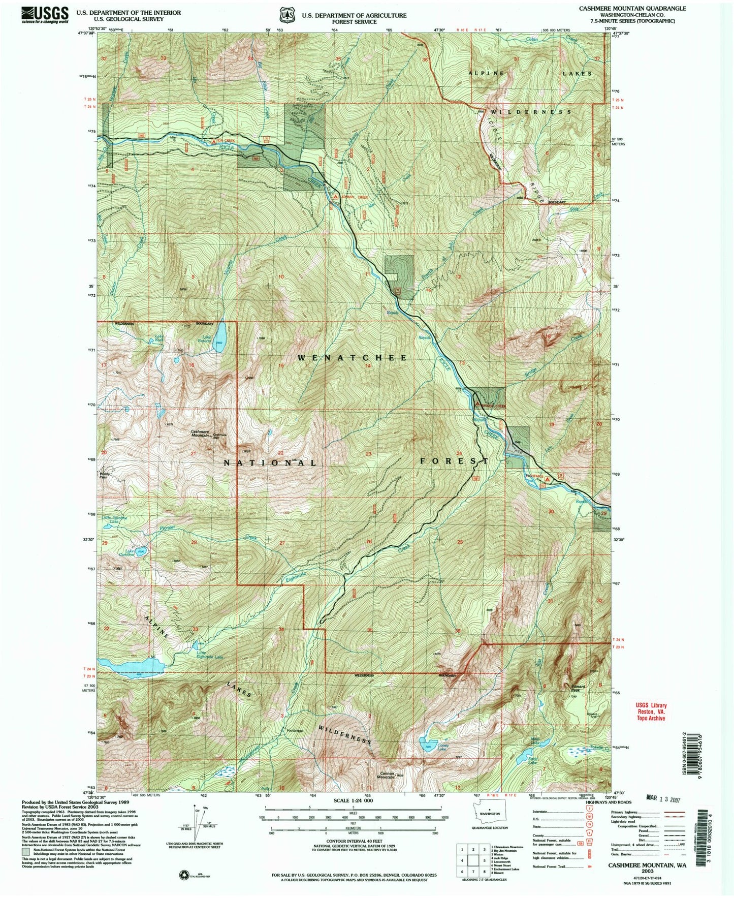
USGS Classic Cashmere Mountain Washington 7.5'x7.5' Topo Map
Couldn't load pickup availability
Historical USGS topographic quad map of Cashmere Mountain in the state of Washington. Scale: 1:24000. Print size: 24" x 27"
This quadrangle is in the following counties: Chelan.
The map contains contour lines, roads, rivers, towns, lakes, and grids including latitude / longitude and UTM / MGRS. Printed on high-quality waterproof paper with UV fade-resistant inks.
Contains the following named places: Big Slide Creek, Bob Creek, Bridge Creek, Bridge Creek Campground, Cannon Mountain, Lake Caroline, Cashmere Mountain, Coney Lake, Doctor Creek, Earle Lake, Edward Peak, Eightmile Campground, Eightmile Creek, Eightmile Lake, Fourth of July Creek, Hoxsey Creek, Ida Creek, Jay Creek, Johnny Creek, Johnny Creek Campground, Lion Creek, Little Caroline Lake, Little Eightmile Lake, Mac Creek, Mesa Lake, Mountaineer Creek, Pioneer Creek, Rat Creek, Lake Ruth, Victoria Creek, Lake Victoria, Windy Pass, Eightmile Lake Campground, Ida Creek Campground, Eightmile Lake Outlet Dam