MyTopo
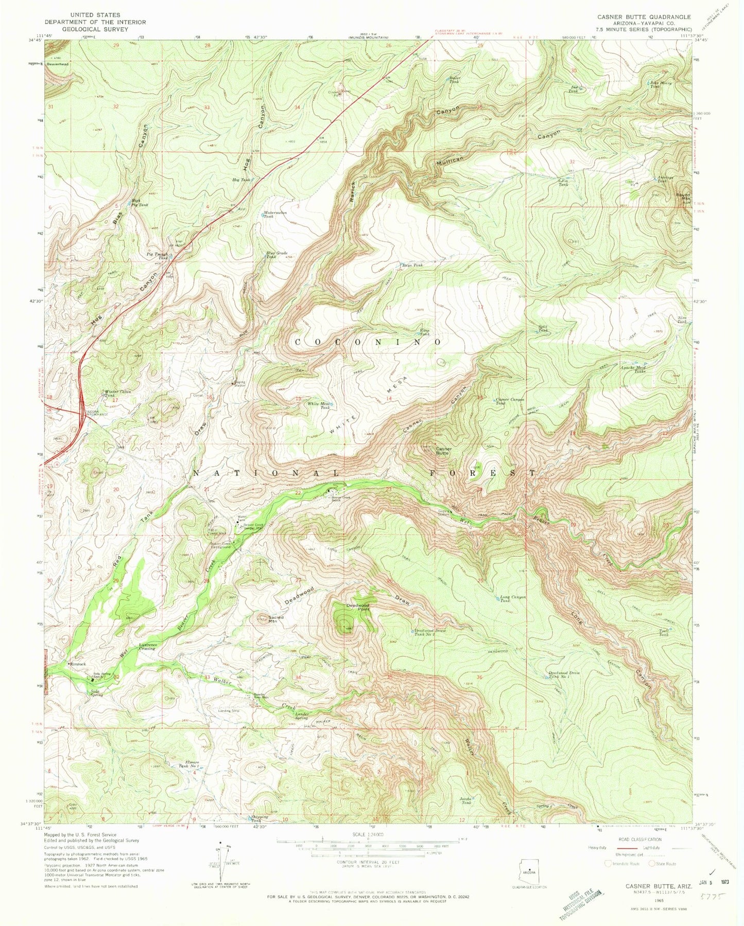
Classic USGS Casner Butte Arizona 7.5'x7.5' Topo Map
Couldn't load pickup availability
Historical USGS topographic quad map of Casner Butte in the state of Arizona. Typical map scale is 1:24,000, but may vary for certain years, if available. Print size: 24" x 27"
This quadrangle is in the following counties: Yavapai.
The map contains contour lines, roads, rivers, towns, and lakes. Printed on high-quality waterproof paper with UV fade-resistant inks, and shipped rolled.
Contains the following named places: Antelope Tank, Apache Maid Tanks, Beaver Creek Campground, Beaver Creek Ranch, Beaver Creek Ranger Station, Bell Trail, Blue Grade Tank, Boiler Tank, Casner Butte, Casner Canyon, Casner Canyon Tank, Deadwood Draw, Deadwood Draw Tank Number One, Deadwood Draw Tank Number Two, Deadwood Point, Deadwood Trail, Doe Tank, Elmore Tank Number One, High Pig Tank, Hog Tank, Jacobs Tank, John Henry Tank, Lander Spring, Lawrence Crossing, Long Canyon, Long Canyon Tank, Long Canyon Trail, Mullican Canyon, Nira Tank, Pig Trough Tank, Rancho Roco Roja, Rarick Canyon, Rays Tank, Red Tank Draw, Rimrock, Round Mountain, Ruin Tank, Sacred Mountain, Shipping Tank, Soda Spring, Soda Spring Ranch, Split Tank, Spring Creek, Three-Jim Tank, Trail Tank, Walker Basin Trail, Walker Creek, Watermelon Tank, White Mesa, White Mesa Tank, Winter Cabin Tank, Maverick Butte, Maverick Tank, Purgatory Tank, Rancho Roca Roja Airport (historical), Wier Number One, Wier Number Three, Wier Number Two, Southwestern Academy Beaver Creek Ranch Campus