MyTopo
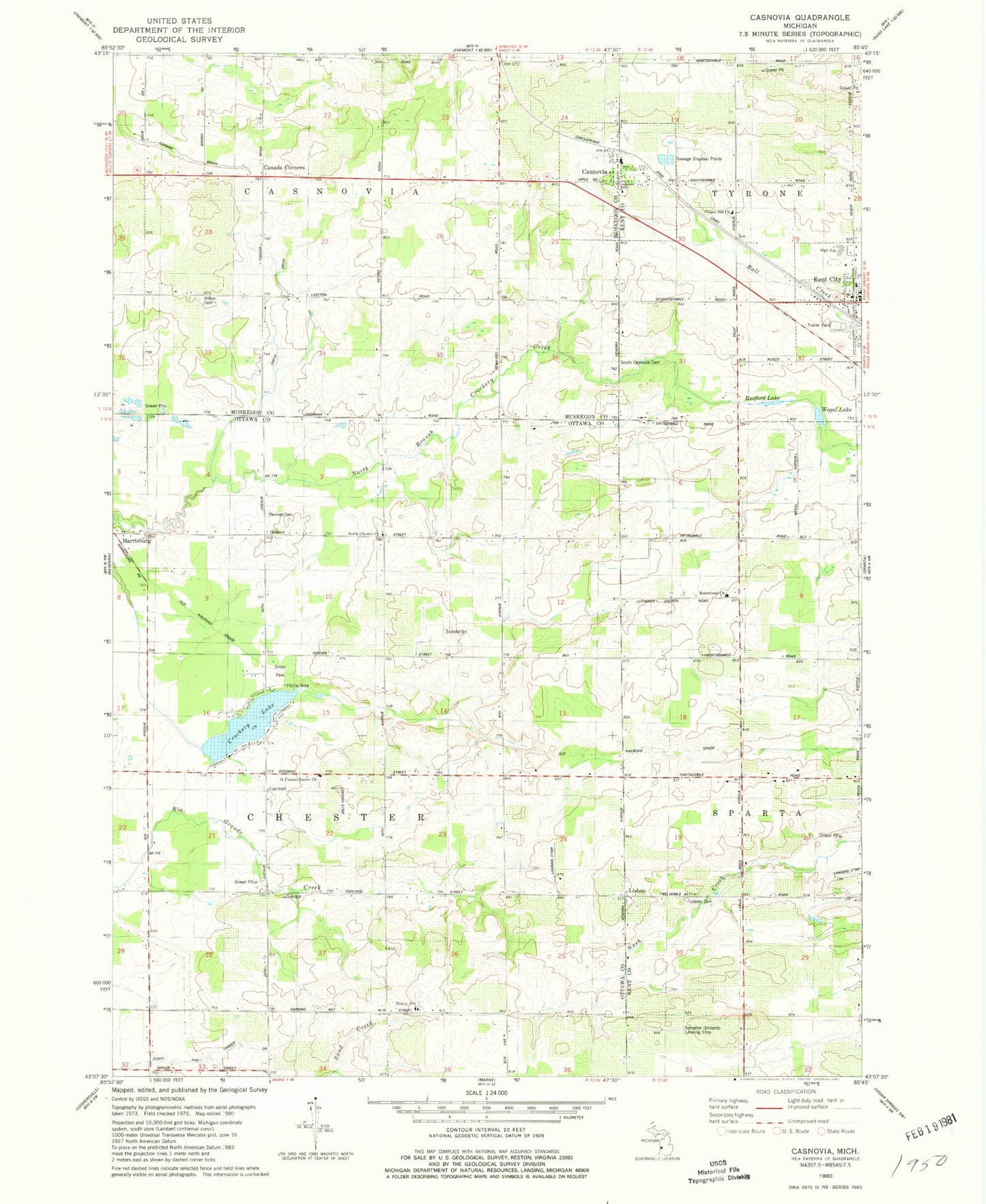
Classic USGS Casnovia Michigan 7.5'x7.5' Topo Map
Couldn't load pickup availability
Historical USGS topographic quad map of Casnovia in the state of Michigan. Map scale may vary for some years, but is generally around 1:24,000. Print size is approximately 24" x 27"
This quadrangle is in the following counties: Kent, Muskegon, Ottawa.
The map contains contour lines, roads, rivers, towns, and lakes. Printed on high-quality waterproof paper with UV fade-resistant inks, and shipped rolled.
Contains the following named places: Bennett Cemetery, Camelot Village Mobile Home Park, Canada Corners, Canada Corners Post Office, Canada Corners School, Casnovia, Casnovia Post Office, Casnovia Reformed Church, Casnovia Station, Chapel Hill Church, Clark School, Crockery Lake, Gooding Post Office, Gooding Station, Grose Park, Harrisburg, Harrisburg Post Office, Harrisburg Station, Hayward School, Hilton Cemetery, Johnson School, Kent City, Kent City Baptist Church, Kent City Elementary School, Kent City High School, Kent City Medical Center, Kent City Post Office, Kent City Station, Lachman School, Lisbon, Lisbon Cemetery, Lisbon Post Office, Lisbon School, Lutheran School, Mamrelund Church, Manchester School, Mill Creek, North Chester Church, Porter School, Reister School, Rexford Lake, Saint Francis Church, Saint Francis Xavier Church Cemetery, Schaefer Orchards Landing Strip, Scott and Tanner Drain, Smith Drain, South Casnovia Cemetery, Spangenberg School, Township of Casnovia, Township of Chester, Trinity Church, Trinity Lutheran Cemetery, Trinity Lutheran Church, Trinity School, Village of Casnovia, Village of Kent City, Waller School, Wegal Lake, ZIP Codes: 49318, 49403