MyTopo
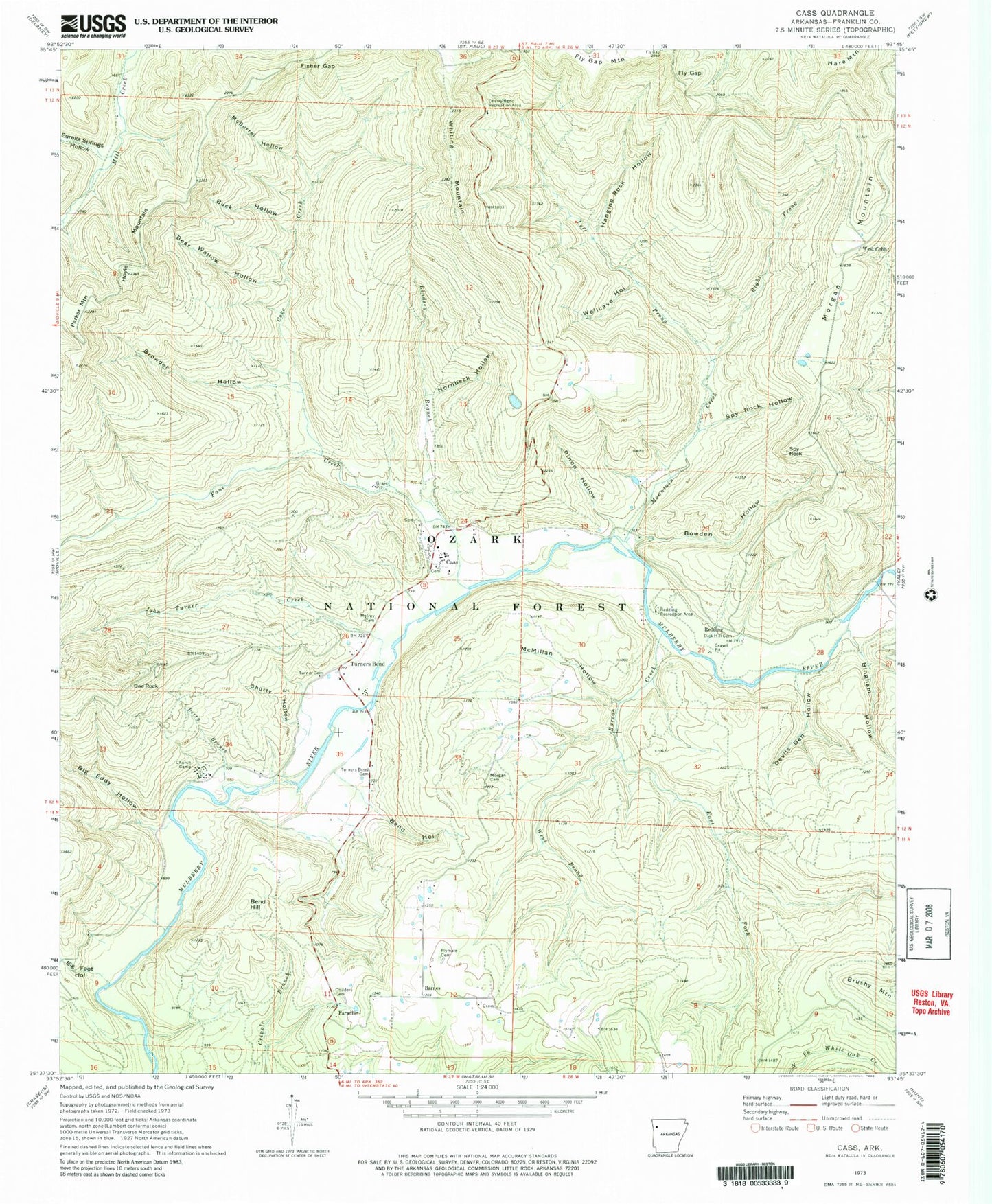
Classic USGS Cass Arkansas 7.5'x7.5' Topo Map
Couldn't load pickup availability
Historical USGS topographic quad map of Cass in the state of Arkansas. Typical map scale is 1:24,000, but may vary for certain years, if available. Print size: 24" x 27"
This quadrangle is in the following counties: Franklin.
The map contains contour lines, roads, rivers, towns, and lakes. Printed on high-quality waterproof paper with UV fade-resistant inks, and shipped rolled.
Contains the following named places: Berry Chapel School (historical), Big Foot Branch, Camp Frazier (historical), Camp Taft (historical), Cass Job Corp Center, Fresno (historical), North Liberty School (historical), West Cobb School (historical), Township of Boston, Township of McIlroy, Township of Morgan, Barnes, Barron Creek, Bear Wallow Hollow, Bee Rock, Bend Hill, Bend Hollow, Big Foot Hollow, Bingham Hollow, Bowden Hollow, Browder Hollow, Buck Hollow, Cherry Bend Recreation Area, Childers Cemetery, Cove Creek, Devils Den Hollow, Dick Hill Cemetery, East Fork Barron Creek, Fane Creek, Fisher Gap, Fly Gap, Hanging Rock Hollow, Hornbeck Hollow, Hoyle Mountain, John Turner Creek, Left Prong Mountain Creek, Lindsey Branch, McBurrel Hollow, McIroy Cemetery, McMillan Hollow, Morgan Cemetery, Morgan Mountain, Mountain Creek, Paradise, Parker Mountain, Perry Branch, Pinon Hollow, Plymale Cemetery, Redding, Redding Recreation Area, Right Prong Mountain Creek, Rock Creek, Shorty Hollow, Spy Rock, Spy Rock Hollow, Turner Cemetery, Turners Bend, Turners Bend Cemetery, Wellcave Hollow, West Cobb, West Prong Barron Creek, Spy Rock Redding Loop, Cass Job Corps Center, Bee Rock Point of Interest, Big Eddy Hollow, Cass, Eureka Springs Hollow, Barnes Volunteer Fire Department