MyTopo
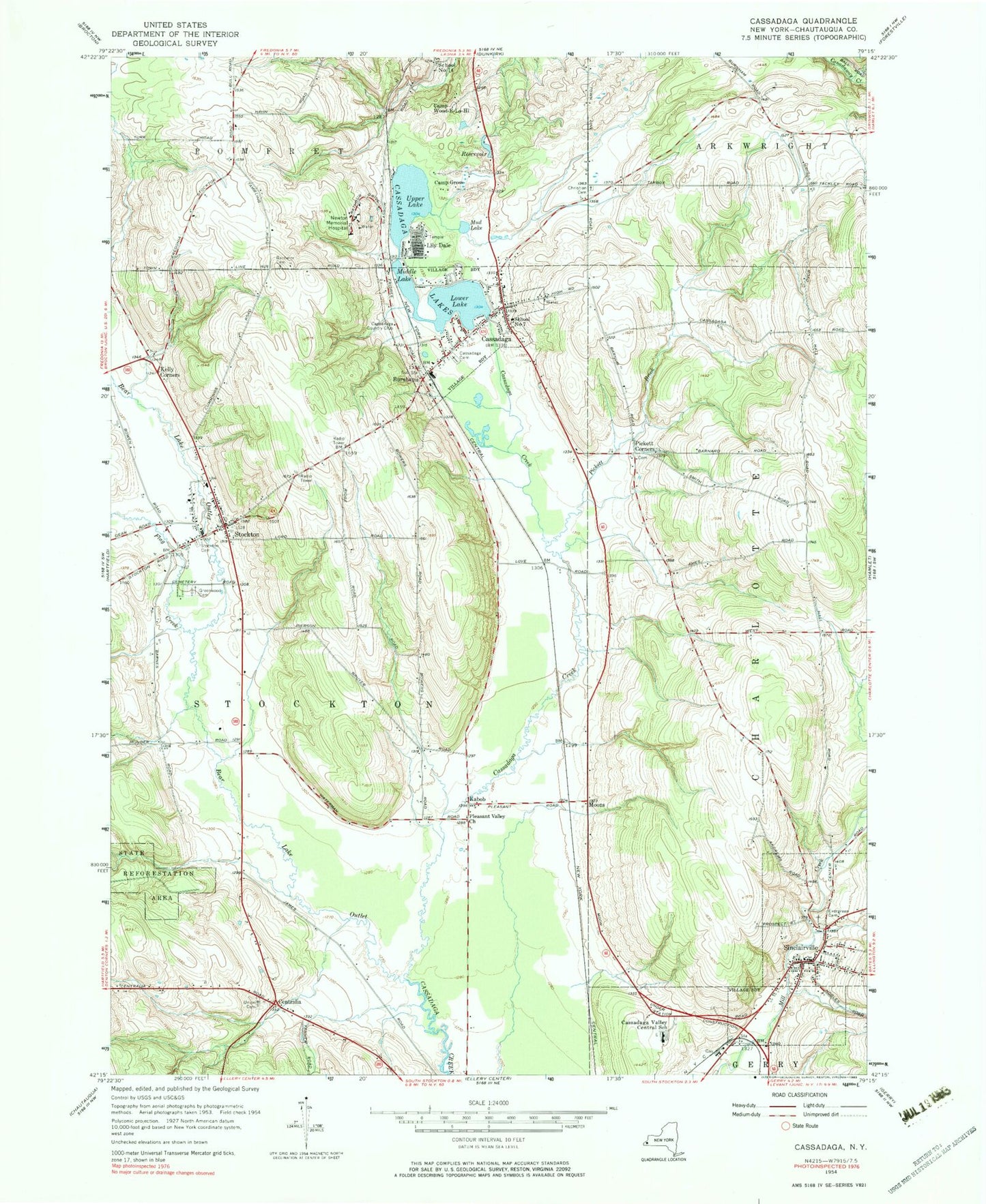
Classic USGS Cassadaga New York 7.5'x7.5' Topo Map
Couldn't load pickup availability
Historical USGS topographic quad map of Cassadaga in the state of New York. Map scale may vary for some years, but is generally around 1:24,000. Print size is approximately 24" x 27"
This quadrangle is in the following counties: Chautauqua.
The map contains contour lines, roads, rivers, towns, and lakes. Printed on high-quality waterproof paper with UV fade-resistant inks, and shipped rolled.
Contains the following named places: Bachelor Cemetery, Bear Lake Outlet, Burnhams, C and W Farm, Camp Gross, Camp Wood E Lo Hi, Cassadaga, Cassadaga Cemetery, Cassadaga Community Baptist Church, Cassadaga Country Club, Cassadaga Elementary School, Cassadaga Fire Department, Cassadaga Lakes, Cassadaga Post Office, Cassadaga Valley Central School, Centralia, Charlotte Town Hall, Christian Cemetery, Clinton Brook, District School Number 6, Evergreen Cemetery, Flag Creek, Greenwood Cemetery, Immaculate Conception Roman Catholic Church, Kabob, Kelly Corners, Kobob Gospel Tabernacle, Lily Dale, Lily Dale Post Office, Lily Dale Volunteer Fire Company, Lower Lake, Marian H Skidmore Library, Mary E Seymour Memorial Free Library, Melrose Park, Middle Lake, Moons, Mud Lake, Newton Memorial Hospital, Open Door Baptist Church, Our Lady of Lourdes Seminary, Park United Methodist Church, Pickett Brook, Pickett Corners, Picketts Corner Cemetery, Pleasant Valley Church, School Number 7, Sinclairville, Sinclairville Baptist Church, Sinclairville Elementary School, Sinclairville Free Library, Sinclairville Post Office, Sinclairville Volunteer Fire Company 1, Stockton, Stockton Community Church, Stockton Post Office, Stockton Volunteer Fire Department, Town of Stockton, Union Cemetery, Upper Lake, Village of Cassadaga, Village of Sinclairville, ZIP Codes: 14718, 14752, 14782