MyTopo
Classic USGS Cassatt South Carolina 7.5'x7.5' Topo Map
Couldn't load pickup availability
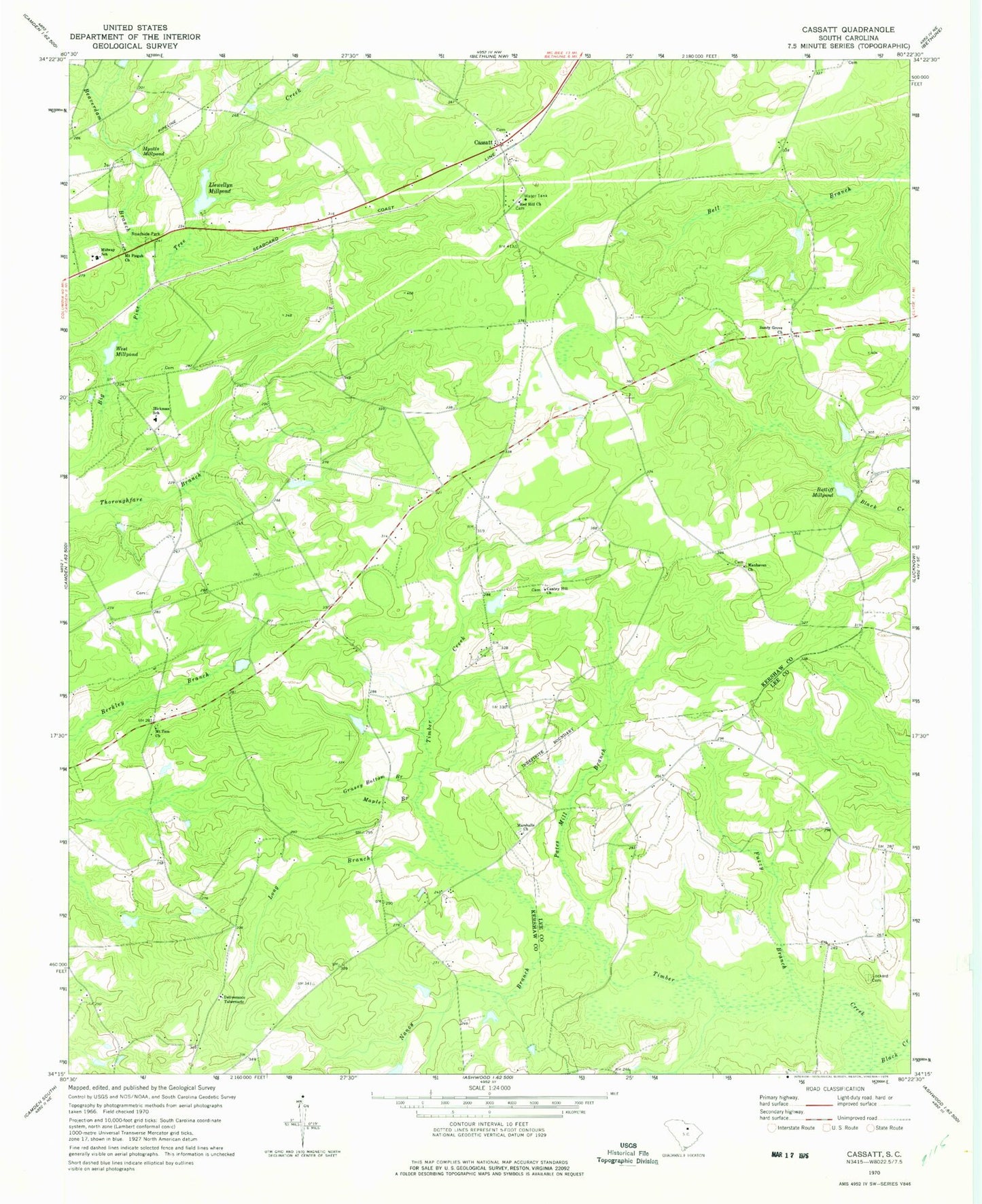
Historical USGS topographic quad map of Cassatt in the state of South Carolina. Map scale may vary for some years, but is generally around 1:24,000. Print size is approximately 24" x 27"
This quadrangle is in the following counties: Kershaw, Lee.
The map contains contour lines, roads, rivers, towns, and lakes. Printed on high-quality waterproof paper with UV fade-resistant inks, and shipped rolled.
Contains the following named places: Beaverdam Branch, Black River School, Cantey Hill Church, Cantey Hill School, Cassatt, Cassatt Baptist Church, Cassatt Church, Cassatt Post Office, Cassatt School, Central School, Deliverance Tabernacle, Fuzzy Branch, Gogo Pond, Gogo Pond Dam D-2507, Grassy Bottom Branch, Greenwood School, Hickman School, Hudson Pond, Hyatts Millpond, Kershaw County Fire Department Cassatt Station, Lewellem Millpond, Llewellyn Millpond, Lockard Cemetery, Long Branch, Manhaven Church, Maple Branch, Marshalls Church, Midway School, Mount Pisgah Church, Mount Zion Church, Mount Zion School, Nancy Branch, Pates Mill Branch, Pine Tree Presbyterian Church, Ratliff Millpond, Red Hill Church, Sandy Grove Church, Shrocks Mill, Shrocks Mill School, Shrocks Plantation, South Carolina Noname 28010 D-1064 Dam, South Carolina Noname 28039 D-1147 Dam, South Carolina Noname 28049 D-2508 Dam, Timber Creek, West Millpond, ZIP Code: 29032