MyTopo
Classic USGS Cassville Pennsylvania 7.5'x7.5' Topo Map
Couldn't load pickup availability
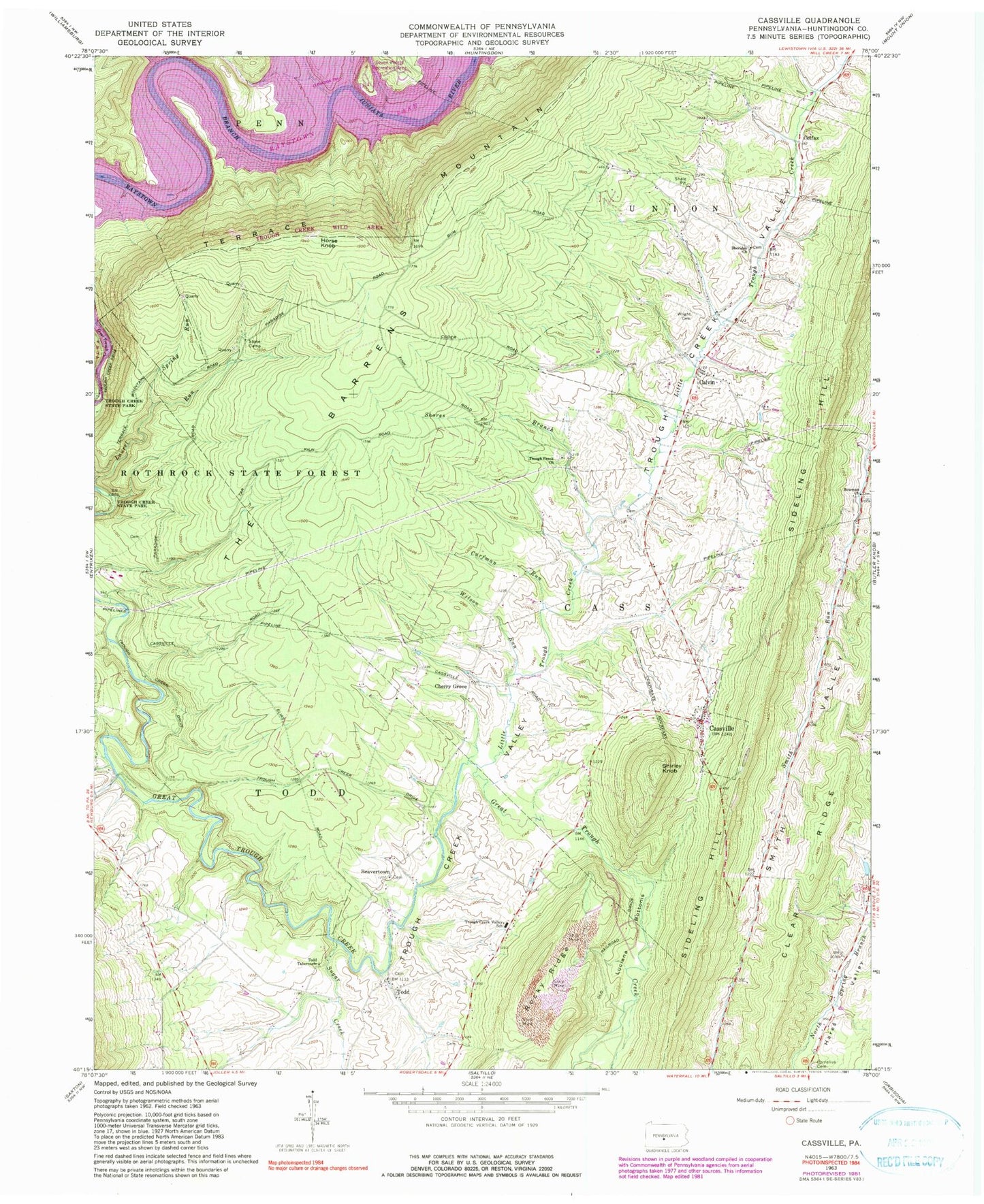
Historical USGS topographic quad map of Cassville in the state of Pennsylvania. Typical map scale is 1:24,000, but may vary for certain years, if available. Print size: 24" x 27"
This quadrangle is in the following counties: Huntingdon.
The map contains contour lines, roads, rivers, towns, and lakes. Printed on high-quality waterproof paper with UV fade-resistant inks, and shipped rolled.
Contains the following named places: Bowman Church, Calvin, Cassville, Cornelius Cemetery, Cornelius Chapel, Curfman Run, Horse Knob, Laurel Run, Little Trough Creek, Luciana Bottoms, Sheridan Church, Shirley Knob, Shores Branch, Spring Run, Stone Camp, Sugar Creek, The Barrens, Todd, Todd Tabernacle, Trough Creek Church, Trough Creek Valley School, Upper Comer Cemetery (historical), Wilson Run, Wright Cemetery, Raystown Lake, Terrace Mountain, Eagle Foundary, Salmon Hole, Beavertown, Cherry Grove, Colfax, Newburg, Upper Corners, Point Campground, Borough of Cassville, Township of Cass, Township of Todd, Sheridan School Cemetery, Trough Creek Baptist Cemetery, Smith Cemetery, Cassville Cemetery, Trough Creek Cemetery, Beavertown Cemetery, Taylor Cemetery, Paradise Furnace Cemetery, Lincoln Farms Airport, Schrenkel Airport, Trough Creek Volunteer Fire Company Station 21, Baker Bridge, Cassville Post Office, Calvin Post Office, Evans Family Cemetery