MyTopo
Classic USGS Castaic California 7.5'x7.5' Topo Map
Couldn't load pickup availability
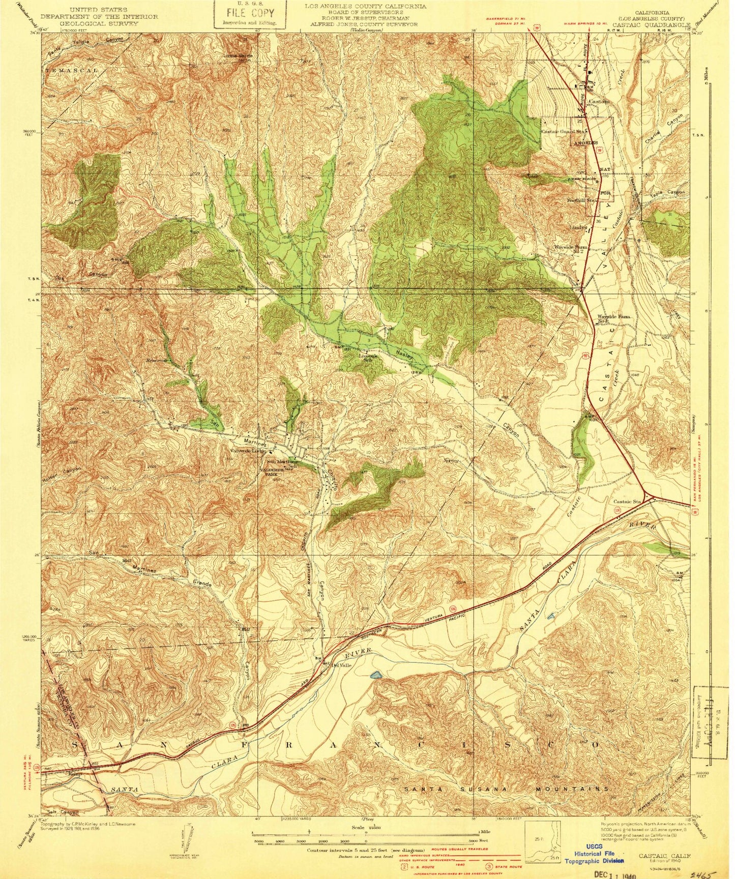
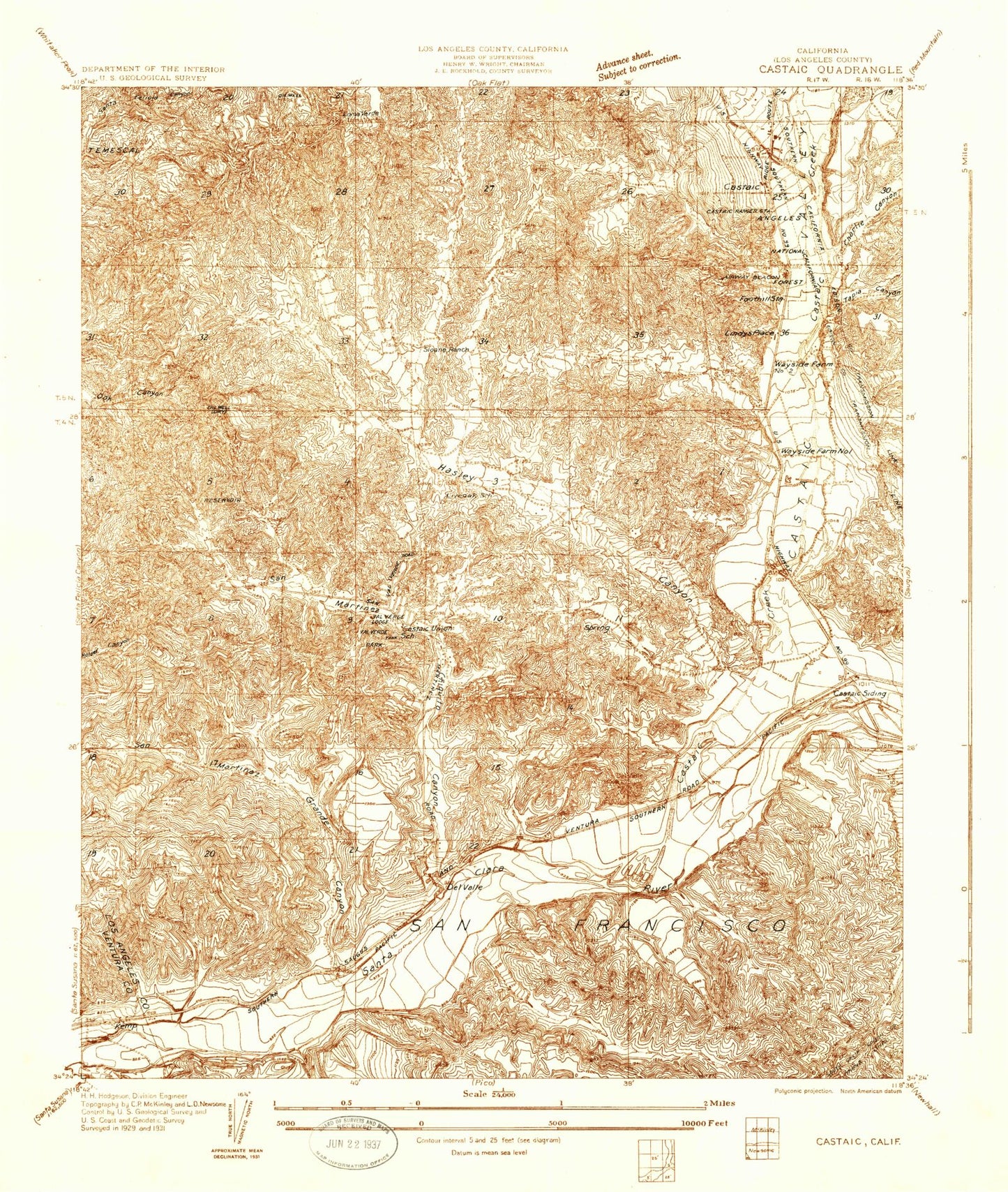
Historical USGS topographic quad map of Castaic in the state of California. Map scale may vary for some years, but is generally around 1:24,000. Print size is approximately 24" x 27"
This quadrangle is in the following counties: Los Angeles, Ventura.
The map contains contour lines, roads, rivers, towns, and lakes. Printed on high-quality waterproof paper with UV fade-resistant inks, and shipped rolled.
Contains the following named places: California Highway Patrol - Newhall Office, Camino Del Valle Park, Castaic, Castaic Census Designated Place, Castaic Creek, Castaic Elementary School, Castaic Forest Patrol Station, Castaic Hills Oil Field, Castaic Junction, Castaic Junction Oil Field, Castaic Middle School, Castaic Post Office, Castaic Shopping Center, Castaic Valley, Charlie Canyon, Chiquita Canyon Landfill, Del Valle, Del Valle Oil and Gas Field, Hasley Canyon, Hasley Canyon Census Designated Place, Hasley Canyon Oil Field, Hasley Canyon Park, Live Oak Elementary School, Loma Verde, Los Angeles County Fire Department Station 149, Los Angeles County Fire Department Station 76, Mayo Spur, Newhall Potrero Oil Field, Newhall Ranch, Ninetynine Oaks, Oak Canyon Oil Field, Potrero Canyon, Romero Canyon, San Francisco, San Martinez Chiquito Canyon, San Martinez Grande Canyon, Sepulveda Ranch, Sloan Canyon, Smith Canyon, Stanley Ranch, Sulphur Springs, Tapia Canyon, Val Verde, Val Verde Census Designated Place, Val Verde Park, Valencia, Villa Canyon, Wayside Canyon, ZIP Code: 91355