MyTopo
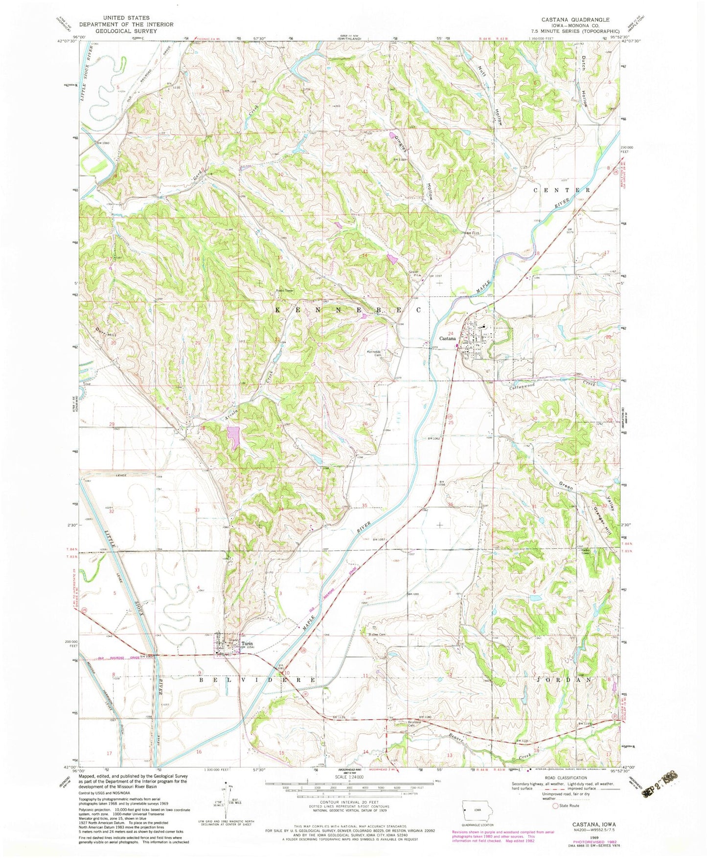
Classic USGS Castana Iowa 7.5'x7.5' Topo Map
Couldn't load pickup availability
Historical USGS topographic quad map of Castana in the state of Iowa. Map scale may vary for some years, but is generally around 1:24,000. Print size is approximately 24" x 27"
This quadrangle is in the following counties: Monona.
The map contains contour lines, roads, rivers, towns, and lakes. Printed on high-quality waterproof paper with UV fade-resistant inks, and shipped rolled.
Contains the following named places: Arcola, Arcola Creek, Belvidere, Belvidere Cemetery, Bisbee Cemetery, Castana, Castana City Hall, Castana Community Church, Castana Elementary School, Castana Fire and Rescue, Castana Grain Company Elevator, Castana Post Office, City of Castana, City of Turin, Cottonwood Creek, Davis Wetland, Durr Hill, Dutch Hollow, Gingles Hollow, Granger Hill, Green Valley, Kennebec Cemetery, Loess Hills Wildlife Area, Monona County, Nutt Hollow, Township of Kennebec, Turin, Turin Ciy Hall, Turin Post Office, United Methodist Church, ZIP Code: 51010