MyTopo
USGS Classic Castle Mountain Montana 7.5'x7.5' Topo Map
Couldn't load pickup availability
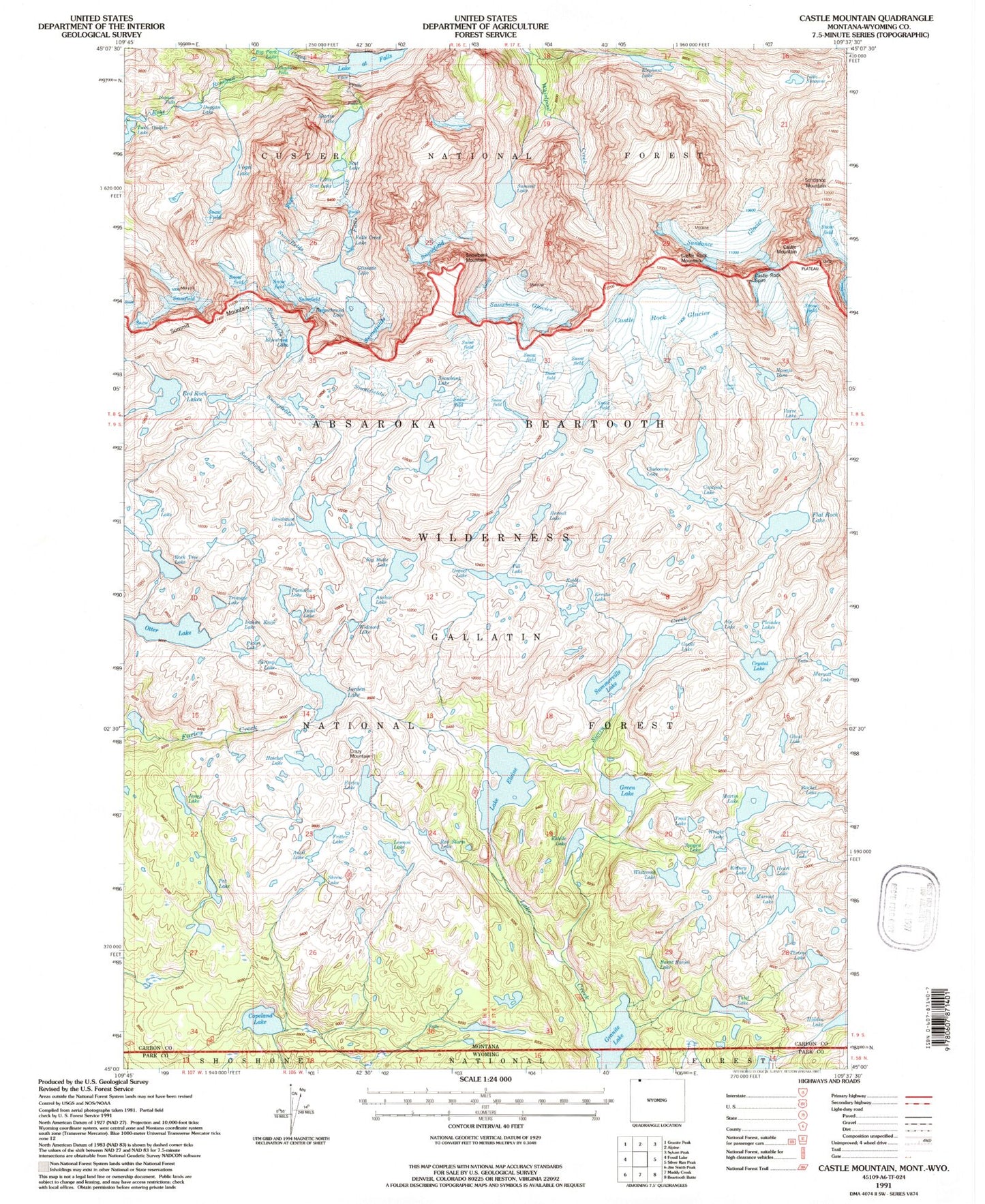
Historical USGS topographic quad map of Castle Mountain in the state of Montana. Scale: 1:24000. Print size: 24" x 27"
This quadrangle is in the following counties: Carbon, Park.
The map contains contour lines, roads, rivers, towns, lakes, and grids including latitude / longitude and UTM / MGRS. Printed on high-quality waterproof paper with UV fade-resistant inks.
Contains the following named places: Anchor Lake, Big Butte Lake, Castle Mountain, Castle Rock Glacier, Castle Rock Mountain, Copeland Lake, Crazy Mountain, Desolation Lake, Lake Elaine, Elephant Lake, Lake at Falls, Falls Creek, Farley Lake, Flat Rock Lake, Granite Creek, Green Lake, Hidden Lake, Jenny Lake, Jorden Lake, Kidney Lake, Martin Lake, Martin Lake, Otter Lake, Pat Lake, Picket Lake, Red Rock Lakes, Shrimp Lake, Snowbank Glacier, Summerville Lake, Summit Lake, Sundance Glacier, Thiel Lake, Wright Lake, North Hidden Lake, Anvil Lake, Fritter Lake, Lennon Lake, Shrew Lake, Hatchet Lake, Crystal Lake, Cladocera Lake, Varve Lake, Castle Lake, Copepod Lake, Snowbank Lake, Gravel Lake, Till Lake, Erratic Lake, Robble Lake, Planaria Lake, Indian Knife Lake, Widowed Lake, Snail Lake, Z Lake, Castle Rock Spire, Triangle Lake, Rock Tree Lake, Elpestrine Lake, Bergschrund Lake, Navajo Tarn, Lake Susanne, Scat Lake, Little Scat Lake, Glissade Lake, Falls Creek Lake, Duggan Lake, Impasse Falls, Charlie Falls, Vogel Lake, Maryott Lake, Alp Lake, Hermit Lake, Rachel Lake, Ghost Lake, Estelle Lake, Red Storm Lake, Burnt Bacon Lake, Whitcomb Lake, Sierra Creek, Throop Lake, Liver Lake, Trail Lake, Spogen Lake, Heart Lake, Lake Creek, Pleiades Lakes, Snowbank Mountain, Summit Mountain