MyTopo
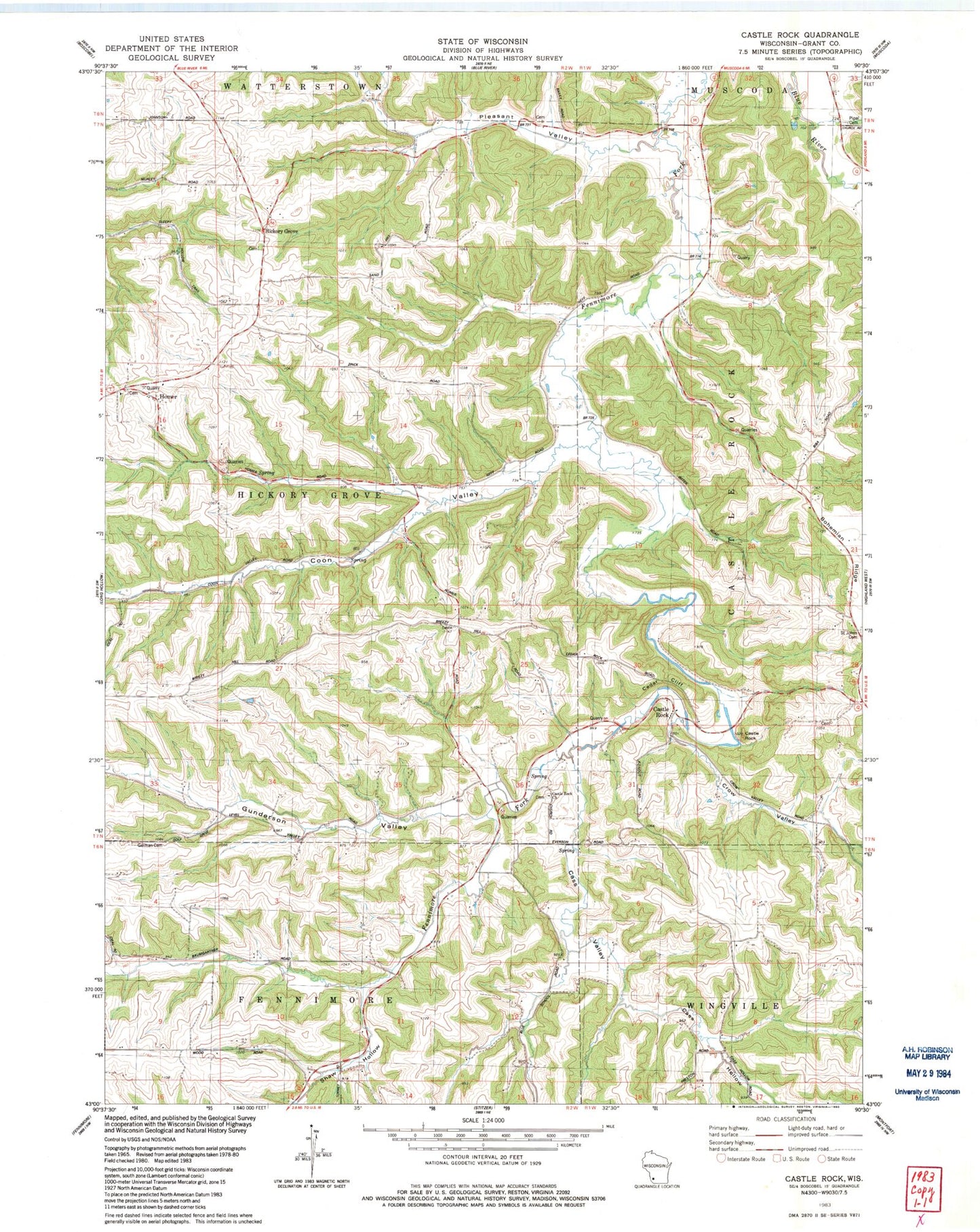
Classic USGS Castle Rock Wisconsin 7.5'x7.5' Topo Map
Couldn't load pickup availability
Historical USGS topographic quad map of Castle Rock in the state of Wisconsin. Typical map scale is 1:24,000, but may vary for certain years, if available. Print size: 24" x 27"
This quadrangle is in the following counties: Grant.
The map contains contour lines, roads, rivers, towns, and lakes. Printed on high-quality waterproof paper with UV fade-resistant inks, and shipped rolled.
Contains the following named places: Cass Valley, Castle Rock, Castle Rock, Cedar Cliff, Coon Valley, German Cemetery, Gunderson Valley, Pleasant Valley, Saint John Nepomuc Cemetery, Shaw Hollow, Hickory Grove, Town of Hickory Grove, Cass Hollow, Castle Rock Church, Crow Valley, Homer, Cass Valley School (historical), Coon Valley School (historical), Foley School (historical), Gates School (historical), Gunderson School (historical), McLaughlin School (historical), Pleasant Valley School (historical), Gehrke Farms, Tuck Away Farms, Duha Dairy, C and J Farms, Suncrest Farms, Whitesides Branch