
MyTopo
Classic USGS Cat Creek Summit Idaho 7.5'x7.5' Topo Map
Regular price
$16.95
Regular price
Sale price
$16.95
Unit price
per
Couldn't load pickup availability
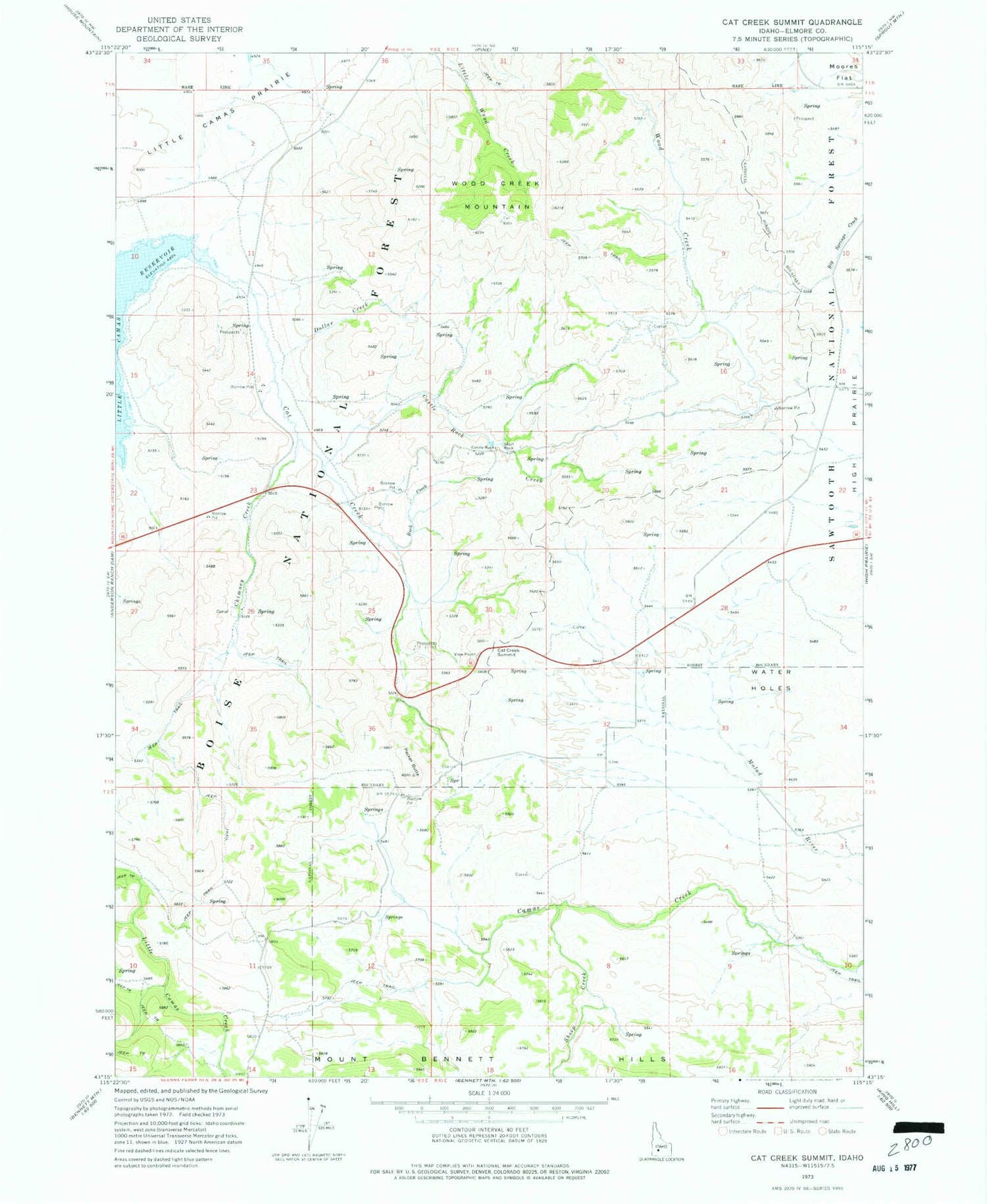
Historical USGS topographic quad map of Cat Creek Summit in the state of Idaho. Map scale may vary for some years, but is generally around 1:24,000. Print size is approximately 24" x 27"
This quadrangle is in the following counties: Elmore.
The map contains contour lines, roads, rivers, towns, and lakes. Printed on high-quality waterproof paper with UV fade-resistant inks, and shipped rolled.
Contains the following named places: Buck Creek, Castle Rock Creek, Castle Rocks, Cat Creek, Cat Creek Summit, Chimney Creek, Dollar Creek, Packer Butte, S Bar Ranch Airport, Sheep Creek, Skull Rock, Soldier Mountain Game Preserve, View Point, Water Holes, Wood Creek Mountain


