MyTopo
Classic USGS Cat Island Mississippi 7.5'x7.5' Topo Map
Regular price
$16.95
Regular price
Sale price
$16.95
Unit price
per
Couldn't load pickup availability
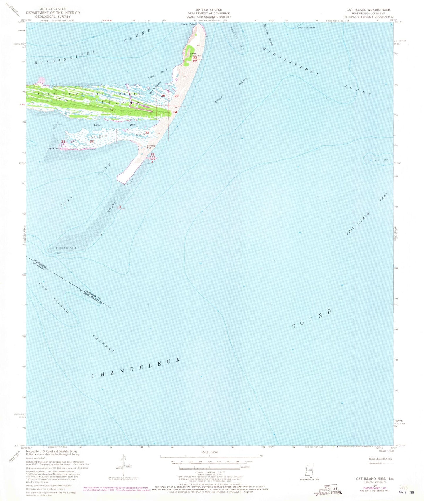
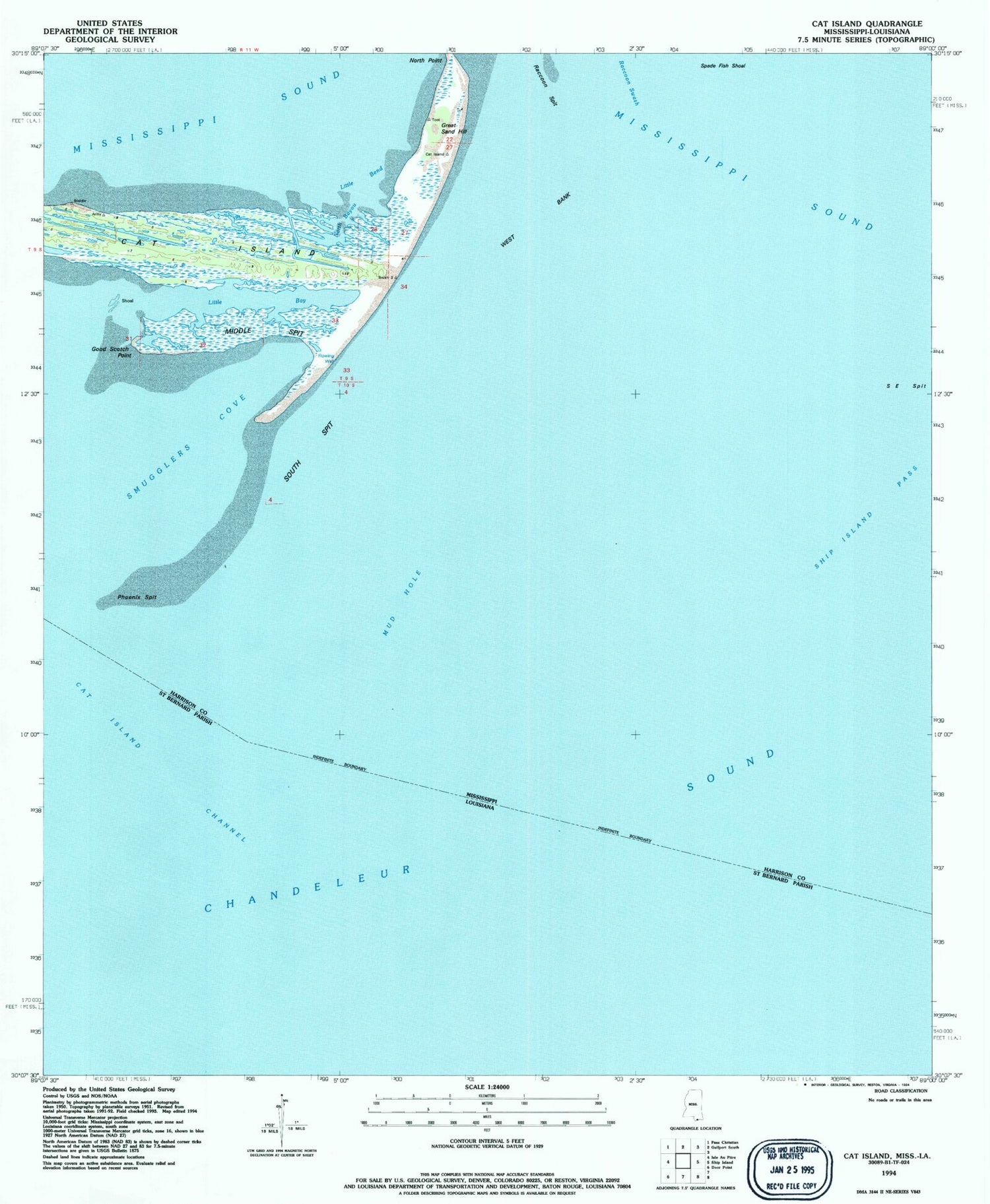
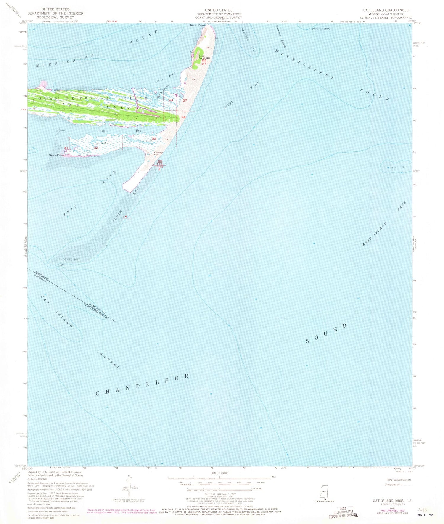
Historical USGS topographic quad map of Cat Island in the state of Mississippi. Map scale may vary for some years, but is generally around 1:24,000. Print size is approximately 24" x 27"
This quadrangle is in the following counties: Harrison, St. Bernard.
The map contains contour lines, roads, rivers, towns, and lakes. Printed on high-quality waterproof paper with UV fade-resistant inks, and shipped rolled.
Contains the following named places: Cat Island, Good Scotch Point, Great Sand Hill, Juan DeCuevas Claim, Little Bay, Little Bend, Middle Spit, Mud Hole, North Bayou, Phoenix Spit, Raccoon Spit, Smugglers Cove, South East Spit, South Spit, West Bank